————— NL version (ENG version below) —————
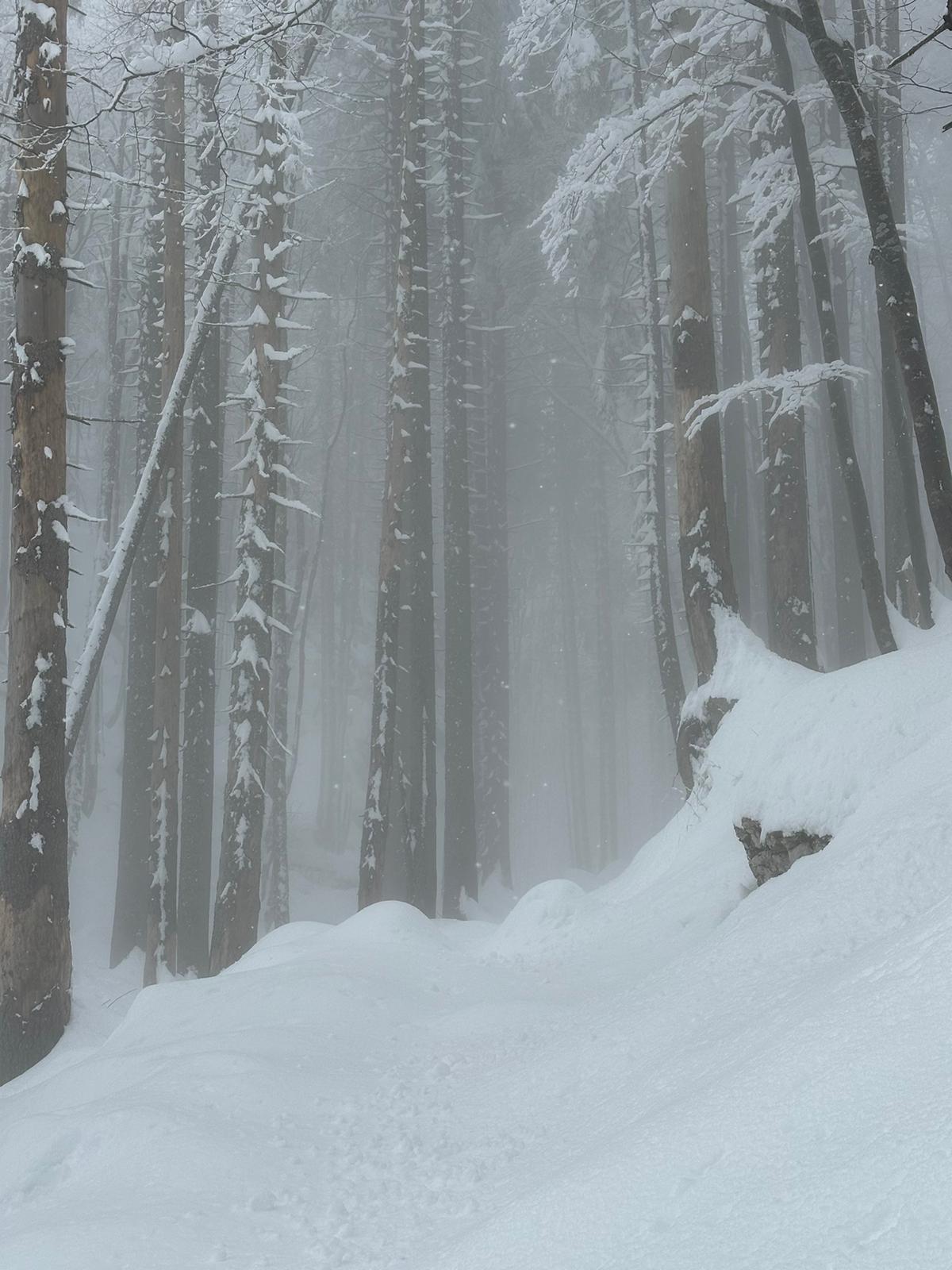
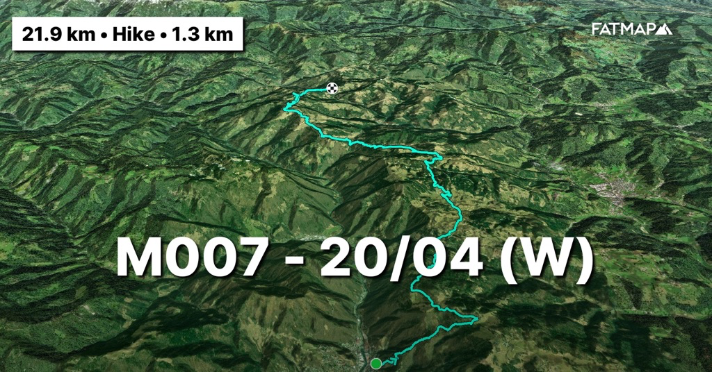
(Zaterdag 20/04) Genoeg gerust. Het is rusten van ‘moetes’ want ‘slow and steady wins the race’ maar dat zit niet altijd in de aard van het beestje. Het materiaal is terecht en de inkopen zijn gedaan bovenop de voedselpakketten die we eerder afzetten. Er moet elke dag gemiddeld zo’n 3500 kcal binnen gespeeld worden en met 7 dagen voor de boeg in het afgelegen Triglav nationaal park (waar nog geen enkele hut open is) weegt de rugzak door. Ik keer terug naar de derde vlaggenmast aan de Spar supermarkt in Idrija. Daar zette ik 2 dagen geleden de tracker stop en begint de reis terug opnieuw. Een tracker die in de eerste plaats vooral dient om met 1 druk op de knop de nooddiensten te kunnen verwittigen in geval van maar ook mooi meegenomen om ze thuis te kunnen laten volgen waar ik exact zit. Ik denk dat ik nog nooit zo transparant geweest ben naar het thuisfront toe. Tegen de steile flanken rond Idrija klimt de ‘Slovenian mountain trail’ (SMT) onmiddellijk omhoog en een derde van de 1200 hoogtemeters van die dag zijn snel binnen als opwarmer. Het gewicht van de rugzak dwingt me om het tempo traag te houden. Het spijtige aan dit stuk van de SMT is dat ie je tot aan het Triglav nationaal park voortdurend over verharde wegen stuurt en zelden door de bossen. De verwachtingen voor het nationaal park zijn alvast hoger. Verder zijn de gezichten op de Triglav steeds indrukwekkender en lijkt ie er na de extreme sneeuwbui van enkele dagen terug al beter bij te liggen qua condities. De weersvoorspellingen en lawine berichten hou ik elke dag toch maar nauwlettend in de gaten. Net voor mijn eindpunt voor de dag, zet ik buiten het dorpje Kladje de tent op in het bos en besluit de volgende dag terug te keren om water in te slaan. De huidige structuur van de rugzak wil ik als ik door Kladje loop niet aantasten door er nu de camelbag uit te halen.
https://fatmap.com/adventureid/122772315/m007-20-04-w
(Zondag 21/04) Als ik eerder zei dat ik nog nooit zo transparant geweest was naar het thuisfront toe dan bewijst de volgende ochtend dit. Als ik terugkeer naar het dorp om water te halen, loopt het bericht binnen: “Waarheen gaat de weg…?” Ons vader die van op zijn oud Samsung toestel waar zelfs de moeder van de porseleinen kast geen geduld voor zou hebben, elke stap mee in de gaten kan houden. Mooi om ze er in dit avontuur zo ook een stuk bij te hebben want missen doen we ze alvast zeker.
Het eerste deel van dag daal ik via grind- en boswegen af naar een Sloveens nationaal monument, Partizanska bolnica Franja. Een oud en volledig gerestaureerd kampement en ziekenhuis van de Sloveense partizanen ten tijde van de Tweede Wereldoorlog. Verderop in de route zal het alsmaar duidelijker worden in het landschap hoe zwaar de Slovenen hier gevochten moeten hebben in de bergen, gekneld in de tang van het Italiaanse en Duitse fascisme.
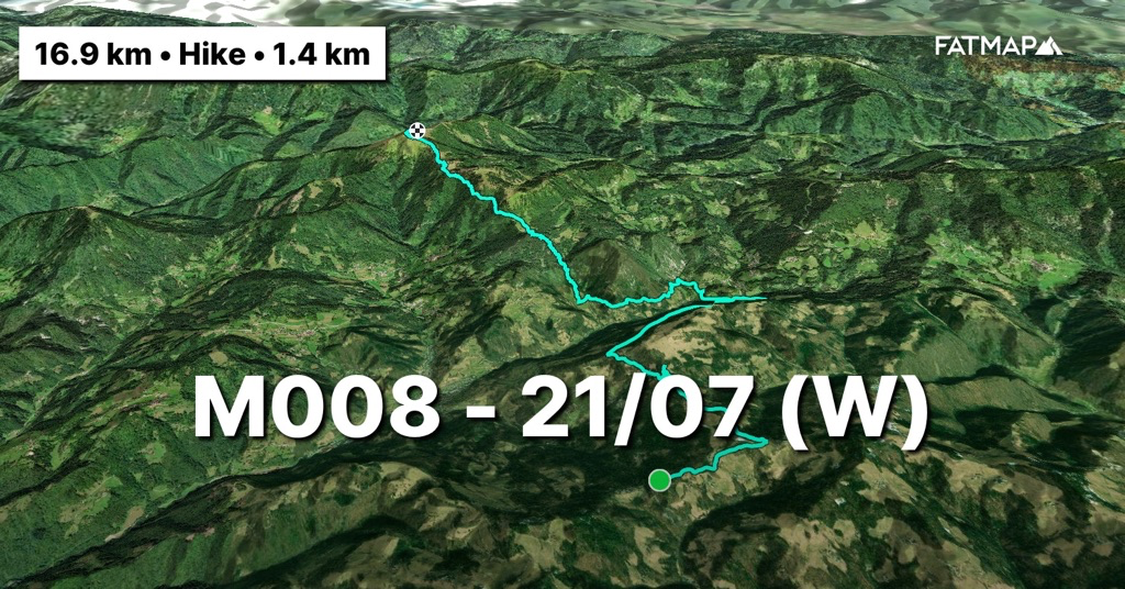
Het venijn zit hem vandaag in de staart van de route. De 1200 hoogtemeters stijgen van de dag zijn voorzien voor de laatste 4 km ervan tot aan de top van de Porezen. Een nieuw hoogtepunt in de route met zijn 1632m. Onderweg duiken naast de eerste bergrivieren ook verscheidene bunkers en oude militaire stellingen op die blijk geven dat hier zwaar gevochten moet zijn geweest. De slag bij de Porezen klinkt alvast baldadig genoeg om ergens notoir in een Sloveens geschiedenisboek op een schoolbank te verschijnen. Net onder de top ligt de Porezenhut en wonder boven wonder zijn ze open tijdens het weekend. Uit de websites die ik tijdens de planning raadpleegde, kon je niks opmaken. Elke taal die je aanduidde gaf een html 1.0 site weer in het Sloveens. Maar met zo’n pracht aan Alpen zou een mens voor minder chauvinistisch worden. Even snel zoveel mogelijk van alle elektronica opladen en dan net voor ze sluiten kruip ik in hun bivakhut. Iets verder op de berg gestationeerd en niet groter dan 4m2. Als ik in het avond ritueel kruip, wordt er op de gammele deur geklopt en duikt de Sloveense gastvrijheid weer op. 2 liter aan warme thee en een half brood krijg ik toegestopt vooraleer ze de hut sluiten en terug naar beneden trekken. Ik neem het in alle dank aan maar bedenk me onmiddellijk “Waar moet ik dit nog steken in die overvolle rugzak?”. Calorieën zijn calorieën dus een groot deel van de thee en het half brood gaan erdoor. De nacht passeert warmer dan verwacht aangezien het ‘s nachts toch gemakkelijk tot -5 à -6 graden afkoelt en de gevoelstemperatuur gemakkelijk voorbij de -10 ligt.
https://fatmap.com/adventureid/123028924/m008-21-07-w
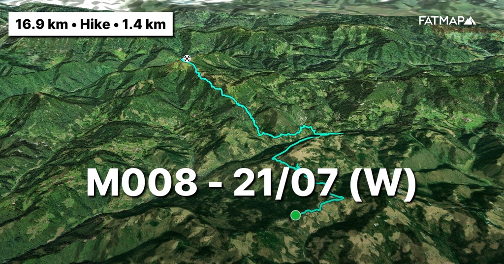
(Maandag 22/04) De volgende dag is alles bedekt in een dikke rijm. De rest van de thee warm ik op en als ik eraan begin, duurt het toch tot we terug op 1000m hoogte zijn om de zon en de vogels door de rijm heen te laten komen. Aan de pas bij Petrovo Brdo laad ik alle elektronica verder volledig op aangezien we vanaf hier de doorsteek maken in het nationaal park en niets meer zullen tegenkomen. Ook hier blijkt de militaire geschiedenis van dit gebied en de pas was 1 van de 2 passen op de oude grens tussen het Italië van Mussolini en het derde rijk van Hitler. De route volgt in haar filosofie van zo hoog mogelijk te blijven een groot stuk van deze grens doorheen het nationaal park. De rest van de dag wandel ik dus ook op deze oude grens naar de Črna prst. (In het Sloveens rad van fortuin moet je alvast niet te veel klinkers kopen). Met zijn 1844m een nieuw hoogtepunt op de route en vele toppen erachter voor de volgende dag. Over de laatste kilometer doe ik echter maar liefst 1,5 uur. Ik moet enkele oude en steile sneeuw flanken over en die liggen er volledig verijsd bij. De stappen moet ik dus stuk voor stuk uithakken met de ijspikkel om zo stap voor stap het Triglav nationale park in te kruipen. De bivak van de hut net onder de top val ik na al het gezwoeg met veel plezier binnen. De verijsde sneeuwflanken hebben wel een notie achtergelaten. Morgen moet ik 22km over een graad wat nog net moet lukken gezien het weerbericht dat lichte neerslag voorspelde maar het zal vroeg opstaan zijn om eraan te beginnen en verrassingen geen roet in het eten te laten strooien.
https://fatmap.com/adventureid/123264453/m009-22-04-w
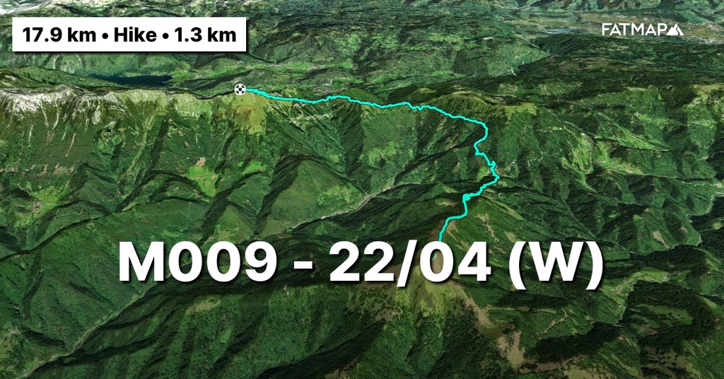
(Dinsdag 23/04) Als ik opsta om 6u is de verrassing compleet. Zichtbaarheid is uiterst beperkt en ‘s nachts is er maar liefst 40cm sneeuw gevallen. Ze hadden neerslag voorspeld maar niet in die mate. Geen ideale combinatie dus om een hele dag een steile graad af te lopen en links en rechts oude en verijsde sneeuwflanken te moeten opzoeken waar een dik pak verse sneeuw op beland is. Op zo’n oude sneeuwlaag glijdt zo’n vers pak met zijn gewicht en dat van mij als niks. En als ik het lawinebericht erop nakijk worden mijn vermoedens bevestigd. De schaal die op 1 (geen gevaar) stond, staat ineens op 3 (opletten geblazen) op een schaal van 5. Wijselijk beslis ik dus om af te dalen naar Bohinj en daar de hele route voor de volgende dagen tegen het licht te houden van nieuwe weervoorspellingen. Het blijft gedurende de hele afdaling sneeuwen en van een pad is al lang geen spraken meer. Het is tussen bomen en struiken laveren zoals het je goed uitkomt. Tegen de middag ben ik beneden, droog alles en begin te plannen. Uit de update van de weervoorspellingen blijkt snel dat ik in het midden van een serieuze depressie het park door moet. Dit hebben ze hier op dit moment in het jaar nog nooit gezien, zegt menig Sloveen waarmee ik aan de praat raak. Op 16/04 werd zelfs een nieuw nationaal record gevestigd waarbij de temperatuur van 27 graden op de ene naar 1 graad schoot de volgende dag en de 0-graden grens (‘isotherm’) die het vriesniveau aangeeft, fluctueerde lustig mee. Binnen 3 dagen wordt ie zelfs verwacht van de op dat moment 1100 op minder dan 2 dagen tijd naar 3100m hoogte te springen. Van radicale schommelingen gesproken. Liefste wetenschappers, we mogen er misschien nog niet uit zijn wat het effect van klimaatverandering op de straalstroom en op de wisselvalligheid van het weer is maar hier is toch iets niet in de haak. Tijdens de planning van deze route was ik op basis van historische data uitgegaan van een sneeuwgrens op 2000m wat de doorsteek had moeten mogelijk maken en de Triglav een winterse uitdaging had gemaakt. Gezien deze omstandigheden is de Triglav een onmogelijke zaak nu en zal ik hem links moeten laten liggen want de trein rijdt door en daar kan ik spijtig genoeg niet op wachten. Geen zwaar gemis want ik deed hem als allereerste bergervaring 25 jaar geleden al eens als 15-jarige ‘kadee’. Ik had hem echter graag eens in winterse omstandigheden gedaan. Voor volgende keer dan maar, nu eerst de juiste route kiezen om lawine gevoelige flanken te vermijden.
https://fatmap.com/adventureid/123424257/m010-d-23-04-w
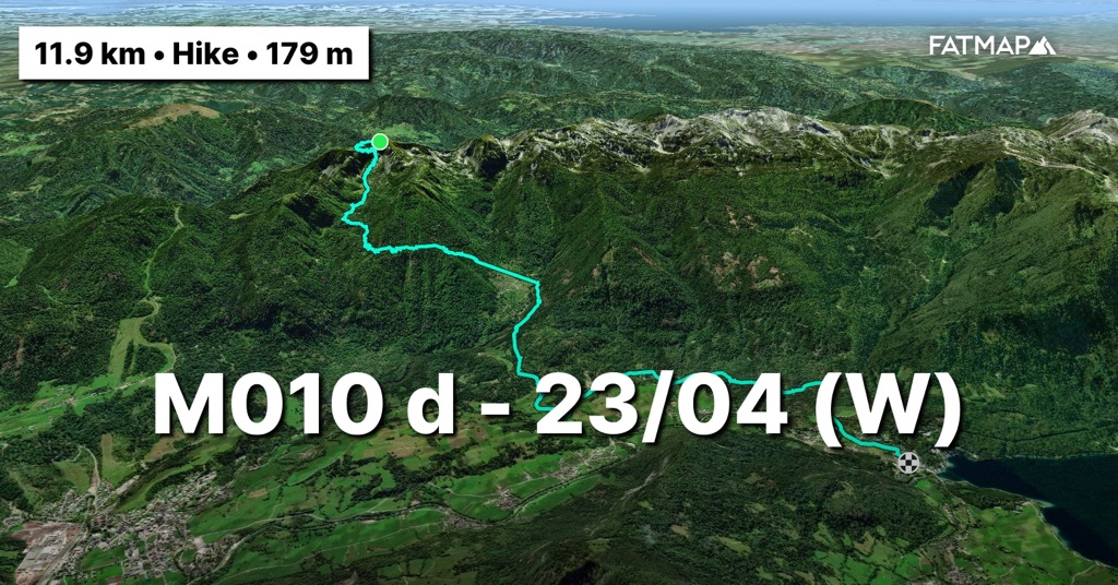
(Woensdag 24/04) Een route gevonden. Op een paar sleutelpassages na moet ze te doen zijn en me door lawine veilig terrein loodsen in de richting van waar ik moet uitkomen. Aangezien het ook vannacht zonder ophouden heeft gesneeuwd, mag ik me aan wat ploegwerk door de sneeuw verwachten. Er liggen 2 hutten en hun bivaks op de route dus ik heb opties. Ik begin eraan en wandel het idyllische meer van Bohinj af en klim langs de flank waar de watervallen het meer voeden door de eerste sleutel passage. Een via ferrata die steil tegen de bergwand opklimt en mee onder een tapijt van 50cm sneeuw ligt brengt me tot in de Dolina Triglaskih Jezer ofwel de vallei van de 7 meren. Het eindpunt van deze vallei moet me tot aan de Prehodavci pas brengen op 2050m waarlangs ik dan kan afdalen naar het westelijk gedeelte van het nationale park. Het vorderen gaat tergend traag in een sneeuwpak dat ondertussen aangezwollen is tot 70-100cm. Ik voel me als die oude bejaarde man die je soms op straat tegenkomt en schuifelend onderweg is naar de bakker voor pistolets voor zondag en al op vrijdag vertrok. Verder als de eerste hut geraak ik niet die dag en het is 6u als ik na 4,5km ploegen bij de bivak aankom. Gelukkig is het gestopt met sneeuwen maar het ploegwerk laat zijn sporen na dus dubbele portie eten met elk 1000kcal. De monitor toont immers dat er meer dan 4250kcal doorgingen tov de 3500kcal die elke dag gepland zijn. Morgen nog 5km en dan afdalen en de vallei uitlopen. Lijkt simpel maar ik besluit toch om er om 7u aan te beginnen zodat ik zeker om 2u op de pas ben en de laatste hut kan overslaan en richting drogere oorden kan trekken.
https://fatmap.com/adventureid/123951296/m011-d-24-04-w
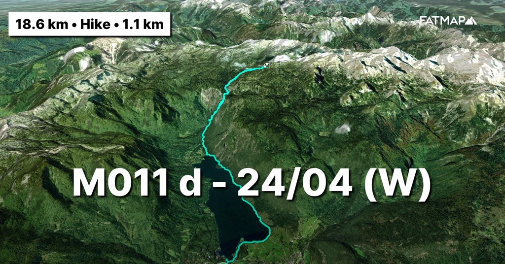
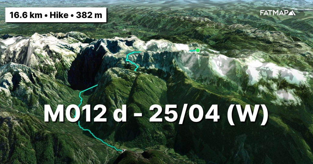
(Donderdag 25/04) Portie havermout binnen, verstand op nul en sneeuw stampen. Ik kan mijn coach niet genoeg bedanken om me te geselen tijdens training door een slede met gewichten voort te duwen. De dijbenen doen hun werk in dit terrein. Verder is het voortdurend moraal boosten door jezelf kleine doelen op te leggen. Bij de volgende boom of rots mag je nog eens kijken hoe ver het nog is. De snelheid ligt zo ongeveer op 1km per 1,5u. Voldaan en binnen planning sta ik om 2u op de pas en op een nieuw hoogtepunt van 2050m. Eén van de twee wandelstokken heeft het moeten bekopen en brak in het traject maar ook met zijn resterend stompje komen we er wel. Zolang het wc papier maar droog blijft is alles ok.
Onderweg heb ik het sneeuwpak meer als voldoende kunnen testen en aangezien het zich goed zet, verwacht ik niet al te veel problemen voor de afdaling. Zolang er geen slechte onderlagen liggen zou het niet mogen schuiven. Prikken en peilen maar met die 1,5 stok. De afdaling gaat geweldig en is een deugd voor de beentjes die opnieuw opleven. Eens bij de boomgrens aangekomen is het laveren tussen struiken, stenen en bomen tot aan het einde van de vallei. Een kudde van zeker 15 gemzen schiet me nog peil snel voorbij naar beneden. Had ik maar zulke knieën. Nog even doorduwen tot in Trenta om er de Sloveense gastvrijheid terug tegen het lijf te lopen in het dorp. De winkel die sloot om 3u wordt door de lokale kassierster zonder verpinken terug open gedaan voor me terwijl ze opnieuw het discours van de ongeziene omstandigheden laat klinken.
https://fatmap.com/adventureid/123951342/m012-d-25-04-w
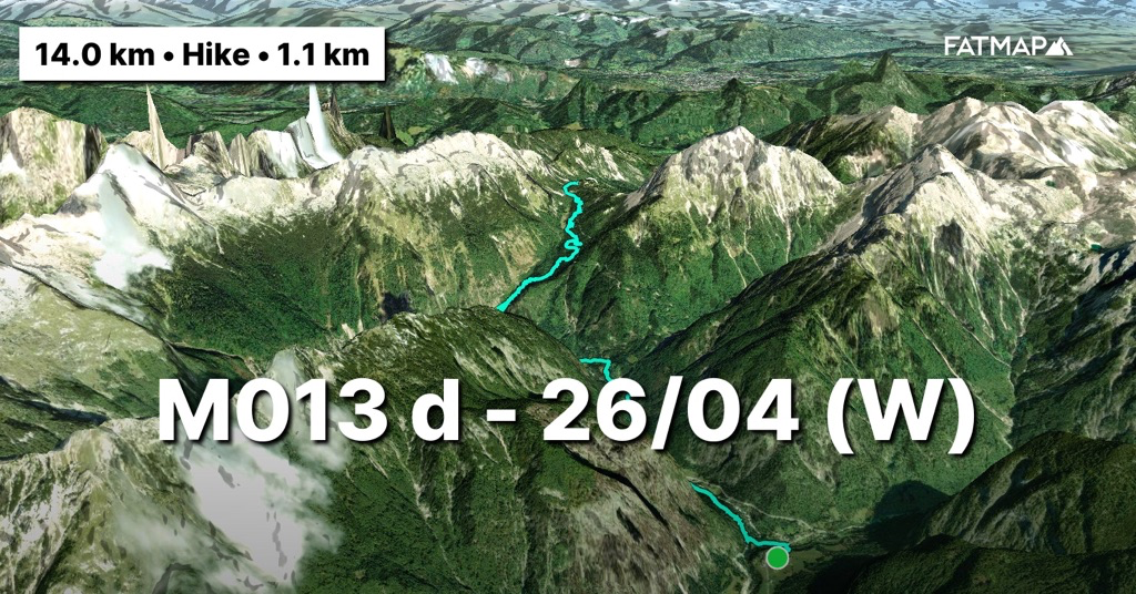
(Vrijdag 26/04) Ik besluit om de volgende dagen lager aan te houden tot aan de Sloveense grens. De beentjes moeten nog een paar maanden mee. Ik loop van vallei naar vallei langs de Soča, de meest gekende wildwater rivier van het nationale park waarop ik 25 jaar geleden ook aan het kajakken sloeg maar vooral meer kajak met Sander was dan Sander met kajak. Na tot aan de bron ervan te zijn gelopen, is de laatste pas van het nationale park aan de beurt. Nog even doorsteken naar 1611m en onderweg het sneeuwpak weer tegenkomen als ook erachter de enigste hut die open is in het park. Ze zijn er verbaasd van nog een levende ziel te zien nu ze zo ingesneeuwd zitten. De volgende dag is enkel nog afdalen tot in Rateče, de ooit tweede grensovergang tussen de twee fascistische mogendheden en vandaag op een boogscheut van het Sloveens-Oostenrijks-Italiaans drielandenpunt en het einde voor me van de Sloveense en Julische Alpen. Verder rusten en beter weer afwachten maar dat zit in de lucht. Hoewel het ook duidelijk kan verkeren.
https://fatmap.com/adventureid/124072374/m013-d-26-04-w
Op naar Monaco!
Bergse groeten en tot snel!
————— ENGLISH VERSION —————
(Saturday 20/04) Enough rest. It is a mandatory because 'slow and steady wins the race', but that is not always in my DNA. My gear has been found, groceries have been in addition to the food packages that we previously dropped off. An average of about 3500 kcal has to be consumed every day and with 7 days ahead of me in the remote Triglav national park (where not a single hut is open yet), the backpack weighs a lot. I return to the third flagpole at the Spar supermarket in Idrija. This is where I stopped the tracker 2 days ago and the journey will start again. A tracker that is primarily intended to be able to notify the emergency services at the touch of a button, but is also a nice bonus to allow people at home to follow me exactly where I am. I don't think I have ever been so transparent in the eyes of the home front. The 'Slovenian mountain trail' (SMT) immediately climbs up the steep slopes around Idrija and a third of the day's 1200 meters of altitude are quickly covered as a warm-up. The weight of the backpack forces me to keep the pace down. The unfortunate thing about this part of the SMT is that it takes you continuously on paved roads until the Triglav national park and rarely through the forests. Expectations for the national park are growing. Furthermore, the views on the Triglav are increasingly impressive and the slopes seem to be in better condition after the extreme snow shower a few days ago. Nevertheless, I keep a close eye on the weather forecasts and avalanche reports every day. Just before my end point for the day, I pitch the tent in the forest outside the village of Kladje and decide to return there the next day to stock up on water. I don't want to affect the current structure of the backpack when I walk through Kladje by taking out the camel bag now.
https://fatmap.com/adventureid/122772315/m007-20-04-w

(Sunday 21/04) If I said earlier that I had never been so transparent towards the home front, the next morning proved this. When I return to the village to get water, the message comes in: “Where does the road go…?” My dad, who can keep an eye on every step from his old Samsung device for which even the mother of the china shop would have no patience. It's nice to have them part of this adventure in this way because I certainly miss them.
The first part of the day I descend via gravel and forest roads to a Slovenian national monument, Partizanska bolnica Franja. An old and fully restored encampment and hospital of the Slovenian partisans during the Second World War. Further along the route it will become increasingly clear throughout the landscape how hard the Slovenes must have fought here in the mountains, being squeezed by the Italian and German fascism.
The devil is in the tail of the route today. The day's 1200 meters of elevation gain are planned for the last 4 km up to the top of the Porezen. A new highlight in the route with its 1632m. Along the way, in addition to the first mountain rivers, several bunkers and old military positions also appear, proving there must have been heavy fighting here. The Battle of the Porezen certainly sounds rowdy enough to appear infamously in a Slovenian history book on a school desk somewhere. Just below the summit is the Porezen mountain hut and miraculously they are open during the weekend. You couldn't tell anything from the websites I consulted during the planning phase. Each language you indicated displayed an HTML 1.0 site in Slovenian. But with such splendid Alps, one would become less chauvinistic. I quickly charge as many electronics as possible and then just before they close I crawl into their bivouac hut. Stationed a little further up the mountain and no larger than 4m2. As I enter the evening ritual, there is a knock on the rickety door and Slovenian hospitality reappears. I am given 2 liters of hot tea and half a loaf of bread before they close the hut and move back down to the valley. I thankfully accept, but immediately question: "Where should I put this in that overfull backpack?" It’s all about the calories, so a large part of the tea and half the bread go down. The night is passed on feeling warmer than expected as it easily cools down to -5 to -6 degrees at night and the perceived temperature is easily beyond -10 degrees.
https://fatmap.com/adventureid/123028924/m008-21-07-w
(Monday 22/04) The next day everything is covered in a thick frost. I heat up the rest of the tea and when I get on the trail again, it takes until we are back at an altitude of 1000m for the sun and the birds to reappear. At the pass at Petrovo Brdo I fully charge all electronics since from here the crossing into the national park will be made and I will not encounter anything anymore. The military history of this area is also evident here and the pass was one of two passes on the old border between Mussolini's Italy and Hitler's Third Reich. In its philosophy of staying as high up as possible, the route follows a large part of this border through the national park. The rest of the day I walk this old border to the Črna prst. (In the Slovenian wheel of fortune you don’t have to buy too many vowels). With its 1844m, a new high point on the route. However, the last kilometer takes me no less than 1.5 hours. I have to cross some old and steep snow slopes and they are completely iced over. So I have to carve out the steps one by one with the ice axe to crawl step by step into the Triglav national park. After all the labor, I enter the bivouac of the hut just below the summit with great pleasure. The icy snow slopes however did ring a bell. Tomorrow I have to complete 22km over a ridge, which should just be feasible given the weather report that predicted a chance of light snow, but I will have to get up early to get started and not let any surprises conflict with the plan.
https://fatmap.com/adventureid/123264453/m009-22-04-w

(Tuesday 23/04) When I get up at 6 am, I cannot believe my eyes. Visibility is extremely limited and no less than 40cm of snow fell during the night. They had predicted some light snow but not to this extent. Not an ideal combination to spend a whole day walking down a ridge and having to alter left and right sides of the ridge with potential old and icy snow slopes on which a thick layer of fresh snow has landed. On such an old layer of snow, a fresh snowpack with its weight and mine included is prone to slide. And when I check the avalanche report, my suspicions are confirmed. The scale that was at 1 (no danger) is suddenly at 3 (be careful) on a scale of 5. So I wisely decide to descend to Bohinj and review the entire route for the next few days against these new weather forecasts. It continues to snow during the entire descent and there is no longer a path. It's about navigating between trees and shrubs. By noon I'm in the valley. I dry everything and start planning. The weather forecast update quickly reveals that I have to cross the park during a serious weather depression. Many Slovenians I talk to have never seen these conditions at this time of year. On 16/04, a new national record was even set when the temperature dropped from 27 degrees on one day to 1 degree the next day and the freezing level ('isotherm') fluctuated consequently. Within 3 days it is even expected to jump from the current height of 1100 m to 3100 m in less than 2 days. Talk about radical fluctuations. Dear scientists, we may not yet know what the effect of climate change is on the jet stream and on the variability of the weather, but something is not right here. During the planning of this route, based on historical data, I had assumed a snow cover and freezing level at 2000m, which should have made the crossing possible and made the Triglav a winter challenge. Given these circumstances and material, the Triglav is an impossible task now and I will have to ignore it given the time and planning constraints. Not a tremendously loss because it was my very first mountain experience 25 years ago as a 15-year-old 'rascal'. However, I would have liked to have done it in winter conditions. Maybe next time. First, it’s about choosing the right route to avoid avalanche-prone flanks.
https://fatmap.com/adventureid/123424257/m010-d-23-04-w

(Wednesday 24/04) I found a route. With attention to some key passages, it should be feasible and lead me through avalanche-safe terrain toward where I need to end up. Since it snowed continuously last night, I can expect some plowing through the snow. There are 2 huts and their bivouacs on the route so I have options. I start and walk down the idyllic Lake Bohinj and climb along the flank where the waterfalls feed the lake through the first key passage. A via ferrata which climbs steeply up the mountainside and is covered in a carpet of 50cm of snow takes me to the Dolina Triglaskih Jezer or the valley of the 7 lakes. The end point of this valley is the Prehodavci pass at 2050m, along which I can then descend to the western part of the national park. Progress is painfully slow in a snowpack that has now swollen to 70-100cm. I feel like that old elderly man you sometimes meet on the street, shuffling on his way to the bakery for rolls for Sunday whereas he left his house probably on Friday. I don't get any further than the first hut that day and it is 6am when I arrive at the bivouac after 4.5km of ploughing. Fortunately it has stopped snowing, but the plowing leaves its mark. For supper is a double portion of 1000kcal each. Whereas I said each day a total of 3500kcal has to be consumed my monitor is saying it was above 4250kcal today. Tomorrow another 5km and then descend towards the valley. Seems simple, but I decide to start at 7 a.m. so that I will definitely be at the pass at 2 a.m. and can skip the last hut and descend to drier places.
https://fatmap.com/adventureid/123951296/m011-d-24-04-w

(Thursday 25/04) A portion of oatmeal for breakfast, shutting off the head and start kicking snow. I can't thank my coach enough for flogging me during training by pushing a sled with weights. The quadriceps are doing their best in this terrain. Next, the day is about constantly boosting morale by setting small goals for yourself. At the next tree or rock you can check again how far it is. The speed is approximately 1 km per 1.5 hours. Satisfied and on schedule, I reach the pass at 2am and reach a new height marker of 2050m. One of the two hiking poles had to pay for it and broke during the journey, but we will also get there with his remaining stump. As long as the toilet paper stays dry, everything is fine.
Along the way I was able to test the snowpack more than sufficiently and since it is settling well, I don't expect too many problems for the descent. As long as there are no bad layers underneath, it should not slide. Just poke and gauge with that 1.5 stick. The descent goes great and is a virtue for the legs that revive again. Once I reach the tree line, it’s about navigating between bushes, stones and trees to the end of the valley. A herd of at least 15 chamois shoots past me downhill. If only I had knees like that. The rest of the day is about pushing on to Trenta to encounter Slovenian hospitality again in its village. The store that closed at 3 am is opened again for me by the local cashier without blinking as she once again recites the tale of the unprecedented circumstances.
https://fatmap.com/adventureid/123951342/m012-d-25-04-w

(Friday 26/04) I decide to stay lower in altitude for the next few days until reaching the Slovenian border. The legs should last a few more months. I walk from valley to valley along the Soča, the most famous whitewater river in the national park, on which I also kayaked 25 years ago, but it was mainly more Sander in the ice water than Sander in the kayak. After walking to its source, I head up the last pass of the national park to 1611m and encounter the snowpack again along the way as well as behind it the only hut that is open in the park. They are surprised to see a living soul now that they are so snowed in. The next day I only have to descend to Rateče, the once second border crossing between the two fascist powers and today a stone's throw away from the Slovenian-Austrian-Italian border crossing and the end for me of the Slovenian and Julian Alps. But first some rest and wait for better weather, but it seems to be coming. Although it can also clearly change.
https://fatmap.com/adventureid/124072374/m013-d-26-04-w

Off to Monaco!
Mountain greetings and see you soon!
