TITLE: To the halfway point
SUBTITLE: 28/06-3/07
————— NL version (ENG version below) —————
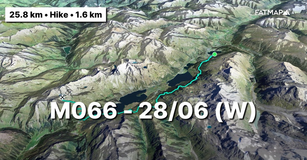
(Vrijdag 28/06) 2 dagen rust. Rust is een groot woord want wat zaken opvolgen in België en aangezien er ook geen alpiene routes in de volgende 2 etappes liggen, is er wel wat logistiek mee gemoeid. Om de kosten te drukken, heb ik me die 2 dagen rust gekocht in de jeugdherberg van Sankt Moritz. Jeugdherbergen in Zwitserland zijn halve hotels. Super goed voorzien, geweldig eten en zeer schappelijk van prijs. Zwitserland is namelijk niet al te goedkoop en voor alles betaal je. Ze zouden je op restaurant zelfs een toeslag durven aanrekenen als je wilt praten tijdens het eten. Voor niks beschaamd de Zwitsers. De goedkope jeugdherberg optie dan maar. Nadeel, je slaapt er op een kamer met 4 en ik heb nu net het (on)geluk om iedere nacht Zweedse, Canadese en Indische snurk-bombardementen mee te maken. Weinig herstel dus van de vorige 11 dagen onderweg. Het lijf heeft er alvast geen zin in.
Pas om 9u ‘s ochtends trek ik me op gang langs de meren rond Sankt Moritz tot aan Maloja. De enkels die begonnen te protesteren aan het einde van vorige etappe zijn verdeeld. De rechter enkel wil nog mee maar de linker denkt er het zijne van. Niet veel later lopen we toch tegen de bergflanken aan en als een hert het pad over paradeert, ben ik content van terug onderweg te zijn. Ik ben verre van mensenschuw maar het was me toch iets te veel mensenmassa aan het worden daar in het mondaine dorp. Het is prachtig weer en dat brengt veel Zwitsers aan het wandelen. Als ik een oudere dame passeer die druk met haar wandelstokken aan de gang is, terwijl haar Louis Vuitton handtas om haar heupen bengelt, laat ik Sankt Moritz achter me. You go, girl!
Langs de bergflanken en de vele meren tot aan Maloja kan je prachtig wandelen en fietsen. Menig oudere Zwitser is op de been en kijkt me geïnteresseerd aan als ik passeer. Spijtig genoeg zou zelfs Jean-Marie Pfaff zich geen blijf weten met het Zwitsers Duits. De vragen van de oudjes kan ik dus amper beantwoorden en resulteren snel in een “Chuss” (Tot ziens). Vandaag doe ik op mijn gemak. Het lijf heeft er geen zin in en dus gaan we het niet te hard laten afzien. 25km voor de boeg en een zee van tijd. Elk uur las ik pauzes in langs een van de vele banken met panoramisch zicht of aan de vele picknick plaatsen waar je kan bbq’en en het hout er zelfs gekliefd voor je klaar ligt. Hier zou ik ook oud kunnen worden.
Tegen 3u ben ik 21km verder in Maloja. Het dorp, dat me enkel van de CM kampen bekend klinkt, stelt niet veel voor. Ik sla er nog wat suikers in om aan het venijn van de dag te beginnen. Nog 700hm in de laatste 4km naar het meer van Lughin op 2500m. Als ik aan de klim wil beginnen, kom ik een Duitse bergwandelaar tegen die op een rots zit te koken voor hij aan zijn klim begint. Dit stukje van de route loopt samen met de populaire Via Alpina route en daar is hij aan bezig. In het Engels doet ie me ongelofelijk denken aan Graaf Tel uit Sesamstraat en ik merk dat mijn hoofd er niet al te veel zin in heeft en gewoon snel de klim achter de rug wil hebben om te kunnen rusten. De klim gaat in één ruk en wordt alleen onderbroken door het wachten voor een kudde longhorns die door de herderin naar beneden worden geleid. Geweldig zicht. Ik merk dat hoofd en benen in een conflict zitten. Het hoofd heeft geen zin om te luisteren naar de benen die pap zijn. En als er vanaf 2300m ook nog oude sneeuwvelden bijkomen is het helemaal verstand op 0 en stampen.
Om 5u sta ik boven. De oude gletsjerkom waar het meer nu resideert, ligt nog volledig onder de sneeuw. Het is eind juni en we zitten op 2500m nog in de sneeuw. Een schril contrast met het kurkdroge 2022 en 2023 in de Alpen. De besneeuwde flanken beklimmen, dat is voor morgen. Ik zoek een plek om de tent op te zetten. Ik waag me aan mijn eerste plons in het meer dat nog grotendeels bevroren is en na de volle 30 seconden in het water gezeten te hebben, begin ik snel aan het koken. Graaf Tel zie ik alvast niet meer verschijnen. Hij zal zich onderweg misteld hebben. De benen krijgen nog een massage en ik kruip vroeg de tent in met zicht op de toppen van het Bernina massief in de verte. De Bianco graat ligt er van ver weer prachtig bij maar ondertussen weten we wel beter. Die open rekeningen sluiten we volgend jaar af.
https://fatmap.com/adventureid/140782738/m066-28-06-w
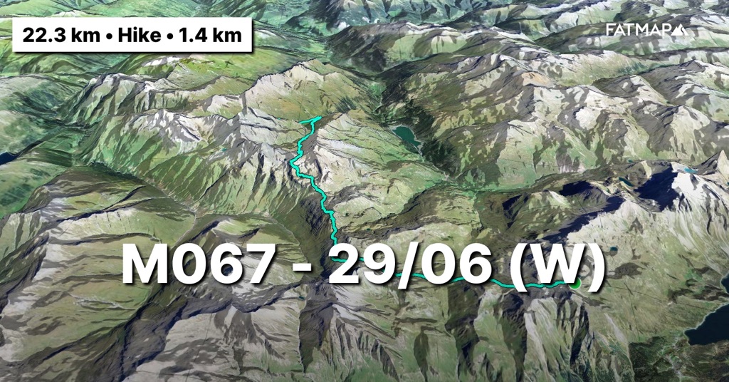
(Zaterdag 29/06) De nacht heeft me een buurman gebracht die in een tent verderop op de rots staat. Als ik de tent begin af te breken en aan de dagelijkse portie havermout begin, zie ik hem het bevroren meer aflopen. Eerst denk ik dat ik aan de late kant ben om te vertrekken maar snel wordt me duidelijk dat ie aan het vissen is. Hardcore. Maar zo te zien vangt ie bot. Ik duim voor hem dat hij beet zal hebben en begin aan mijn dag.
Zadel hoppen vandaag. Maar liefst vier zadels moet ik door en als de flanken er overal zo besneeuwd bij liggen, dan wordt dat een hels karwei. Ik begin er op mijn gemak aan want nu ze stevig aan het smelten zijn, is het als lopen in mul zand. Het eerste stuk van de route loopt nog samen met de via alpina maar in deze condities zal er - denk ik - niet veel volk te zien zijn dit jaar. Sowieso is de oversteek van de Alpen op de Via Alpina zeer moeilijk te doen in 1 wandelseizoen. Na het tweede zadel en toch nog een paar wandelaars te zijn tegengekomen, laat ik de Via Alpina achter me en trek door om toch nog een top mee te pikken die ik op de route had voorzien. Het doet deugd om nog eens mijn eigen route te kunnen lopen gezien alle omstandigheden.
En dan afdalen tot in het derde zadel om erna door te trekken naar het vierde en laatste van de dag. Maar eerst even eten want het lichaam schreeuwt om brandstof en dan moet ik luisteren. Een pakje royco en een handvol linzen en je hebt een calorie bommetje van zo’n 500kcal. Genoeg voor de laatste klim lijkt me. Met al iets meer gemak geraak ik tot in het zadel en dan direct door in de afdaling naar het eindpunt van de dag. Tegen de late namiddag hebben ze immers onweer voorspeld en tegen dan zou ik de tent al willen recht hebben. Het lichaam heeft het nog steeds zwaar want ook gisterennacht was geen topnacht in de tent.
Als ik aan het eindpunt ben, trek ik nog een stuk door op de route van morgen op zoek naar een goede slaapplek. De vallei waar ik door trek, is door de lokale boer volledig ingericht voor zijn koeien. Ik zal dus nog een stuk moeten stijgen om niet ten prooi te vallen aan hun ongebreidelde nieuwsgierigheid. De beesten hebben met hun hoeven de grasflanken hervormd in een maanlandschap. Hier een vlak stukje gras vinden is onbegonnen werk. Op de tweede wei staan ook koeien, dus we blijven stijgen. Als ik in de derde wei aankom, loopt het pad steil langs de bergflank. De rivier ernaast is stevig gezwollen en kan ik nergens oversteken. Spijtig want aan de overkant liggen perfecte stukjes grond. Ik blijf stijgen maar ben ondertussen goed kapot. Als ik een bocht omsla en er een waterval van meer dan 50m hoog opdoemt, zie ik een klein lapje gras tussen de stenen dat zou kunnen doorgaan voor een slaapplek. Het begint te regenen en te waaien en dus twijfel ik niet. Tent uit de rugzak en in een wip staat ie recht. Ik bouw nog een muurtje van stenen tegen de oprukkende wind en smijt alles in de tent en begin aan het avondritueel. Het licht was al even uit maar gaat definitief uit om 19u.
https://fatmap.com/adventureid/140782807/m067-29-06-w
(Zondag 30/06) Een helse nacht. Een zware windstorm heeft me heel de nacht beziggehouden. Het was slapen in blokken van 2 uur. Net na middernacht zat ik met de 2 wandelstokken in mijn handen rechtop, omdat de wind op de tent aan het inbeuken was. Maar ik heb dus een geweldige tent die het perfect heeft uitgehouden. Desalniettemin gaat de wekker om 6u. Iets vroeger dan de vorige dagen om vooral meer tijd te hebben om de afstand en hoogtemeters op het gemak te doen.
Terwijl de wind nog stevig te keer aan het gaan is, begin ik met een weerspannig gevoel beetje bij beetje het huishouden bij elkaar te verzamelen. Het sluitstuk is het opplooien van de tent en in de stevige wind lijkt dat op mezelf die stuntelig een lakenhoes over een donsdeken probeert te krijgen maar dan horizontaal uitgespreid op de grond.
Binnen de timing begin ik eraan om 7u. Door gisteren door te lopen, moet ik niet al te ver meer naar het eerste zadel van de dag. Goed vroeg in de ochtend ligt de oude sneeuw er goed verijsd bij. Het stappen tot in het zadel verloopt dus zeer vlot en de afdaling erna is terug plezierig naar beneden skiën op de schoenen. Vandaag ruil ik het wit van de zadels vooral in voor groen. Daar waar de Via Alpina langs de autobaan loopt, bleef ik toch liever wat hoger en in de natuur. En ik krijg wat ik wou. De vallei waar ik afdaal ligt er zeer groen, oogverblindend en tamelijk onbetreden bij. De vergroening van de Alpen is eveneens een effect van de klimaatverandering Een studie van wetenschappers op basis van satellietbeelden tussen 1984 en 2021 heeft aangetoond dat de vegetatie boven de boomgrens in bijna 80 procent van de Alpen is toegenomen. Enerzijds een positieve noot want meer groen betekent meer CO2 opslag maar ook een negatieve noot want door de stijgende temperaturen zijn het vooral bepaalde sterkere plantensoorten die nieuwe gebieden koloniseren en dat steeds hoger en dichter doen. De unieke lokale soorten die op grotere hoogte leven worden gewurgd door deze evolutie en dreigen te verdwijnen. Dat heeft dan weer een impact op de rest van het alpiene ecosysteem dat leeft van deze planten. Een evolutie die volledig toe te schrijven is aan de klimaatverandering.
Als ik op het einde van de vallei in het skigebied Radons aankom, is het tijd om mezelf even in de watten te leggen na de vorige nacht en er iets te eten. En dan door naar de laatste klim en het volgende zadel. Het weer blijft zeer onvoorspelbaar, dus wil ik niet teveel tijd verliezen zolang het nog goed is. De Alpen-passen-weg leidt me er heen. Een pad dat niet al te veel gebruikt wordt want als het niet verstopt ligt onder de oude sneeuwvelden dan ben je nog steeds aan het zoeken naar markeringen in de alpenweiden waar de koeien hun eigen paden hebben aangelegd.
Hoewel de route voor vandaag een beetje onder het zadel eindigt, duw ik toch verder door en daal volledig af tot in Ausserferrera. De tracker zit bijna zonder batterij en om alles op te laden heb ik niet meer voldoende in de powerbank. Aangezien er de volgende dag ook 2100 hoogtemeters op de planning staan, start ik daar liever fris aan en niet met al 1000 hoogtemeters afdaling in de benen ‘s ochtends. Het zou serieus gummi benen betekenen nog voor er een meter gestegen is. Ausserferrera telt maar een handvol huizen, maar heeft wel een backpacker hostel dat zeer geliefd is bij klimmers aangezien dichtbij een boulderparadijs ligt, genaamd de ‘Magic Woods’. Als ik er aankom, is de talk-of-the-town alle noodweer, modderstromen en overstromingen die plaatsgevonden hebben in de laatste dagen en weken. Zermatt, Ticino, La Bérarde, e.a iedereen is er wel eens gepasseerd, kan het niet geloven en loopt te vloeken op de bizarre weersomstandigheden die de Alpen dit jaar kennen. De uitbaatster die Belgisch blijkt en al jaren in de streek verblijft, zegt me dat hier toch iets klimatologisch fout moet zijn. Ik vertel haar dat ik mijn deel er al zeker van gehad heb. Eens de elektronica opgeladen, trek ik door met het plan net buiten het gehucht in het bos en op de route van morgen een slaapplek te zoeken. Ik zou kunnen blijven overnachten in het hostel maar ik vrees dat Zwitserland me nog wel een duit zal kosten, dus effe spaarzaam zijn. Op amper 200m verder vind ik de perfecte plek op een plateautje dicht bij de rivier. Water voldoende en hoog genoeg voor het geval er meer water zou afkomen. Snel het bed in want morgen wordt het de hele dag klimmen.
https://fatmap.com/adventureid/140782860/m068-30-06-w
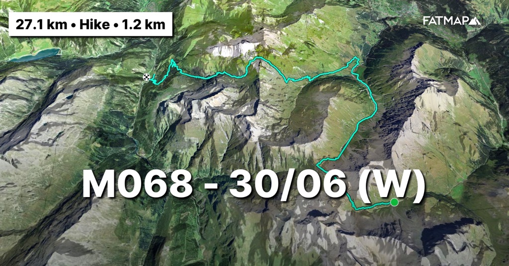
(Maandag 1/07) Vandaag spelen de Belgen tegen Frankrijk op het EK. De wedstrijd volgen zal er spijtig genoeg niet in zitten want nergens onderweg zal ik bereik hebben. Ik hoop dat ze er meer van bakken dan ik vandaag. Ik werk me door de dagelijkse portie havermout en begin stipt om 7u aan de eerste pittige klim van de dag. De eerste 500hm liggen pal aan het begin en ik start op het gemak om het lichaam zich op gang te laten trekken. De wolken hangen laag, dus is het klimmen tot boven het wolkendek. Na een uur zijn de hoogtemeters achter de rug. Een stevig tempo ondanks dat het lichaam niet top aanvoelt.
Boven ligt een alm, Alpe Nursera. Met zelfs geen weg ernaar toe is ie totaal afgesloten van de buitenwereld en toch is ie permanent bewoond door 2 herders, zoals ze me vertelden. Prachtig gegeven dat me vaak doet denken aan het boek en de film ‘de 8 bergen’. De resolute keuze om weg van de bewoonde wereld alleen met het vee te gaan leven. Echte Montagnards.
Ik trek verder op het pad. Een prachtige route die weg van de platgetreden alpenwegen loopt en zodanig ongebruikt is dat het vaak zoeken is naar waar het pad heen buigt. Gelukkig is het goed gemarkeerd maar je bent soms wel even aan het zoeken. Doorheen de route heb ik herhaaldelijk zulke paden erin gestoken. Ze bieden soms een nog ongereptere blik op de schoonheid van de Alpen. Mijn tip dus. Ben je in de Alpen, kijk op de kaart naar de paden die er zijn en laat de grote Alpenwegen even links liggen. Niet veel verder ligt het bewijs. Als ik langs de flank door de opstijgende wolken trek, schiet in de mist over de bergkam op zo’n 20m een gems voorbij. Ik hou de wandelstokken in en loop rustig verder zonder al te veel lawaai te maken. Nog een flank verder eentje op 10m en als ik een rots passeer staat er plots een op 3m van me.
Ik daal verder af door de lagergelegen alpenweiden naar waar ik terug op de Via Alpina zal inhaken. Onderweg nog een opstopping met wat kalveren die het pad versperren. Ik drijf ze voor me uit en ze blijven een hele afstand land voor me uit lopen op het pad. Als ze een veldje hebben gevonden om me te laten passeren, begint de achtervolging. Super nieuwsgierig die beesten, ze blijven me ettelijke meters volgen.
Net voor ik terug aansluit op de Via Alpina die lager de gravel banen heeft gevolgd, geraak ik nog aan de praat met de enige levende ziel die ik die dag zal tegenkomen. Een sympathieke herder die de 300 koeien in de gaten houdt die hier tijdens de zomer verblijven. Hij geeft me wat info over de rest van de route die zal flirten met de Italiaans-Zwitserse grens en waarschuwt me dat de Italiaanse markeringen niet van de beste zijn en er zo al vaak Italianen verkeerd terecht zijn gekomen in Zwitserland. Ik bedank hem en trek door naar de pas op de grens om daar de Via Alpina te verlaten en de grens te volgen en zo nog een top mee te pikken, de Pizzo Spadolazzo (2722m).
Vanuit de pas start de beklimming en hoewel ik al een pak hoogtemeters in de benen heb, is het toch amusant klauteren over rots op de steile beklimming. Als ik op de top sta is die volledig omgeven door de wolken. Soms trekken ze even weg en kan ik zien hoe steil de flanken aan weerszijden van de graat zijn. De staat van de benen telt nu niet meer, dit doen ze het liefst. Vanop de top kan ik verderop de kleine broer van de Pizzo zien liggen en aangezien we hier nu toch zijn, gaat die er ook aan. De wind staat hard en de wolken proberen zich een weg te banen door de lager gelegen pas. Aangezien ze in de late namiddag onweer voorspeld hadden met potentieel bliksem blijf ik niet al te lang treuzelen op de top en daal snel af naar de pas. Vandaaruit moet ik enkel nog het meer rond en nog 2,5km tot aan het noodbivak, Bivacco Suretta (2750m) aan de voet van de Surettahorn (3027m). Dus moest het slecht uitdraaien, zitten we snel veilig.
Eens het meer en de pas erachter voorbij, doemt het noodbivak op. Maar ook de 200 hoogtemeters door de oude sneeuwvelden die nog tussen ons in liggen. In de pas slaat de miezer om in een stevige regenbui en zo zit het venijn vandaag weer mooi in de staart. Ik ploeter door de flanken van papsneeuw en hoe hoger ik trek, hoe steviger de rukwinden die er nog bij krijg. De kin gaat op de borst en het is stampen tot aan de hut in de ijzige regen en wind. De hut is nog eentje uit de oude tijd. Een blikken doos van nog geen 12m vierkante groot waar 9 mensen in zouden kunnen overnachten. Ik heb ze gelukkig volledig voor me alleen.
Vooraleer alles uit te trekken en nieuwe kleren aan te doen, haal ik nog een ketel sneeuw en begin te smelten. Ik kook 2 keer warm want met uiteindelijk 2200 hoogtemeters en 20km heeft het lichaam goed afgezien. Met een volle warme maag duurt het niet lang of ik ben voor 19u al richting dromenland. De wind die raast om de blikkendoos heen en de regen klettert ertegen maar dat deert me niet na vandaag. Hopelijk bakken de Belgen er evenveel van tegen Frankrijk.
https://fatmap.com/adventureid/140782915/m069-1-07-w
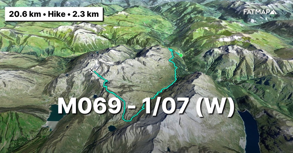
(Dinsdag 2/07) De wekker gaat om 6u maar ik klop hem uit. Nog een uurtje extra want de nacht in de bivak was geweldig en buiten gaat de wind nog serieus tekeer. De hut hangt ook nog volledig in de wolken en dat maakt het ijskoud. Geen zin dus om nu al uit de warme slaapzak te kruipen. Een uurtje later beginnen we er dan toch aan. Dat de kleren die ik gisteren te drogen hing, droog zouden zijn, was uiteraard wishful-thinking. Dus snel de klamme kleren aantrekken en laag bovenop laag stapelen om niet te hard af te koelen. Verder drogen doen ze wel onderweg.
En dan de hut uit. De wind snijdt ijzig in mijn gezicht en met bril, buff en kap probeer ik me er zoveel mogelijk voor te verstoppen. Ik probeer het pad te vinden tussen de oude sneeuwvelden en door de wolken heen maar dat is niet zo evident en herhaaldelijk is het de verschillende gps’en erbij halen om het te kunnen blijven volgen. De vingers zijn verkleumd intussen en zitten verkrampt rond de grepen van de wandelstokken. Gelukkig slaag ik erin om snel af te dalen en vergroot ook de zichtbaarheid als ik afdaal in het wolkendek. Een geluk want het zomerpad dat in de rotswand loopt, loopt nu langs geweldig steile sneeuwflanken. Er ligt nog gemakkelijk 2 á 3 meter sneeuw. Beetje bij beetje en vooral gedreven om weg te geraken uit de rukwinden en koude, geraak ik lager en lager.
Als ik uit het wolkendek en de sneeuwvelden ben, kom ik onderweg nog een paar 50+’ers tegen die vol moed naar boven aan het klimmen zijn. Ik kijk ze bedenkelijk aan en informeer hen over de condities boven. Desalniettemin en in een vleug van och-gij-kadeeke-niks-gewoon zetten ze hun tocht verder. Ik wens hen succes. Als ik aankom in de Splügenpass, houd ik halt. Op de wandelkaart die er hangt, bekijk ik de opties om de Pizzo Tambo (3278m) te vermijden. Sowieso ligt er nog teveel sneeuw op en met deze rukwinden en onvoorspelbaar weer kruip ik er niet op. Een pad tegen de bergflank aan zou me via een skipiste naar het eindpunt van vandaag kunnen brengen. De markering van het pad is echt ver te zoeken en de onderneming wordt snel een stuntelen doorheen heide, struiken en af en toe via de vele semi-paden die de beesten erin getrokken hebben. Aan de ski-piste is het even terug de trekkersbenen vinden en de zeemansbenen afschudden. De zon komt er door, dus even alles laten opdrogen. Als ik ook nog een werkend stopcontact vind, heb ik helemaal prijs en neem ik rustig de tijd om soep te koken terwijl de tracker oplaadt. Kers op de taart. Ook nog 4G, dus ook nog even bellen met het thuisfront want morgen komen ze op bezoek. Speciale gelegenheid ook want ik zal dan precies halverwege de totale tocht zijn in afstand. En nog beter, mijn zus die in de States woont en ik sinds Kerst en Nieuw niet meer zag, komt mee.
Maar eerst op naar de laatste pas voor de dag. Nog een klim van 600 hoogtemeters tot aan de voet van de noordgraat van de Pizzo Tambo waarlangs ik in betere condities zou zijn afgedaald. Eens op de pas, leg ik me er net achter in de zon en uit de wind. Ik zou er uren kunnen liggen en eigenlijk was dit het eindpunt voor de dag maar ik heb opnieuw liever de afdaling achter achter de rug om morgen fris te beginnen aan de laatste klim van deze etappe.
Het pad geraak ik opnieuw kwijt in de oude sneeuwvelden die er nog liggen. Het is opnieuw klungelen langs struiken en heide op de steile bergflank om terug aan het pad te geraken. De rest van de afdaling is niet van de poes. Het gaat bijna loodrecht naar beneden tussen de struiken waaronder het pad vaak verstopt ligt. Overal springen kikkers op terwijl je ze vooral niet zou verwachten op deze hoogte. Beneden in de vallei aangekomen, leg ik me uit het zicht van de alm in de verder totaal verlaten vallei. Tegen een marmotten burcht zo blijkt want met velen houden ze me nauwlettend in de gaten. Ik begin onmiddellijk te koken om binnen het uur na aankomst zeker te eten zodat het lichaam later geen energie moet gebruiken om te verteren. En dan een beetje rusten in afwachting van het opzetten van de tent. In Zwitserland mag je in het wild bivakkeren maar enkel boven de boomgrens (1800 à 2200m) en buiten nationaal parkgebied. En daar zit ik nu net niet, aangezien ik zowel onder de boomgrens als in het natuurgebied Beverin zit. Als de herder van de alm zwaar bepakt vanuit de vallei van San Bernardino naar boven komt, ziet ie me zelfs niet liggen in het gras. De herderin die wat later komt, heeft me wel gezien maar lacht me vriendelijk toe. Dat is dan het startschot om de tent op te zetten en erin te kruipen voor wat rust en een vroege nacht.
https://fatmap.com/adventureid/140783567/m070-d-2-07-w
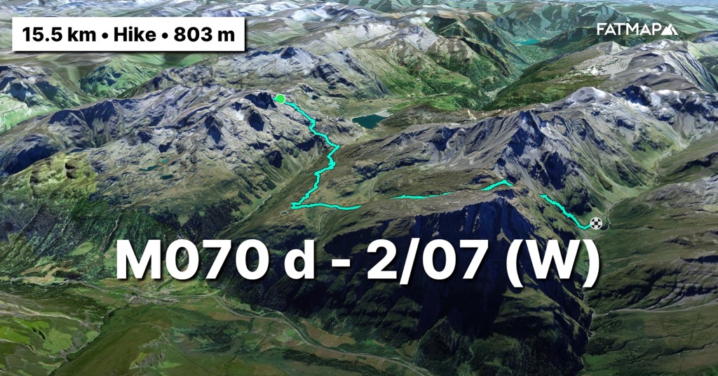
(Woensdag 3/07) Ik sta mee op met de zon, dus om 6u begin ik het huishouden bij elkaar te sprokkelen en de tent op te breken. Alles hangt nog volledig in de wolken. Een snelle check op de weerradar laat zien dat ze rond 7u zouden moeten beginnen optrekken. Ze houden me alvast niet tegen om snel aan de laatste klim van deze etappe te starten. Niet veel later klim ik door de wolken heen en wandel er boven op weg naar de enige pas voor de dag, Strec de Vignun (2373m).
Het lichaam is maar zus en zo en duidelijk toe aan rust. Eens in de pas is het enkel nog afdalen en dat gaat snel. Het vooruitzicht op rustdagen en het bezoek van familie stuwen de benen vooruit. Na een prachtige afdaling en een even geweldige waterval op het pad lben ik in San Bernardino. Het dorpje ligt dicht tegen de Italiaanse grens en dat merk je. Overal hoor je Italiaans in plaats van het Zwitserse Duits. Alles is een beetje vergane glorie of half vervallen maar ik ben nochtans nog steeds in Zwitserland. Er wordt dan ook zwaar gerenoveerd om het dorp een make-over te geven. Overal zwaaien bouwkranen met bouwmaterialen. Op een groot spandoek prijkt ‘l’inizio di una nuova storia’. Ik ben halverwege mijn project en hoop dat de weercondities in de 2de helft ook una nuova storia zullen zijn.
Ik val de lokale supermarkt binnen want het eten is op. De lokale bewoners spreken me onmiddellijk aan op wat, waarom, van waar, waarheen, enz. Ik vertel mijn verhaal terwijl ik de koeken die ik kocht binnenspeel. En dan gaat de tracker uit. Tijd voor rust, genieten met de familie en trots zijn dat ik halfweg deze trip ben…
https://fatmap.com/adventureid/140782940/m071-3-07-w
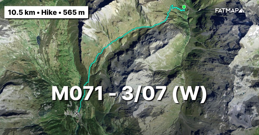
Op naar Monaco!
Bergse groeten en tot snel!
————— ENGLISH VERSION —————
(Friday 28/06) 2 days of rest. Rest is a big word because there are some things to follow up on in Belgium and since there are no alpine routes in the next 2 stages, there are also some logistics involved. To reduce costs, I bought myself those 2 days of rest in the youth hostel of Sankt Moritz. Youth hostels in Switzerland are close to hotels. Very well equipped, great food and very reasonable prices. Switzerland is not too cheap and you pay for everything. They would even dare to charge you a surcharge at the restaurant if you want to talk while eating. The Swiss are ashamed of nothing. The cheap youth hostel option then. The disadvantage is that you sleep in a room with 4 people and I must have just had the chance to experience Swedish, Canadian and Indian snore bombardments every night. So little recovery from the previous 11 days on the road. The body certainly doesn't feel like it.
It isn't until 9 a.m. that I set off along the lakes around St. Moritz to Maloja. The ankles who started protesting at the end of the previous stage are divided. The right ankle still wants to come along, but the left one thinks its own way. Not much later I hike along the mountain flanks and when a deer parades across the path, I am happy to be back on the road. I'm far from shy of people, but it was a bit too much of a crowd there in the fashionable village. The weather is beautiful and that brings many Swiss people out for a walk. When I pass an older lady who is busy with her walking sticks, while her Louis Vuitton handbag dangles from her hips, I leave St. Moritz behind me. You go, girl!
You can enjoy beautiful walking and cycling along the mountain slopes and the various lakes up to Maloja. Many old Swiss people are on a hike and look at me with interest as I pass. Unfortunately, I have a hard time to cope with Swiss German. I can hardly answer the old people's questions and this quickly results in a “Chuss” (Goodbye). Today I'm taking my time. The body doesn't feel like it and therefore there is no need to suffer too hard. 25km ahead and plenty of time. Every hour I take breaks along one of the many benches that provide panoramic views or at the many picnic areas where you can have a BBQ and the wood is even split and ready for you. I could grow old here too.
By 3pm I am 21km further in Maloja. The village that only sounds familiar to me from the youth camps is not much. I stock up on some sugar to start the sting of the day. Another 700m of elevation gain in the last 4km to Lake Lughin at 2500m. When I want to start the climb, I come across a German mountain hiker who is sitting on a rock cooking before he will start the climb. This part of the route runs together with the popular Via Alpina route which he is walking. In English he reminds me incredibly of Count Count from Sesame Street and I notice that my mind is not in the mood for it and I just want to get the climb over with quickly so I can rest. I complete the climb in one go, with the exception of having to wait a while for a herd of longhorns that were led down by the shepherdess. Great view. I notice that head and legs are in a conflict. The head doesn't feel like listening to the legs that are mush. And if old snow fields are added from 2300m onwards, it is all about shutting of the head and stomping.
At 5am I arrive. The old glacier basin where the lake now resides is still completely covered in snow. At the end of June and we are still in the snow at 2500m. A stark contrast to the bone-dry 2022 and 2023 in the Alps. Climbing the snowy slopes is for tomorrow. I'm looking for a place to pitch the tent. I make the first splash in this trip in a lake, which is still largely frozen. The splash therefore only lasts the full 30 seconds. I certainly don't see Count Count appearing anymore. He must have miscounted something on his way up. The legs get another massage and I crawl into the tent early with a view of the peaks of the Bernina massif in the distance. The Bianco ridge again looks beautiful from a distance, but I now know better. I will close that open account next year.
https://fatmap.com/adventureid/140782738/m066-28-06-w

(Saturday 29/06) The night brought me a neighbor who is in a tent further on the rock. As I start to take down the tent and start eating the daily portion of oatmeal, I see him walking down the frozen lake. At first I think I am too late to leave, but I soon notice that he is fishing. Hardcore. But it looks like it's it resulting in much. I keep my fingers crossed that he catches something and starts my day.
Saddle hopping today. I have to go through no fewer than four saddles and if their flanks are covered in snow everywhere, it will be a hard job. I start slowly because now that they are melting firmly, it is like walking in loose sand. The first part of the route still runs together with the Via Alpina, but in these conditions I don't think it will see many people this year. In any case, crossing the Alps on the Via Alpina is very difficult to do in 1 hiking season. After the second saddle and having encountered a few more hikers, I leave the Via Alpina behind me and continue to summit a peak that I had anticipated on the route. It's nice to be able to hike my own route again given all the circumstances.
And then I descend to the third saddle to continue to the fourth and last of the day. But first I eat because the body is crying out for fuel and then I have to listen. It is served soup with lentils. A pack of Royco soup and a handful of lentils and you have a calorie bomb of about 500kcal. Enough for the last climb I think. With a little more ease I get to the saddle and then straight into the descent to the endpoint of the day. After all, they have predicted thunderstorms towards the late afternoon and I would like to have the tent up by then. The body is still having a hard time because last night was not a great night in the tent.
When I reach the endpoint, I continue on tomorrow's route in search of a good place to sleep. The valley I am traveling into has been fully equipped by the local farmer for his cows. So I will have to climb a little further to avoid falling prey to their immeasurable curiosity. In addition, the animals have transformed the grass flanks with their hooves into a moonscape. Finding a flat piece of grass here is impossible. There are also cows in the second meadow behind it, so I continue the ascent. When I arrive in the third meadow, the path runs steeply along the mountain flank and I cannot cross the river that is swollen next to it anywhere. Too bad because there are perfect pieces of land on the other side. I continue to climb, but I'm pretty much broken in the meantime. When I turn a bend and a waterfall of more than 50 meters high looms, I see a small patch of grass between the stones that could pass for a place to sleep. It starts to rain and blow and so I do not doubt. I take the tent out of the backpack and it's up in no time. I build a wall of stones against the advancing wind and throw everything into the tent and start the evening ritual. The lights have been out for a while but will go out for good at 7 p.m.
https://fatmap.com/adventureid/140782807/m067-29-06-w
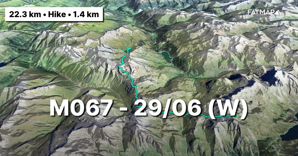
(Sunday 30/06) A hellish night. A heavy wind storm kept me busy all night. I had to sleep in blocks of 2 hours, sitting up just after midnight with the 2 walking sticks that serve as tent poles in my hands because the wind was hitting the tent hard. But a great tent that has held up perfectly. Nevertheless, the alarm goes off at 6am. A little earlier than the previous days to have more time to comfortably cover the distance and elevation gain.
While the wind is still blowing strongly, it is with an unruly feeling that the household is gathered together little by little. The final step is folding the tent and in the strong wind it mainly looks like me clumsily trying to get a sheet cover over a duvet, but then spread horizontally on the ground.
Within the timing, I start at 7am. Continuing the climb yesterday means that I don't have to go too far to the first saddle of the day. Early in the morning the old snow looks well iced. Getting into the saddle is therefore very smooth and the descent afterwards is enjoyable skiing back down on my shoes. Today I mainly exchange the white of the saddles for green. Where the Via Alpina runs along the road, I preferred to stay a little higher and in nature. And I get what I wanted. The valley where I descend is very green and dazzling and relatively untrodden. The greening of the Alps is also an effect of climate change. A study by scientists based on satellite images between 1984 and 2021 has shown that vegetation above the tree line has increased in almost 80 percent of the Alps. On the one hand a positive note because more greenery means more CO2 storage, but also a negative note because due to rising temperatures it is mainly certain stronger plant species that colonize new areas and do so increasingly higher and denser. The unique local species that live at higher altitudes are strangled by this evolution and are in danger of disappearing. Which in turn has an impact on the rest of the alpine ecosystem that lives on these plants. An evolution that can be entirely attributed to climate change.
When I arrive at the end of the valley in the Radons ski area, it is time to pamper myself after last night and I have something to eat. And then on to the last climb and the next saddle. The weather remains very unpredictable so I don't want to lose too much time while the weather is still good. The Alpine Passes Road leads me there. A path which is not used too much because if it is not hidden under the old snow fields, you are still looking for path markings in the alpine meadows where the cows have built their own paths.
Although today's route ends a bit under saddle, I push on and descend completely to Ausserferrera. The tracker is almost out of battery and I no longer have enough to charge everything with the power bank. Since there are also 2100 meters of elevation gain planned for the next day, I would rather start fresh than have to climb 1000 meters in the morning after a long descent. It would seriously mean rubbery legs before one meter has been climbed. No bigger than a handful of houses, Ausserferrera does have a backpacker hostel that is very popular with climbers as it is close to a bouldering paradise called the 'Magic Woods'. When I arrive, the talk of the town quickly and repeatedly turns to all the severe weather, mudslides and flooding that have occurred in the last days and weeks. Zermatt, Ticino, La Bérarde, etc. everyone has passed by, cannot believe it and is cursing at the bizarre weather conditions that the Alps are experiencing this year. The manager, who turns out to be Belgian and has been living in the region for years, tells me that there must be something climatologically wrong here. I reassure her that I have already had my fair share. Once the electronics have been charged, I continue with the plan to look for a place to sleep in the woods just outside the hamlet and on tomorrow's route. I could stay overnight in the hostel, but I fear that Switzerland will cost me a lot of money, so I'll have to watch the budget. Just 200m further I find the perfect spot on a plateau close to the river. Water sufficiently present and high enough in case more water comes off the mountain side. I hurry to bed because tomorrow will be a whole day of climbing.
https://fatmap.com/adventureid/140782860/m068-30-06-w
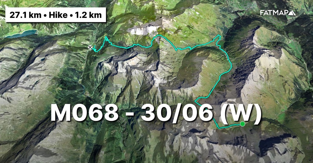
(Monday 1/07) Today the Belgians play against France in the European Championship. Unfortunately, following the game will not be an option because I will not have coverage anywhere along the way. I hope they make more of it than I will do today. I work through my daily portion of oatmeal and start the first tough climb of the day at 7am sharp. The first 500 meters of elevation gain are right at the beginning and I start slowly to let the body warm up. The clouds hang low so I climb through the cloud cover. After an hour the elevation gain is done. Still at a strong pace even though the body doesn't feel great.
Above there is an alpine pasture, Alpe Nursera. With not even a road to it, it is completely cut off from the outside world and yet it is permanently inhabited by 2 shepherds, as they told me. Beautiful fact that often reminds me of the book and film 'the 8 mountains'. The resolute choice to live alone with the cattle away from civilization. Real Montagnards.
I continue on the path. A beautiful route that runs away from the beaten alpine roads and is so unused that it is often difficult to find where it bends. Fortunately it is well marked, but sometimes you have to search for a while. I have repeatedly added such paths throughout the route. They sometimes offer an even more unspoilt view of the beauty of the Alps. So a tip. If you are in the Alps, look at the map for the available trails and ignore the major Alpine roads. The proof lies not much further. As I trek along the flank through the rising clouds, a chamois passes by in the mist over the ridge at about 20 meters. I keep my walking sticks in and walk quietly without making too much noise. Another flank further, one at 10m and when I pass a rock there is suddenly one at 3m from me.
I descend further through the lower alpine meadows to where I will rejoin the Via Alpina. Along the way there is a traffic jam with some calves blocking the path. I drive them ahead of me and they walk ahead of me on the path for a long distance. Once they have found a field to let me pass, the chase begins. These animals are super curious and they keep following me for several meters.
Just before I rejoin the Via Alpina, which follows the gravel paths lower down, I get to talking to the only living soul I will encounter that day. A sympathetic shepherd who keeps an eye on the 300 cows that stay here during the summer. He gives me some information about the rest of the route that will flirt with the Italian-Swiss border and warns me that the Italian markings are not the best and that Italians have often ended up in Switzerland wrongly. I thank him and continue to the pass on the border to leave the Via Alpina and follow the border to reach another peak, the Pizzo Spadolazzo (2722m).
The climb starts from the pass and although I already have a lot of eleven gain in my legs, it is still amusing scrambling over the rocks to the summit. When I get to the top it is completely surrounded by clouds. Sometimes they move away for a moment and I can see how steep the flanks are on either side of the ridge. The condition of the legs no longer counts and this is what they prefer to do. From the top I can see Pizzo's little brother further up and since I am here now, I will bag it too. The wind is strong and the clouds are trying to push their way through the lower pass. Since they had predicted thunderstorms with potential lightning in the late afternoon, I don't linger too long at the top and quickly descend to the pass. From there I only have to go around the lake and another 2.5km to the emergency bivouac, Bivacco Suretta (2750m) at the foot of the Surettahorn (3027m). So if things had to turn out badly, I would soon be safe.
Once past the lake and the pass behind it, the emergency bivouac appears. But also the 200 meters of altitude through the old snow fields that still lie between us. In the pass the drizzle turns into a heavy rain shower and so the devil is in the tail again today. I trudge through the slopes of slush snow and the higher I go, I get strong gusts of wind. The chin goes to the chest and I have to stomp all the way to the hut in the icy rain and wind. The hut is still one from the old days. A tin box of less than 12m2 in size that could accommodate 9 people overnight. But I have it completely to myself tonight.
Before taking everything off and putting on new clothes, I get another kettle of snow and start to melt. I cook twice because after 2200 meters of elevation gain and 20km the body has suffered well. With a full, warm stomach, it doesn't take long before I'm off to dreamland before 7 p.m. The wind rushes around the tin box and the rain beats against it, but that doesn't bother me after today. Hopefully the Belgians will do just as much against France.
https://fatmap.com/adventureid/140782915/m069-1-07-w
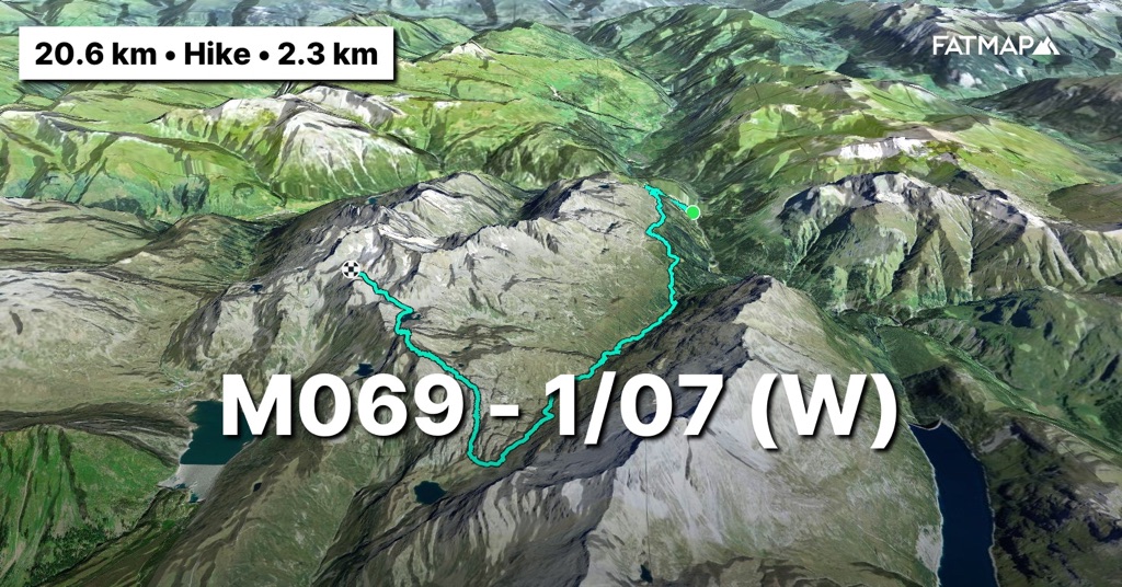
(Tuesday 2/07) The alarm goes off at 6am but I snooze it. An extra hour of sleep because the night in the bivouac was great and outside the wind is still blowing heavily. The hut is also completely covered in clouds and that makes it ice cold. So there's no point in crawling out of the warm sleeping bag just yet. An hour later I have to start anyway. The clothes I hung out to dry yesterday were obviously wishful thinking. They would never really dry. So quickly put on the damp clothes and stack layer upon layer to not cool down too much. They will further dry along the way.
And then out of the cabin. The wind cuts icy across my face and with goggles, buff and hood I try to hide from it as much as possible. I try to find the path between the old snow fields and through the clouds, but that is not so obvious and I have to repeatedly use different GPS’s to keep following it. The fingers are now numb and cramped around the handles of the walking sticks. Fortunately, I manage to descend quickly and the visibility also increases as I descend into the cloud cover. This is fortunate because the summer path that runs into the rock wall now runs along incredibly steep snow slopes. There is still easily 2 to 3 meters of snow. Little by little and mainly driven to get away from the wind and cold, I get lower and lower.
When I leave the cloud cover and snow fields, I encounter a few people over 50 along the way who are climbing up with courage. I look at them suspiciously and tell them about the conditions above. Nevertheless, and with a hint of oh-you youngster-not-used-to-anything, they continue their journey. I wish them luck. When I arrive at the Splügenpass, I stop. On the walking map that is hanging there, I look at the options to avoid the Pizzo Tambo (3278m). In any case, there is still too much snow on it and in these gusts of wind and unpredictable weather I cannot climb it. A path against the mountainside could take me to today's destination via a ski slope. The markings of the path are really hard to find and the undertaking quickly becomes a bumble through heathland, bushes and occasionally via the many semi-paths that the animals have drawn in. On the ski slopes it's time to find my hiker's legs again and shake off the sailor's legs. The sun is coming through so I let everything dry. If I also find a working socket, it's all worth it and I take the time to cook soup while the tracker charges. Cherry on the cake. Also 4G, so I call home because they are coming to visit tomorrow. Also a special occasion because I will be exactly halfway through the total distance of the route. And even better, my sister who lives in the States and whom I haven't seen since Christmas and New Year, is coming along.
But first on to the last pass for the day. Another climb of 600 vertical meters to the foot of the north ridge of the Pizzo Tambo, along which I would have descended in better conditions. Once on the pass, I lie down just behind it in the sun and out of the wind. This was actually the end point for the day, but again I would rather have the descent behind me and start fresh tomorrow on the last climb of this stage.
I lose the path again in the old snow fields that are still there. And have to scramble again through bushes and heathland on the steep mountain slope to get back to the path. The rest of the descent is not easy. It goes almost vertically down between the bushes, where the path is often hidden underneath. Frogs are jumping up everywhere in the bushes where you wouldn't expect them at this height. When I arrive at the bottom of the valley, I hide out of sight of the alm in the otherwise completely deserted valley. Against a marmot castle, as it turns out, because there are many of them keeping a close eye on me. I start cooking immediately to be sure to eat within the hour of arrival so that the body does not have to use energy to digest later. And then rest a bit while waiting to set up the tent. In Switzerland you are allowed to camp, but only above the tree line (1800 to 2200m) and outside the national park area. And that's not where I am right now as I am both below the tree line and in the Beverin nature reserve. When the mountain shepherd comes up from the San Bernardino valley, heavily loaded, he doesn't even see me lying in the grass. The shepherdess who comes a little later has seen me but smiles at me kindly. That's the starting signal to set up the tent and crawl in for some rest and an early night.
https://fatmap.com/adventureid/140783567/m070-d-2-07-w

(Wednesday 3/07) I'm up with the sun so at 6am I start gathering everything and take down the tent. Everything is still completely in the clouds. A quick check on the weather radar shows that they should start moving at 7am. They certainly won't stop me from quickly starting the last climb of this stage. Not much later I climb through the clouds and walk above them on the way to the only pass for the day, Strec de Vignun (2373m).
The body is what it is and clearly needs some rest. Once in the pass, it is only a descent between San Bernardino and me and it goes quickly. The days of rest and the prospect of visiting family boost the legs. After a beautiful descent and an equally amazing waterfall on the path later, I am in San Bernardino. So close to the Italian border, the village has an incredible Italian appearance. Everywhere you hear Italian instead of Swiss German. Everything is a bit of a faded glory, but I am still in Switzerland. They are therefore heavily renovating to give the village a makeover. There are construction cranes everywhere, busy moving building materials. A large banner reads 'l'inizio di una nuova storia'. I am already halfway through this project and hope that the weather conditions in the 2nd half will also be una nuova storia.
I raid the local supermarket because my food is gone. The local residents immediately ask me what, why, from where, where to, etc. I tell my story while I eat the cookies I bought. And then the tracker turns off. Time to rest and enjoy with the family the fact that I am halfway through this trip... and!
https://fatmap.com/adventureid/140782940/m071-3-07-w

Off to Monaco!
Mountain greetings and see you soon!Start hier met schrijven...
