————— NL version (ENG version below) —————
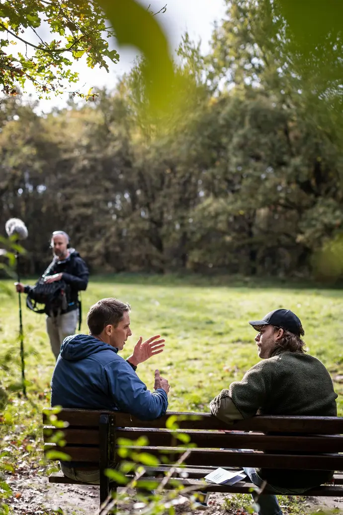
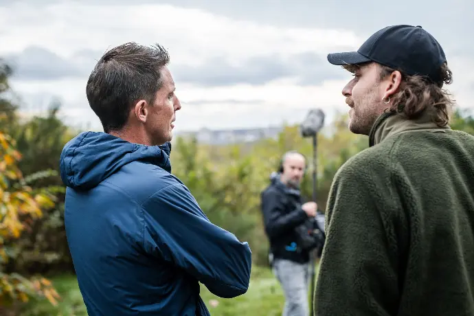
(Dinsdag 28/05) Een onweer heeft me nog een dag langer gegijzeld in Luttach. Maar met alle aanpassingen aan de route heb ik nog tijd genoeg om tijdig op het punt van afspraak met Bruno te geraken. Ik ken Bruno van een klim in de Ötztaler Alpen vele jaren geleden maar deze keer zal ie mee het stuk van de route door de Stubaier Alpen die er net voor liggen, voor zijn rekening nemen.
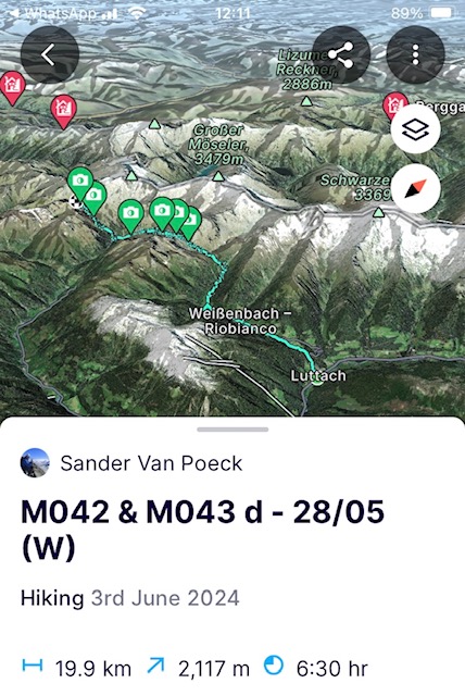
Het miezert. Ondertussen beschouw ik dat als goed weer. Ik kruip het dal van de Weissenbachrivier in richting het gelijknamige dorp. In het Italiaanse Zuid-Tirol is alles tweetalig aangegeven en in het Italiaans klinkt de rivier als Rio Bianco. Echter zo Bianco is ze niet. Eerder vuil geel tot bruin kleurig. Door de constante regenbuien is de grond verzadigd en neemt het oppervlakte water modder mee tot in de rivier. Als moeder natuur de kraan nog wat verder open zet, gaat ook de regenbroek aan. 2,5u later zit ik tot mijn eigen verbazing in de helft van de route van de dag. De eerste 1100 hoogtemeters en 11 kilometers staan op de teller. De conditie is top en de recuperatie ongezien.
Vanaf dit punt op zo’n 2000 meter hoogte, besluipt de nieuwsgierigheid me. Ik heb iets meer dan 5 dagen alles boven de 2600m hoogte vermeden omwille van het lawinegevaar en ben benieuwd, gezien de regenval, wat het gedaan heeft met het sneeuwpak. Ze heeft alvast serieus huis gehouden en onder de 2600m heeft ze bijna alle nieuwe sneeuw weggevaagd en oude sneeuwlagen besprenkeld met Sahara zand en in een pap veranderd. Her en der is het sneeuwpak ingesneden met door de regen gevormde afwaterkanalen omdat die niet door een bevroren laag van het oude sneeuwpak geraakten. Mits zon in de komende weken kan het nu snel gaan en het landschap volledig transformeren. Het Sahara zand en de ijlere lucht zijn een katalysator op het smeltproces. Ook rotspartijen zijn komen bloot te liggen in de zuidgerichte flanken en pas op 2400m trek ik mijn sneeuwschoenen aan om door de pap te ploeteren. Nadeel is dat de afdaling in zo'n nat sneeuwdek iets minder prettig is dan het sneeuwschoen-surfen van voordien.
Onder de 2000m loop ik zelfs enkele wandelaars tegen het lijf. Maar als ze verderop het natte sneeuwdek ervaren, zie ik ze even snel terugkeren richting de alm aan het lager gelegen stuwmeer. Aan het stuwmeer staat het waterpeil zeer laag ondanks alle neerslag, maar dit vooral omdat door de weinige zon ze overschakelden op de stuwmeren voor de energieproductie. Alpenlanden zoals Oostenrijk en Zwitserland zitten vandaag met +/- 37% al ver boven het Europese gemiddelde van 23% (2022) qua aandeel van gebruikte energie uit hernieuwbare bronnen. De Europese doelstelling om 45% te behalen tegen 2030 is uitdagend maar mist individuele doelstellingen per land en liep in 2022 al tegen een dalende groeiratio aan versus eerdere trends. Om de nieuwe doelstelling te halen moeten we naar een verdubbeling van de groeiratio vs. de ratio geobserveerd in de laatste 10 jaar. We hebben misschien niet allemaal bergrivieren maar wind en zon hebben we overal. Het is dus een kwestie van concrete acties en geen verstoppertje achter doelstellingen zonder plan.
Na in de alm wat suikers te hebben binnengespeeld, begin ik aan het laatste stuk van de dag richting de Edelrauthütte. Onderweg is het klimmen in het oude sneeuwlawinepuin maar ook recentere lawines tekenen zich af. Het gewicht van het nat sneeuwpak op de steilere hellingen blijft een aandachtspunt. ‘Never a dull day in the mountains’. Eens bij de overigens spiksplinternieuwe, hypermoderne en ecologisch gebouwde hut blijkt die geen winterruim te hebben dat open is zoals de website van de Alpenvereniging zei. Ik kruip dus in het houtkot dat altijd open is en bouw het om tot een slaapplek. De waterpas op mijn gsm komt er zelfs bij te pas. Ik installeer me uit de wind, kook er en leg schoenen en kousen te drogen in de zon die er sinds enkele uren is doorgekomen. Morgen meer zon alvast maar vannacht vriest het tot -10 dus snel de slaapzak in om die warm te stoken.
https://fatmap.com/adventureid/133387472/m042-m043-d-28-05-w
(Woensdag 29/05) Het heeft zwaar gevroren in de nacht en aan een stuk van de slaapzak waar mijn mond zat, is zelfs de condens van mijn ademhaling vastgevroren. De voorspellingen hadden een zeer zonnige dag voorspeld en die krijg ik ook gepresenteerd. Gisterennacht was ik in slaap gevallen met het overlopen van de opties om in het volgende dal te geraken, het Pfitscher dal. De keuze tussen de opties die verschillen van korte tot lange afstanden en vlakke tot steilere hellingen, zou volledig afhangen van hoe het sneeuwdek uit de koude nacht gekomen zou zijn.
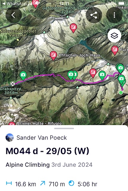
De nachtelijke ijzige temperaturen hebben heel het sneeuwdek verhard. Perfecte condities om voor de kortste route langs het zadel aan de Höchfeiller te gaan (3183m) en een nieuwe hoogte qua mijlpaal neer te zetten. Ik zal wel stevig uit mijn pijp mogen komen tijdens de klim om door het zadel te geraken en op tijd aan de afdaling te beginnen voordat de zon haar zinnen zet op het sneeuwpak.
Ik ben niet alleen. Her en der duiken er als marmotten tourskiërs op in de flanken. Allemaal druk trekkend aan hun stokken om de steile flank op te geraken. 3 uur later sta ik in het zadel op 3183m. Het is er prachtig en met geen wolkje aan de lucht kan je de bergketens tot in Zwitserland zien. Allemaal nog ingepakt onder een goed pak sneeuw. Ik zou er wel gemakkelijk een uur hebben kunnen blijven staan maar de zon speelt vandaag ook mee, dus snel aan de afdaling beginnen. De snelle klim tegen de steile flank heeft me serieus wat energie gekost en hoewel de top van de Hochfeiler maar 2,5km en nog eens 700 hoogtemeters verwijderd is, ga ik moeten passen. De kans dat de zon me de afdaling bemoeilijkt, speelt ook mee en in de huidige afdaling laat ze al haar sporen zien met nattere sneeuw als gevolg. Boven zal het wel iets langer duren maar die top houden we dan maar voor een volgende keer. De bergen lopen niet weg.
Aangezien ik de kortste route heb kunnen nemen zit ik een dag voor op het afspraak moment met Bruno. Ik beslis dus om verder af te dalen via de Tiroler Höhenweg tot in Sankt Jakob voorbij het afspraakpunt, er de voorspelde regen voor vannacht uit te zitten en de volgende dag al richting Europa Hütte te trekken. Aangezien ze morgen ook nog regen geven, is de route naar de hut dan iets korter en dat geeft me meer flexibiliteit ifv het weer. Ik stuur Bruno een bericht dat ik overmorgen met een lege rugzak de 8 kilometer zal teruglopen om hem te ontlasten van het touw en eten dat ie mee naar boven zeulde voor me.
https://fatmap.com/adventureid/133387511/m044-d-29-05-w
(Donderdag 30/05) Het regent dat het giet als ik wakker word. Dat belooft. Als buien afgewisseld worden met opklaringen haal ik er tot 3 weerapps bij om me een idee te geven van wat de dag zal brengen. Daar waar er 2 aangeven dat dit voor de rest van de dag zo is, geeft de derde, de radar, uitsluitsel. Het grootste stuk van de depressie zit boven Zwitserland vast en zal amper bewegen. Ik mag me dus aan opklaringen verwachten voordat het terug beweegt.
Ik begin aan de klim. Het wolkenpak zit tamelijk laag, zo rond de 2000m en trekt op en open hoe dichter ik nader. Het is een pracht van een beklimming en zeker een aanrader. Kort (+/- 7km) en relatief pittig (+/- 1200 hoogtemeters) tot aan de hoofdkam. Op de kam ligt de oude Europa Hütte die in 1899 gebouwd werd, pal op de grens tussen Italië en Oostenrijk ligt en eigendom is van het Duitse alpenverein. De grens loopt er dwars door de slaapzaal. Europese samenwerking avant-la-lettre.
Aangekomen in het winterruim gaat alles uit wat nat is door het zweet. Ik laat het drogen in de zon die tussen de wolken komt piepen, droge kleren aan, sneeuw smelten, soep koken en een dutje doen. Morgen wordt het weer nog slechter met vooral regen als ik Bruno ga halen. Dat belooft weer een nat pak maar dat zullen we morgen wel zien want in de bergen kan je nooit zeker zijn.
https://fatmap.com/adventureid/133387541/m045-d-30-05-w
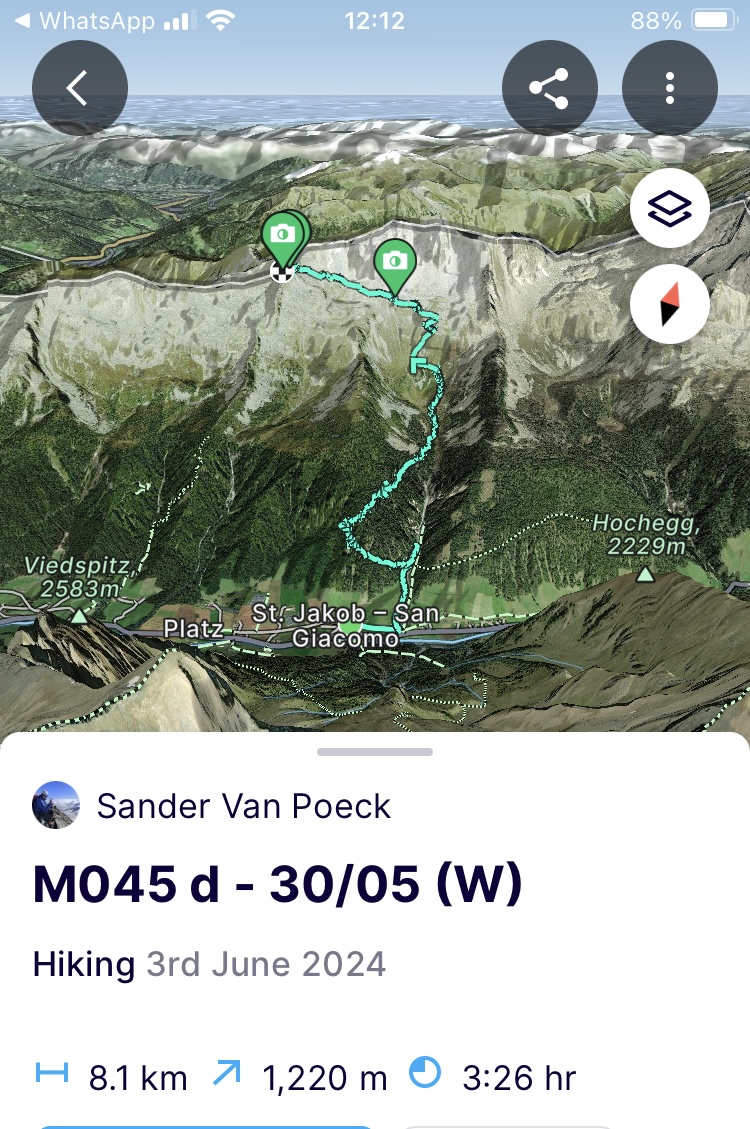
(Vrijdag 31/05) Pa is jarig en met het beetje bereik dat ik hier heb stuur ik hem een bericht om hem gelukkige verjaardag te wensen. De temperaturen zijn zwaar gekelderd tijdens de nacht. De voorspelde regen is een zware sneeuwval geworden met bijna een extra 50cm sneeuw hier op 2600m. Ik begin met stevige wind en aanhoudende sneeuw aan de route naar het pad dat leidt naar het zadel waar Bruno zal staan wachten. Ik verwacht er echter niet te veel van. Deze sneeuwval bovenop de oude laag gaat maken dat ik het pad of het idee ervan in de flank nooit zal kunnen gebruiken door het gevaar op lawines. De eerste honderden meters op de graad bevestigen mijn vermoeden. De afdaling van de graad gaat zeer langzaam en bedachtzaam om het verse pak niet te doen schuiven hoewel ik het hier en daar voorzichtig en gecontroleerd doe om te weten waar ik aan toe ben. Eens uit de graad is het me duidelijk. Ik geraak via deze route nooit tot bij Bruno. Ik stuur hem dus een bericht dat ie het zadel moet oversteken en rechtstreeks naar Sankt Jakob moet afdalen en dat ik hem daar zal opwachten. Ik neem het pad dat ik gisteren omhoog liep naar beneden en vanaf 2200m is de sneeuw niet zo aanwezig meer.
Beneden aangekomen is de Oostenrijkse Lawine dienst er ook al in geslaagd om gezien de ongeziene nieuwe sneeuwval een lawinebericht in elkaar te boksen. De hevige sneeuwval heeft het lawinerisico acuut de hoogte ingejaagd door de massale sneeuwval gepaard met hevige wind. De sneeuwgrens is teruggevallen op sommige plekken van 2500m naar 1700m. Bruno heeft er alvast ook zijn doop mee gekregen. Hij geraakt niet tot bij mij of het duurt alleszins zeer lang om af te dalen uit het zadel. De communicatie loopt net zoals het weer spaak en ik krijg hem keer op keer niet te pakken. Later zal blijken dat de koude de batterij van zijn verouderde gsm tot nul herleid heeft. Na lang wachten, komt ie er uiteindelijk door rond 3u in de namiddag. Aangezien het slechte weer is blijven aanhouden, het ondertussen te laat is om nog de Europa Hütte te bereiken (ook als we rekenen op een langere duur door de verse sneeuw) en Bruno moet bekomen van de doop die ie kreeg op zijn eerste dag, beslissen we om er even de nacht uit te zitten. Morgen als het weer iets zou moeten beteren en het sneeuwdek zich hopelijk wat heeft kunnen zetten, zullen we de oversteek wagen en mijn materiaal ophalen in de Europa Hütte.
Het weerbericht op de tv zegt dat de zomer eraan komt maar blikt even goed terug op de sprongen die het weer gemaakt heeft in april en mei tot dusver. Ik kruis de vingers dat het eindelijk eens het geval mag zijn en we op weg zijn naar meer zomerse condities.
(Zaterdag 1/06) Moeder natuur heeft nog niet direct oor naar mijn gebeden. De nacht heeft nog meer sneeuw gebracht. De route om tot aan de Europa Hütte te geraken, zal dus het grootste deel van onze dag innemen in deze omstandigheden. Meer en meer begin ik me als een naakte schildpad te voelen. Afgeremd door de sneeuw en niet in het bezit van al mijn materiaal dat in een bepaalde structuur in mijn rugzak past. Als een schildpad zonder huis.
De sneeuw heeft zich tot onder de 2000m gewaagd en dat betekent dus nog 650 hoogtemeters ploeteren door het sneeuwdek tot aan de hut. Het blijft onophoudelijk sneeuwen maar gelukkig is de ijzige wind gaan liggen. Bruno ziet af in het ploeteren nu ook een stok bij hem het onderspit heeft moeten delven. Niet evident dus jezelf zo staande te houden in een meer dan 70cm dik vers sneeuwdek. Ik ploeg me er door, op kop met het verstand op nul en probeer zo goed mogelijk een spoor te maken voor hem.
Het is voorbij de middag en ongeveer 5u verder als we door het zadel op 2650m hoogte tot aan de hut kruipen. In het onverwarmde winterruim staan we allebei te dampen van al het zweten. Ik maak warme havermout en probeer in beweging te blijven door al mijn spullen in te pakken. Niet te lang treuzelen en terug de witte massa in naar beneden aan de andere kant van de graad. Het is zoeken naar waar de hellingen het minst steil zijn om mogelijke lawines te vermijden. Eens vanaf 2000m proberen we het zomerpad te vinden zodat de sneeuwschoenen uit kunnen en alles iets sneller gaat.
Bruno is duidelijk kapot van deze extreme eerste dagen. Na een afdaling in stilte waarbij ik probeer het moreel soms wat op te poken, komen we aan op de Brenner pas. Genoeg voor vandaag en we kruipen aan de Italiaanse zijde van de pas een hostel binnen, duken in het bier en in de pasta. Boven de pasta overlopen we de volgende dagen en doe ik een paar telefoontjes zodat we zeker zijn ergens terecht te kunnen onderweg. Bruno gaat de volgende 2 dagen eerst op zoek naar nieuwe stokken en de nodige zorg voor zijn voeten die afgezien hebben in de doorweekte en bevroren schoenen. We zullen elkaar dan binnen 1,5 dag 2 valleien verder terug zien om met het voorspelde mooiere weer terug hoger te trekken en de oversteek over de Stubai Alpen naar Sölden te maken. Ik zal verder gaan op de route maar zal onder de 2000m blijven om de sneeuw uit de weg te gaan, aangezien ik sowieso al te kampen krijg met slecht weer.
https://fatmap.com/adventureid/133387555/m045-d-1-06-w
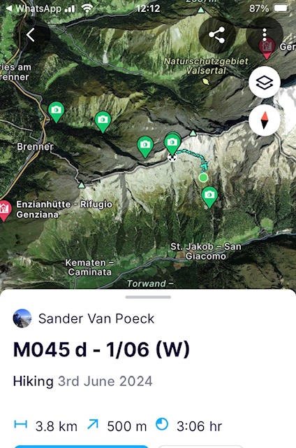
(Zondag 2/06) Ik laat een nog half slapende Bruno ‘s ochtends vroeg achter in het triestige Brenner en klim de flank op naar de Zirogerhohenweg. Niet eenvoudig om er te geraken want ik moet aan de andere kant van de autostrade geraken, dus even mee voor auto spelen op de afritten. De prachtige hohenweg die tegen de flank krult brengt me helemaal terug waar ik moet zijn. Maar ik blijf wel onder de 2000m want na de hevige sneeuwval moet de regen en de stijging van de temperatuur maar eerst zijn werk doen op het sneeuwdek alvorens ik er terug in kruip.
Een haas en een paar reeën op het pad later stop ik even bij de Enzianhütte voor een koffie en het gebruikelijke slecht en extreem weerpraatje. En dan verder naar beneden door Gossensass om naar de volgende vallei te geraken. Een Italiaanse dienster die nog in Breda gewoond heeft, haalt er trots haar beste Nederlands boven en serveert me frittata. Wanneer het terug begint te regenen, bel ik met het thuisfront. Het bellen kost serieus wat van de batterij en aangezien de regen er nog even zin in heeft, laad ik mijn batterij terug op en eet nog een frittata (was echt goed) en dan nog 7km en 900hm op naar de Rosskopf (2189m) of er net onder als eindhalte voor de dag.
Na een lastige en saaie klim op het einde van de dag, stop ik even in het ski-oord op het einde van de skilift. De barman van het bijhorende panorama hotel die me ziet binnen lopen, trakteert me op limonade. Als ze opnieuw na een slecht en extreem weerpraatje vragen waar ik vandaag om 18u30 nog heen trek, probeer ik me eruit te praten met een leugentje om bestwil aangezien ik niet 100% zeker ben hoe ze staan tov wildkamperen/bivakkeren. Ik noem dan maar het dichtstbijzijnde dorp en dat stemt hen gerust. Als ik hen bedank en verder trek, slaat de hemel iets later bijna volledig donker zwart dicht. Snel een onderkomen zoeken dus en dat vind ik snel in de gang van de skilift. Ik installeer me, kook en kruip de bivakzak voor de nacht in.
https://fatmap.com/adventureid/133387600/m046-d-2-06-w
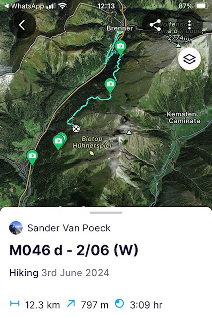
(Maandag 3/06) Geweldig geslapen daar in mijn betonnen bunker en gelukkig dat ik het gevonden heb want het heeft heel de nacht zwaar geregend. Tweemaal prijs dus voor mij want geen lastige nacht en de regen zal de lager gelegen nieuwe sneeuw zeker hebben weggespoeld.
Ik trek door naar de volgende hohenweg, de Ridnauner hohenweg en daal de vallei af naar het gelijknamige dorp. In het dorp aangekomen net voor de middag zit ik nog op 4km van het afspraakpunt met Bruno. Ik stuur hem een bericht om er om 3u in de namiddag af te spreken. Tijd genoeg voor mij dus voor echt middageten met brood, worst en suikers.
Met een goed gevulde maag start ik aan de laatste 4 km naar de ijzermijn van Ridnaun. Een nationaal monument van de industriële revolutie aangezien er de grootste bovengrondse transportinfrastructuur stond die ijzererts vanuit de mijnen in 2 verschillende valleien doorheen de bergen transporteerde. Veel is nog intact en een geweldige locatie om te bezoeken maar breng zeker je bergschoenen mee. Een uurtje later staat Bruno er ook en vangen we de laatste 3 km aan naar de hoogste alm in vallei. Eerder had ik de eigenaar gebeld en hij vond het oké dat we er onze tent zouden opzetten. Zo gezegd zo gedaan en we genieten er nog van de laatste zon terwijl we versteld staan van hoe snel de regen de sneeuwgrens weer heeft teruggedrongen naar 2500m en oude sneeuwflanken heeft blootgelegd.
https://fatmap.com/adventureid/134123675/m047-d-3-06-w
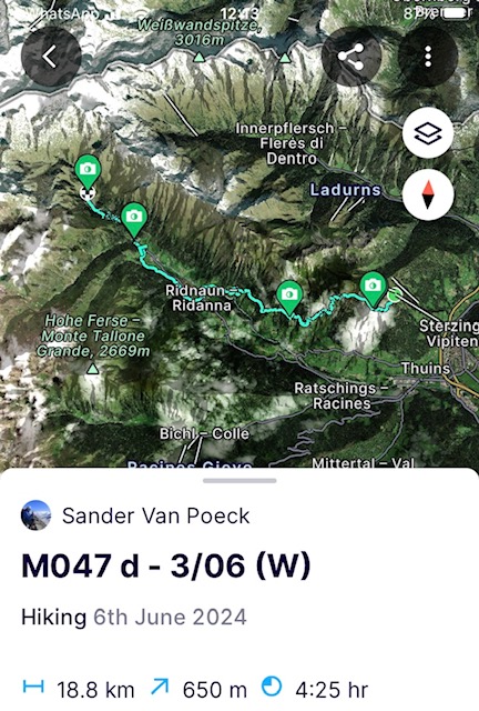
(Dinsdag 4/06) Als we wakker worden in de tent om 6u ‘s ochtends belooft het een prachtige dag te worden en een klein uurtje later beginnen we aan de klim richting het winterruim van de hoogstgelegen hut in Zuid Tirol, het Becherhaus (3195m).
Onderweg zullen we 2 andere hutten passeren en alles loopt qua pad perfect tot aan de eerste hut. Hier en daar liggen er een paar oude sneeuwvelden die we moeten traverseren maar niks noemenswaardig. Na een korte pauze beginnen we aan de doorsteek naar de tweede hut. De klim wordt iets lastiger, vooral wanneer we een volledig besneeuwde steile couloir moeten uitklimmen om tot aan de hut te geraken. Net voor de middag komen we bij de hut aan. In de hut zijn ze bezig aan herstellingswerken voor de start van het nieuwe seizoen. De kokkin van de werkploeg had ons in de verste verte niet verwacht en er is geen slecht en extreem weerpraatje nodig of ze biedt ons limonade en apfelstrudel aan die ze gisteren gebakken heeft. We zeggen geen neen en kunnen de suikers zeker gebruiken voor het laatste stuk van onze klim.
Tot de nok vol met suikers, bedanken we de kokkin uitgebreid en zetten de route verder naar de tong van de Ubertalferner gletsjer. Aangezien het namiddag is en een stralende dag, is de gletsjer, die onder een dik sneeuwtapijt ligt, veranderd in een gigantische bakplaat. Het is dus zweten van het ploeteren in de smeltende bovenste sneeuwlaag en de reflectie die de gletsjer geeft.
Uiteindelijk na veel zwoegen geraken we tot aan de besneeuwde rotsgraad die naar de hut leidt. In normale omstandigheden is dit stuk van de klim een uitdagende via ferrata waarbij je een stalen kabel volgt over de graad. Maar gezien de hoeveelheid sneeuw die hier nog ligt en het feit dat ie ook aan het smelten is (daar waar ik op een meer ijzige versie had gehoopt gezien de hoogte en de blootstelling aan de wind), beslis ik om de graad volledig beveiligd aan het touw af te klimmen want de ijzeren kabel ligt deels onder de sneeuw verstopt. Na een eerste sectie die ik voor ga, volgt Bruno aan het touw. Halverwege de sectie blokkert ie en ziet ie het niet zitten om door te klimmen. Met in de achtergrond stapelwolken die zich aan het vormen zijn in de verte, beslis ik om de poging hier te staken en af te buigen naar de Müllerhütte (3145m) die 500m verderop tegen een bergflank plakt. Die hut heeft geen winterruim noch een noodruim maar ik hoop er enige vorm van onderkomen te vinden alvorens het onweer losbarst. Een hut heeft altijd wel iets te bieden. Doorweekt en verkleumd komen we er aan en na wat speurwerk blijkt de hut enkel een platform van haar zomerterras te bieden te hebben. Ingenieus met ijs, ijspikkels, musketons en tentpiketten krijgen we de tent er opgezet voor het slechte weer. We kruipen beiden snel de slaapzak in en koken en eten vanuit de slaapzak. Met een warme maag maken we ons klaar voor de nacht en als we beginnen in te dommelen start het onweer.
https://fatmap.com/adventureid/134123700/m048-d-4-06-w
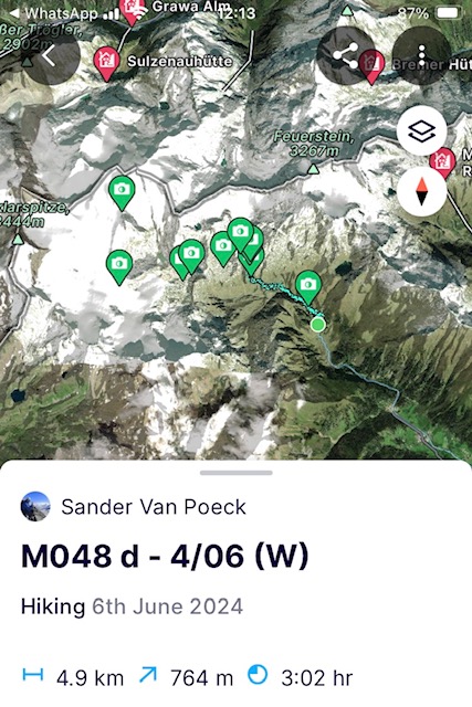
(Woensdag 5/06) Het onweer heeft ons een afgrijselijke nacht bezorgd. Eerst zorgde constante sneeuwval voor een groeiend gewicht op de tent. We moesten die herhaaldelijk sneeuwvrij kloppen om ervoor te zorgen dat hoofd en voeten niet nat werden tegen de tentzeilen. Daarna hielden windstoten ons wakker door de tentzeilen voortdurend heen en weer te schudden en ons te besprenkelen met de condens tegen het tentzeil. Maar alles beter dan op deze hoogte geen dak boven je hoofd te hebben.
Nadat een helikopter werkvolk komt afzetten aan de hut en ons opschrikt in de tent omdat ie op nog geen 50m van ons landt, beginnen we langzaam en voorbij het normale uur aan het opstaan. Alles is nat of bevroren. Het is dus even de knop omdraaien om eraan te beginnen. Maar na 2u slowmotion staan we ingebonden klaar om het hoogste terras van de Ubertalferner over te steken richting een zadel dat ons naar een andere vallei zal brengen om er verderop via een lagere pas door te steken naar Sölden. De kortste route, via een top en graad die ik over wilde, is geen haalbare kaart gezien de hoeveelheid sneeuw die er nog op ligt.
Deze dag zou het beste weer geven voor de initiële oversteek en dat doet het ook. Het is stralend zonnig en het is nog vroeg op de dag, dus de gletsjer ligt er letterlijk en figuurlijk oogverblindend en verijsd bij. We tsjokken tot aan het zadel en dalen af. Ik breng Bruno in de afdaling nog wat sneeuwschoen staptechnieken bij, ook al is dat een beetje vijgen na Pasen. Door het extreme weer op de eerste dag heb ik geen kans gehad om dat eerder te doen. Desalniettemin geraken we beneden in de vallei en stoppen er aan de eerste alm voor limonade, eieren met spek en röstkartoffelen. En dan is het de laatste klim voor Bruno, tot aan de Timmeljoch pas (2509m), en de zoveelste klim voor mij. De pas scheidt Oostenrijks Tirol van Italiaans Zuid-Tirol als ook de Stubaier Alpen van de Otztaler Alpen. Die zijn voor de volgende etappe. Ondanks de 750 hoogtemeters die we moeten overbruggen op 4km afstand gaat de klim geweldig. We kunnen oude sneeuwvelden vermijden door over de rotsen te klauteren (wat we beiden liever doen).
Op de pas staat een filmploeg die een reportage komt maken over het feit dat de pas net is opengemaakt door de wegenwerkers. In andere jaren was dat al begin of half mei gebeurd. Een muur van zeker 4m hoge sneeuw dient als bewijs voor kijkend Oostenrijk. Het zoveelste slechte en extreme weerpraatje dus. Als ze vertrekken kruipen we in het glazen portiek van het café dat op de pas ligt. Als 2 vissen in een bokaal van +\- 4m2 maken we er een slaapplek van.
https://fatmap.com/adventureid/134123775/m048-d-5-06-w
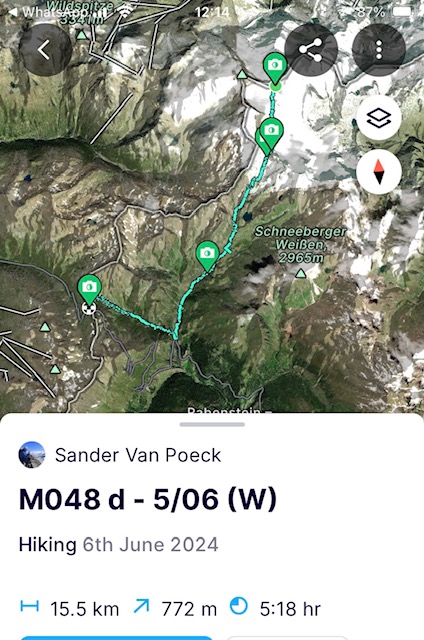
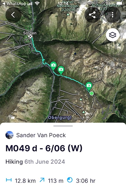
(Donderdag 6/06) Het licht verwarmde portiek heeft alvast Bruno een geweldige nacht bezorgd. Hij heeft geslapen als een blok en menige boom doorgezaagd hoewel er geen bomen staan op de pas. We staan terug op in het normale ritme en beginnen om 7u aan de afdaling. De flanken van de vallei waarin we kruipen zijn nog verscheidene kilometers bedekt met oude sneeuwvelden en het duurt even voor we het zomerpad terugvinden. Nadat we in een dorp voor Sölden nog de nodige suikers krijgen toegestopt van een biker hotel bereiken we ver voor de middag Sölden. Het slechte en extreme weerpraatje van de hostel eigenares kan me niet meer boeien. Ik ken het al uit het hoofd en beantwoord het met een Duitse cadans van ‘genau’, ‘genau’, ‘genau’,… Nu douchen, op krachten komen en…
https://fatmap.com/adventureid/134123815/m049-d-6-06-w
Op naar Monaco!
Bergse groeten en tot snel!
————— ENGLISH VERSION —————
(Tuesday 28/05) A thunderstorm held me hostage for another day in Luttach. But with all the adjustments to the route, I still have enough time to get to the meeting point with Bruno on time. I know Bruno from a climb in the Ötztal Alps many years ago, but this time he will be participating in the part of the route through the Stubai Alps just in front of the Ötztal Alps.
It's drizzling. In the meantime I consider that to be good weather. I crawl into the valley of the Weissenbach river towards the village with the same name. In the Italian part of South Tyrol, everything is signposted bilingually and in Italian the river sounds like Rio Bianco. However, she is not that Bianco. Rather dirty yellow to brownish in color. Due to the constant rain showers, the ground is saturated and the surface water carries mud into the river. When Mother Nature opens the tap a little further, the rain pants also come on. 2.5 hours later, I have completed half of the day's route to my own surprise. The first 1100 meters of altitude and 11 kilometers are done. The condition is excellent and the recovery unprecedented.
From this point, at an altitude of about 2000 meters, curiosity sneaks up on me. I avoided everything above 2600m altitude for a little more than 5 days because of the avalanche danger and I am curious to see what the rainfall has done to the snowpack. She has already done some serious impact and below 2600m she has wiped away almost all the new snow and turned the in Sahara sand sprinkled old snow layers into a slushy snow deck. Here and there the snowpack is incised with drainage channels formed by the rain because it couldn’t penetrate a frozen layer of the old snowpack. More sunshine in the coming weeks could make things move quickly and completely transform the landscape. The Saharan sand and the thinner air are a catalyst for the melting process. Rocks have also become exposed on the south-facing flanks and as of 2400m I put on my snowshoes to trudge through the slushy deck. The disadvantage is that the descent in such wet snow cover is slightly less pleasant than the snowshoe surfing I experienced before.
Below 2000m I even bump into a few hikers. But when they experience the wet snow cover further away, I see them quickly return to the alpine alm at the water reservoir below. The water level at the reservoir is very low despite all the precipitation. But this is mainly because due to the little sun there has been so they switched to the reservoirs for energy production. Alpine countries such as Austria and Switzerland are today at +/- 37% well above the European average of 23% (2022) in terms of the share of energy used from renewable sources. The European target to achieve 45% by 2030 is challenging but lacks individual targets per country and already faced a declining growth rate in 2022 compared to previous years. To achieve the new target, we must double the growth ratio vs. the ratio observed in the last 10 years. We may not all have mountain rivers, but wind and sun can be found everywhere so it is a matter of concrete actions and not hiding behind general objectives without an actionable plan.
After having some sugar in the alm, I start the last part of the day towards the Edelrauthütte. Along the way I climb through the old snow avalanche debris, but more recent avalanches are also visible. The weight of the wet snowpack on the steeper slopes remains a point of attention. 'Never a dull day in the mountains'. Once at the otherwise brand new, ultra-modern and ecologically built hut, it turns out that it does not have an open winter bivouac, as the Alpine Association website said. So I crawl into the wood shed which is always open and convert it into a place to sleep. I settle out of the wind, cook and dry my shoes and socks in the sun which has shown her shiny face since a few hours. More sun tomorrow, but tonight it will freeze to -10 degrees, so I quickly get into my sleeping bag to warm it up.

(Wednesday 29/05) It froze heavily at night and even the condensation from my breathing froze on a part of the sleeping bag where my mouth was. The forecasts had predicted a very sunny day and I got one. Last night I fell asleep going over the options to get to the next valley, the Pfitscher valley. The choice between the options, which differ from short to long distances and flat to steeper slopes, would depend entirely on how the snow cover turned out after a freezing night.
The icy temperatures at night have hardened the entire snow cover. Perfect conditions to take the shortest route along the saddle at the Höchfeiller (3183m) and set a new height milestone. I will have to work hard during the climb to get through the saddle and start the descent in time before the sun reaches its peak and gets its hands on the snow deck.
I am not alone. Here and there backcountry skiers pop up like marmots in the flanks. All of them busy pulling on their sticks to get up the steep slope. 3 hours later I am in the saddle at 3183m. It is beautiful and without a cloud in the sky you can see the mountain ranges all the way to Switzerland. All still wrapped up under a good layer of snow. I could easily have stayed there for an hour, but the sun is also playing its part today, so I quickly start the descent. The fast climb up cost me some serious energy and although the top of the Hochfeiler is only 2.5 km away and another 700 meters of elevation gain, I will have to adjust. The chance that the sun will make my descent from it more difficult also plays a role and in the current descent it is already showing its impact, resulting in wetter snow. I will save the summit for next time. Mountains do not run away.
Since I was able to take the shortest route, I am one day ahead of the scheduled appointment with Bruno. So I decide to descend further via the Tiroler Höhenweg to Sankt Jakob past the appointment point. I’ll wait out the forecasted rain for tonight and head up towards Europa Hütte the next day. Since it will also rain tomorrow, the route to the hut will thus be a little shorter and gives me more flexibility given the weather. I send Bruno a message that the day after tomorrow I will return back the 8 kilometers from the hut with an empty backpack to relieve him of the rope and food that he carried up for me.

(Thursday 30/05) It's raining like crazy when I wake up. When rain showers alter with periods of clearer weather, I use up to 3 weather apps to give me an idea of what the day will bring. Where 2 indicate that heavy rain will be the case for the rest of the day, the third, the radar, provides a definitive answer. The largest part of the weather depression is stuck over Switzerland and will barely move. So I can expect clearer weather before it starts moving again.
I start the climb. The cloud cover is quite low around 2000m and lifts and opens up as I get closer to it. It is a beautiful climb and definitely recommended. Short (+/- 7km) and relatively tough (+/- 1200 altitude meters) to the main ridge. On the ridge stands the old Europa Hütte, which was built in 1899 and is located right on the border between Italy and Austria and is owned by the German Alpine Association. The border runs straight through the dormitory. European collaborations avant-la-lettre.
When I arrive in the winter bivouac, I get rid of everything that is wet with sweat, I let it dry in the sun that peeps through the clouds, put on dry clothes, melt snow, cook soup and take a nap. Tomorrow the weather will be even worse with mainly rain when I go back to pick up Bruno. It promises another wet suit, but we'll see about that tomorrow because you can never be sure in the mountains.
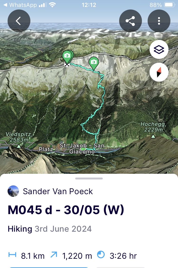
(Friday 31/05) It's Dad's birthday and with a little reach I have here I send him a message to wish him a happy birthday. Temperatures plummeted overnight. The forecasted rain has turned into heavy snow with almost an extra 50cm of snow here at 2600m. With strong winds and persistent snow, I start the route towards the path that leads to the saddle where Bruno will be waiting. However, I don't expect too much from it. This snowfall on top of the old layer will mean that I will never be able to use the path or the idea of it in the flank due to the risk of avalanches. The first hundreds of meters on the ridge confirm my suspicion. The descent of the ridge is very slow and careful not to move the fresh snow pack, although I do it carefully and controlled here and there to know what I am up for. Once off the ridge it is clear to me, I will never get to Bruno via this route. So I send him a message that he must cross the saddle and descend directly to Sankt Jakob where I will wait for him. I take the path I walked up the day before and from 2200m the snow is no longer so present.
When I arrive in the village, the Austrian Avalanche Warning Service also managed to put together an avalanche forecast given the unprecedented new snowfall. The heavy snowfall has acutely increased the avalanche risk due to the massive snowfall accompanied by heavy winds. The snow frontier has fallen from 2500m to 1700m in some places. Bruno has already received his baptism with it. He is not able to reach me or at least it takes a very long time to descend from the saddle. Communication goes wrong just like the weather and I can't get a hold of him. It will later turn out that the cold reduced the battery of his older smartphone to zero. After a long wait, he finally arrives around 3 o'clock in the afternoon. Since the bad weather has continued in the meantime, it is too late to reach the Europa Hütte (even if we count on a longer duration due to the fresh snow) and Bruno has to recover from the baptism he received on his first day. So we decide to spend the night there. Tomorrow, when the weather should improve slightly and the snow cover has hopefully settled a bit, we will attempt the crossing and pick up my equipment at the Europa Hütte.
The weather forecast on TV says that summer is coming, but it also looks back on the exceptional jumps the weather has made in April and May so far. I'm crossing my fingers that this will finally be the case and we are on our way to more summer like conditions.
(Saturday 1/06) Mother Nature has not immediately listened to my prayers. The night brought even more snow. The route to get to the Europa Hütte will therefore take up most of our day in these conditions. More and more I'm starting to feel like a naked turtle. Slowed down by the snow and not having all my equipment that fits into a certain structure in my backpack. Like a turtle without a home on his back.
The snow has reached below 2000m, which means another 650 meters of altitude to trudge through the snow cover to the hut. It continues to snow, but luckily the icy wind has gone. Bruno is tired of struggling now that a walking pole has also lost out on him. So it is not easy to keep yourself standing in a fresh snow cover that is more than 70 cm thick. I plow through at the head with my mind at zero and try to make a trail for him as best as I can.
It is past noon and about 5 hours further when we crawl through the saddle to the hut. In the unheated winter bivouac we are both steaming from all the sweating. I make hot oatmeal and try to keep moving by packing all my things. We don't linger too long and return into the white mass down on the other side of the grade. Continuously looking for where the slopes are least steep to avoid possible avalanches. Once below 2000m I try to find the summer path so that we can take off out snowshoes and progress faster.
After a silent descent where I sometimes try to boost morale but Bruno is clearly devastated by these extreme first days, we arrive at the Brenner Pass. Enough for today and we crawl into a hostel on the Italian side of the pass and have beer and pasta. Over dinner we lay out the next days and I make a few necessary phone calls so that we are sure we have somewhere to shelter along the way. During the next 2 days, Bruno will first look for new hiking poles and the necessary care for his feet that have suffered in the soaked and frozen shoes. We will then meet each other 2 valleys further away within 1.5 days to get back higher up in the predicted nicer weather and make the crossing over the Stubai Alps to Sölden. I will continue on the route but will stay below 2000m to avoid the snow as I will already have to deal with bad weather anyway.

(Sunday 2/06) I leave a half-asleep Bruno behind in Brenner early in the morning and climb up the slope to the Zirogerhohenweg. Not easy to get there because you have to get to the other side of the highway, so I pretend being a car on the exits. The beautiful Hohenweg that curls against the mountain flank takes me all the way back to where I need to be. But I stay below 2000m because after the heavy snowfall, the rain and the rise in temperature have to do their work on the snow cover before I crawl back into it.
After running into a hare and a few deer on the path, I stop at the Enzianhütte for a coffee and the usual bad and extreme weather talk. And then further down through Gossensass to get to the next valley. An Italian waitress who used to live in Breda puts on her best Dutch talk and serves me a frittata. When it starts to rain again, I have a call with the family at home. Calling takes a serious drain on the battery and since the rain still feels like it, I recharge my battery and eat another frittata (it was really good). And then another 7km and 900hm to the Rosskopf (2189m) or just below it as the final stop for the day.
After a difficult and boring climb, I stop in the ski resort at the end of the ski lift. The bartender from the panorama hotel, who sees me walking in, treats me to lemonade. When, after another bad and extreme weather chat, they ask where I am going today at 6:30 PM, I try to talk my way out of it as I am not 100% sure how they feel about wild camping / bivouacking. I just mention the nearest village and that reassures them. When I thank them and move on, heaven turns almost completely dark black a little later. So I quickly look for shelter and I quickly find it in the corridor of the ski lift. I settle in, cook and crawl into the bivouac bag for the night.

(Monday 3/06) Slept great there in my concrete bunker and luckily I found it because it rained heavily all night. So twice the prize for me because it was not a difficult night and the rain will certainly have washed away the new snow lower down.
I continue to the next hohenweg, the Ridnauner hohenweg, and descend into the valley to the village of the same name. When I arrive in the village just before noon, I am still 4km away from the meeting point with Bruno. I send him a message to meet there at 3 o’clock in the afternoon. Enough time for me to have a good lunch with bread, sausage and sugar.
With a well-filled stomach I start the last 4 km to the Ridnaun iron mine. A national monument of the industrial revolution as it housed the largest above-ground transport infrastructure that transported iron ore from the mines in 2 different valleys through the mountains. Much is still intact and a great location to visit, but be sure to bring your mountain boots. An hour later Bruno is there too and we start the last 3 km to the highest alm in the valley. Earlier I had called the owner and he was okay with us setting up our tent there. We enjoy the last of the sun while we are amazed at how quickly the rain has pushed the snow frontier back to 2500m and exposed old snow flanks.

(Tuesday 4/06) When we wake up in the tent at 6 am it promises to be a beautiful day and an hour later we start the climb towards the winter bivouac of the highest hut in South Tyrol, the Becherhaus (3195m).
Along the way we will pass 2 other huts and everything runs perfectly up to the first hut. Here and there, there are a few old snow fields which we have to traverse, but nothing worth mentioning. After a short break we start the passage to the second hut. The climb becomes a little more difficult and we have to climb through a completely snow-covered steep couloir to get to the hut. We arrive at the hut just before noon. They are busy with repairs in the hut for the start of the new season. The cook from the crew was not even remotely expecting us and it doesn't take any bad and extreme weather talk before she offers us lemonade and apfelstrudel which she baked the day before. We cannot say no and can certainly use the sugars for the last part of our climb.
Filled up with sugar, we thank the cook and continue the route to the tongue of the Ubertalferner glacier. Since the afternoon has arrived and it is a bright day, the glacier covered in a thick carpet of snow has turned into a gigantic furnace. So we sweat from slogging through the melting top layer of snow and the sun reflection that the glacier gives.
Finally, after much toil, we reach the snow-covered rock ridge that leads to the hut. In normal circumstances, this part of the climb is a challenging via ferrata where you follow a steel cable along the ridge. But given the amount of snow still here and the fact that it is also melting (whereas I had hoped for a more icy version given the altitude and exposure to the wind), I decide to continue on the ridge fully belayed now that the iron cable is partly hidden under the snow. After a first section that I lead climb, Bruno follows on the rope. Halfway through the section he blocks and doesn't feel like continuing to climb. With cumulus clouds forming in the distance, I decide to abandon the attempt here and turn towards the Müllerhütte (3145m), which is clinging to a mountainside 500m further away. That hut does not have a winter bivouac or an emergency hold, but I hope to be able to find some form of shelter there before the storm breaks. A cabin always has something to offer. We arrive drenched and chilled and after some investigation it turns out that the hut only has a platform on its summer terrace to offer. Ingeniously using ice, ice picks, carabiners and tent picks, we get the tent set up before the bad weather arrives. We both quickly crawl into the sleeping bag, cook and eat in our sleeping bags. With a warm stomach we prepare for the night and when we start to doze off the thunder starts.

(Wednesday 5/06) The storm gave us a horrible night. At first, constant snowfall put increasing weight on the tent, which we had to repeatedly clear of snow to ensure that our heads and feet did not get wet against the tent canvas. Then the wind kept us awake by constantly shaking the tent canvas back and forth and sprinkling us with condensation against the tent canvas. But anything is better than not having a roof over your head at this height.
After a helicopter drops off workers at the hut and startles us in the tent because it lands less than 50 meters from us, we start the day slowly and beyond the normal hour of getting up. Everything is wet or frozen, so we have to turn a mental switch to get the day started. But after 2 hours of slow motion we are ready to cross the highest terrace of the Ubertalferner towards a saddle that will take us to another valley and then cross to Sölden via a lower pass. The shortest route via a peak and ridge that I wanted to cross is not a feasible option given the amount of snow that is still on it.
This day would provide the best weather for the initial crossing and it does. It is sunny and it is still early in the day, so the glacier is literally and figuratively dazzling and iced over. We trudge up to the saddle and descend. I teach Bruno some snowshoe walking techniques during the descent, even though it’s a bit late for that. It's unfortunate that I didn't have a chance to do this sooner due to the extreme weather on the first day. Nevertheless, we reach the bottom of the valley and stop at the first alm for lemonade, eggs with bacon and röstkartoffelen. And then it is the last climb for Bruno's participation up to the Timmeljoch pass (2509m) and the umpteenth for me. The pass separates Austrian Tyrol from Italian South Tyrol as well as the Stubai Alps from the Otztaler Alps, which are the subject of the next stage. Despite the 750 meters of altitude that we have to overcome at a distance of 4 km, the climb goes great because we can avoid old snow fields by scrambling over the rocks (which we both prefer more than snow).
There is a film crew on the pass that comes to report on the fact that the pass has just been opened by road workers. Something that would normally be the case in early to mid-May in other years. A wall of at least 4m snow serves as proof for Austrian spectators. So yet another bad and extreme weather talk. When they leave, we crawl into the glass porch of the café on the pass. Like 2 fish in a bowl of +\- 4m2, we turn it into a place to sleep.

(Thursday 6/06) The slightly heated porch made Bruno sleep like a log as he was sawing many trees even though there are no trees on the pass. We get up again in the normal rhythm and start the descent at 7 am. The flanks of the valley are still covered with old snow fields for several kilometers and it takes a while before we find the summer path again. After we are treated to some necessary sugar from a biker hotel in a village before Sölden, we reach Sölden well before noon. The bad and extreme weather talk of the hostel owner no longer fascinates me. I already know it firsthand and answer it with a German cadence of 'genau', 'genau', 'genau',… Now I just want to take a shower, regain strength and…

Off to Monaco!
Mountain greetings and see you soon!
