————— NL version (ENG version below) —————
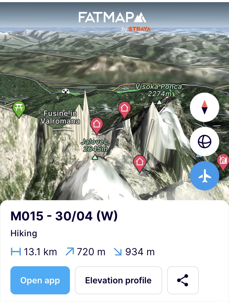
(Dinsdag 30/04) Batterijen zijn al even opgeladen maar het was vooral wachten op beter weer maar zo vroeg in het seizoen blijft dat uiteraard zeer kwakkel. Het is een mooie dag en dus steek ik met een rustige etappe voor de boeg door naar Oostenrijk om er in de grensstad Magglern materiaal op te halen dat we er eerder afgezet hebben. Niet al te rustig want het lichaam heeft er meer dan zin in. De 700 hoogtemeters voor de dag liggen pal in het begin als ik de rustplaats Ratece uitklim. In één ruk gaan ze voor de bijl tot aan de top van de Pec / Ofen / Monte Forno (1508m). De weg slingert via een aangenaam bospad heen en weer naar boven terwijl smeltwater overal naar beneden klettert. Bij elke bocht zie je over je schouder het canvas van de Julische Alpen met zijn mastodonten van bergen. De Triglav prominent in het midden en in dit zonnig weer in geweldige condities zo lijkt (maar we weten wel beter). Hoewel dit een zuid georiënteerde helling is en dus de zon en de wind uit het zuiden (Föhn) er al meer hun werk op hebben gedaan, is het bemoedigend om te zien dat je tot aan de top enkel verdwaalde sneeuwvelden in het landschap tegenkomt. In de komende dagen moet ik immers naar grotere hoogtes en ik denk terug aan het sneeuwpak dat ik in de Jullische Alpen tegenkwam. Het weer en de oriëntatie van de helling zal dus cruciaal worden om gemakkelijk te kunnen vorderen.
Ik heb al veel gelezen over de Karnische Alpen en de sublieme Karnische Höhenweg die er loopt. Het is een bergpad dat zoveel mogelijk de grens tussen Oostenrijk en Italië opzoekt en dus heel vaak de graad die beide landen scheidt van elkaar. In de route heb ik geprobeerd om deze graad bijna permanent op te zoeken maar het sneeuwpak zal beslissen of dat haalbaar is. Volgens de weersvoorspellingen komt er nog een hoop regen aan maar we lopen er voor normaal gezien en hopelijk helpt dat om het sneeuwpak te zetten en vaster te maken.
De top van de Pec / Ofen / Monte Forno is de grens tussen Slovenië, Oostenrijk en Italië. Het fungeert als een punt van verbinding tussen de 3 landen waarbij elk jaar de 3 naties samen komen op de top rond ski festiviteiten. Later hoor ik dat de skipistes er zullen sluiten vanaf volgend jaar omdat ze niet langer rendabel zijn door de warmere condities in de bergen. De opwarming in de Alpen is immers vele malen hoger dan wereldwijd of specifiek in Europa. Zo steeg de temperatuur hier met 2 graden C* gemiddeld sinds 1880 versus de 0,85 graden wereldwijd gemiddeld. De impact van de opwarming van de aarde kan je hier dus letterlijk in het gezicht aankijken. Hopelijk bergen ze de verbondenheid er niet mee bij op. Want als er 1 ding is in de bergen dat je moeilijk elders tegenkomt dan is het wel de verbondenheid die mensen tonen. Iedereen zal er altijd voor elkaar klaar staan en een simpele hallo en een glimlach krijg je er overal gratis bij. Ik denk aan het schrille contrast met in Brussel een metro opstappen waar je vaak niet enkel alleen de zurigheid kan ruiken maar ook afleest aan de gezichten van zijn reizigers. Ik daal af langs de Oostenrijkse zijde en ja hoor daar is ie al bij de eerste wandelaar op weg naar de top die ik kruis, “Servus!”.
https://fatmap.com/adventureid/125004277/m015-30-04-w
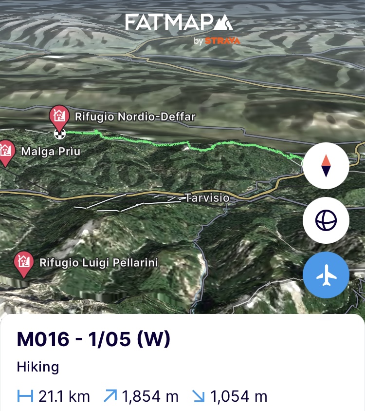
(Woensdag 1/05) Boenk omhoog de Karnische Höhenweg op. Het mooie aan dit bergpad is dat het bijvoorbeeld in vergelijking met de Via Alpina en de SMT in Slovenië je hier bewust weghaalt van grindwegen en andere bredere onverharde wegen. Overal stuurt het je een single track op waar je amper 2 voeten naast elkaar kan zetten en dus catwalkgewijs doorgaat. Verder neemt het je aan het begin mee van grenspaal naar grenspaal en van alm (boerderij hoog in de bergen) naar alm doorheen de typische Alpen weiden waar je verscheidene holen van marmotten tegenkomt maar het nog te koud is om ze te zien of te horen, denk ik. Ik zou er zo kunnen neerploffen en wat zonnen maar helaas liggen er nog serieus wat kilometers en hoogtemeters voor de boeg dus niet talmen in die almen (serieus, Sander?).
Er was regen voorspeld en die krijg ik maar het klaart ook weer even snel terug op. Als ik bijna op het eindpunt van de dag ben en langs de Italiaanse zijde een hut passeer, leidt de gebruikelijke goeiedag en glimlach tot snelle suikers in de vorm van limonade, Weissbier en een gratis plek in hun winterruim.
https://fatmap.com/adventureid/125687839/m016-1-05-w
(Donderdag 2/05) De dag zou beginnen met regen tot 9u maar gezien er voor 9 dagen eten in de rugzak zit past de hoes net niet helemaal over de rugzak. Het wordt dus herschikken en keuzes maken ifv wat absoluut niet nat mag worden. Zoals ik eerder al zei; “toiletpapier wint hier altijd”.
Ook als ik de nodige hoogtemeters doe en boven het wolkendek kom te lopen waar ze helemaal een magisch spel spelen tegen de flanken aan door de opwarming van de vallei, halen ze me toch terug in en geven ze me terug een nat pak.
Er was regen voorspeld tem 9u maar dat wordt 10u, 11u enz en het stopt niet. Als ik op de middag aan het eindpunt van de dag kom, kom ik aan in een slapende alm. Niemand te zien. Net een spookdorp zo buiten het seizoen en de koeien die staan momenteel ook nog beneden in de vallei. Goed nat en aan het verkleumen door stil te staan, warm ik eten op, doe natte kleren uit, trek droge en extra kleren aan en beslis om 14u om door te lopen naar het eindpunt van de volgende dag in de hoop er een levende ziel en onderdak tegen te komen.
Ondertussen volledig in hardshell tenue, met een volle maag en voldoende brandstof draait de motor warm onder die water- en winddichte motorkap. De regendruppels tikken op de hardshell als in een regenbui onder een plastieken afdak. Spijtig om zo door dit gebied te moeten vlammen want volgens mij passeer ik één van de mooiste stukken van de Höhenweg. Een pas in witte dolomiet dat afsteekt tegen een groene helling waar nog herfstbladeren in verspreid liggen is ronduit prachtig en doet me soms de regen vergeten om toch maar enkele foto’s te nemen als het natte touchscreen mee wilt. In de restjes nieuwe sneeuw die er hier en daar nog liggen zie je nu wel zeer afgetekend de sporen van de dieren die hier rond lopen. Naast reeën en gemzen kom ik even goed sporen van wolven en zelfs een beer tegen. Tot de verbeelding sprekend is het vooral als er ellenlang een spoor van een ree en een wolf te zien is op het smalle pad. Wie heeft wie gevolgd
De rivieren zwellen door de zware regenval en er nog over geraken als het pad ze kruist, is garanti met schoenen en al het water in. Maar die waren toch al nat. Warmere condities in de bergen en dus meer regenval dan sneeuwval, leiden zo ook tot meer overstromingen. 2 jaar geleden nog spoelde zo in het Stubaital in Oostenrijk de toegangswegen tot een volledige vallei weg waardoor dorpen volledig afgesloten geraakten. Iets wat je minder prominent hebt bij sneeuw die geleidelijker zijn water zal lossen en enkele op zeer steile flanken acute lawines zal veroorzaken. Een uitdaging die menig Alpen land heeft om oevers te versterken dus als gevolg van opwarming van het klimaat.
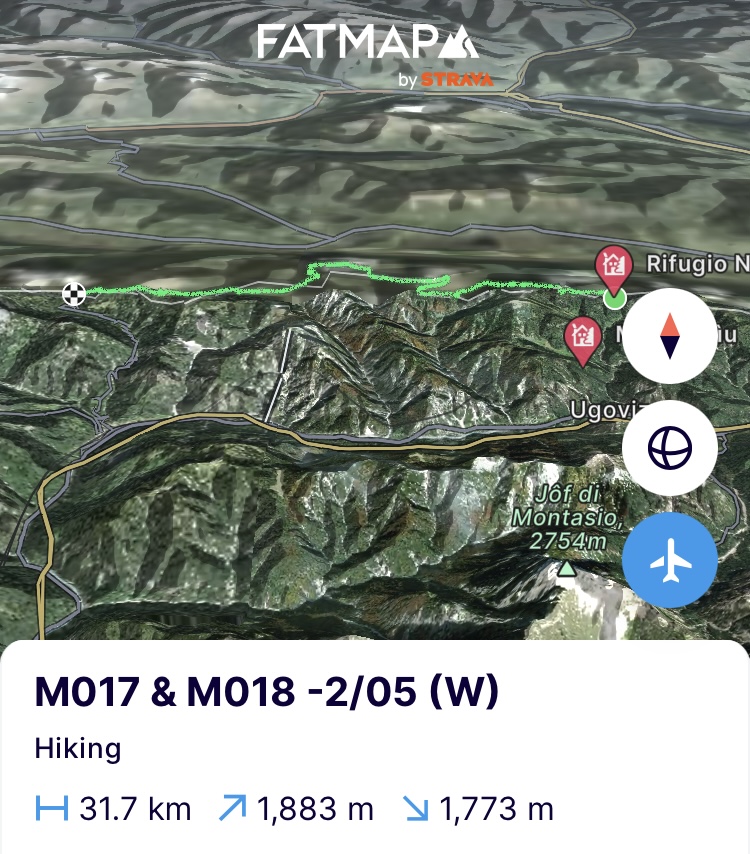
Het is 17u en ik sta 14km verder op de Nassfeldpass nadat ik de skipistes ervan nog heb mogen op en aflopen. Morgen geeft het weer meer van dit, dus even herbekijken wat we ermee doen maar ik heb alvast een dag respijt om het uit te zitten na de 32km en 1800 hoogtemeters van vandaag.
https://fatmap.com/adventureid/125687883/m017-m018-2-05-w
(Vrijdag 3/05) ik zit het slechte weer uit in de vallei. Zo kan ik met het bereik mijn jongste zus een gelukkige verjaardag wensen. Verder is het ook opnieuw kennis maken met de geweldige ontbijtcultuur van de Oostenrijkers in de lokale confiserie. Het weekend is nog niet begonnen maar ze slaan al om 8-9u aan het brunchen alsof het weekend zou zijn. Ik heb een onderdak gevonden bij Gerard, 61 jaar oud en net nog 100km gelopen in 20u tijd tot aan de Italiaanse kust, als ook vorig jaar 809km tot in Santiago de Compostela op 22 dagen. Bergmensen niet kapot te krijgen.
(Zaterdag 4/05) Het weer is opgeklaard en ik sta terug op de Nassfeldpass om er via de smeltende skipistes terug omhoog te klauteren. En daar zijn ze dan. De eerste marmotten. Nog een beetje verward om een mens te zien, lijkt me want ze laten me gemakkelijk tot 20 à 25 meter naderen alvorens ze in hun krijsende rol kruipen als alarmcentrale van de bergen. De nieuwe sneeuw is op deze hoogte merendeels gesmolten en via tourski sporen in de oude sneeuwlaag schuifel ik tot aan de volgende pas om daar de uitdaging van vandaag te zien, de Trogkofel (2279m). Hoewel er 29km voor de boeg liggen en het weer toch ook niet alles is, neemt het speelse kind in mezelf de overhand. Ik kan het niet laten om langs een via ferrata alsnog de top te doen. Boven op de bergkam volg ik de steenmannetjes zodat ik zeker op de rots blijf en niet op de sneeuwluifels terecht kom die door de wind gevormd zijn. Daar staan we dan, 45 minuten later. Het was klimmen op handen en voeten en de kabel van de via ferrata was niet altijd zichtbaar maar dit zicht pakken ze ons niet meer af.
Erop geraken is mooi. Eraf geraken is iets anders en het is serieus zoeken waar de weg naar beneden nu net ligt. De Alta via toont het pad naar beneden en na nog een via ferrata wordt de alta via toch wel serieus technisch hier. In de zomer moet dit gemakkelijk gaan met wat klimwerk maar nu is elke inham bedekt met een sneeuwveld en die liggen er serieus steil en verijsd bij.
Als het na enkele passages meer op alpinisme begint te trekken in het traverseren van de velden dan is de keuze snel gemaakt. De Höhenweg ligt 75m onder de Alta via, dus ik kies de minst steile helling uit en laat me naar beneden schuiven geremd door een ijsbijl tot aan het territorium van de marmotten die krijsend in de verte wegspurten. Ons moeder zou me aan de tafelpoot vastbinden moest ze in detail weten wat ik hier allemaal uitsteek maar ik geraak zonder kleerscheuren beneden. De rest van het pad ligt er kleurloos, zompig en deprimerend bij. De oude sneeuwvelden zijn aan het wegsmelten en laten verbleekte heide achter of vallen terug op hun oude lagen waar de sporen van het toegewaaide Sahara zand nog op liggen.
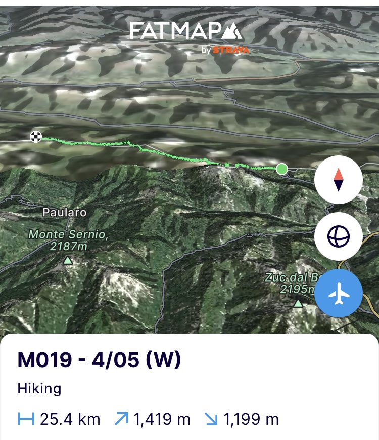
Als ik om 16u aan het eindpunt kom voor de dag, beslis ik om door te steken. 14km verderop ligt een bivak langs de Italiaanse zijde en mochten we daar niet geraken, dan ligt er nog de Zollnersee hütte op het middelpunt maar daar is de bivak gesloten. Zien waar we geraken maar het weer is goed en daar moeten we dus maximaal gebruik van maken. Een lange traverse van een noordhelling waarlangs de Höhenweg loopt, strooit roet in het eten. Elke stap zet ik 2 keer om trapjes in de helling uit te stampen in de sneeuwvelden die het pad bedekken. Soms ligt het pad bloot en kan ik voor enkele meters snelheid maken maar het merendeel is stampen. De voeten doen hun ding en wisselen hun eigen techniek erop af. Het is 19u als ik aan de Zollnersee hut aankom en de benen compleet rubber zijn na die dronkenmanswandeling op de helling en ik besluit het er hier bij te houden. De hut is volledig dicht zoals verwacht maar één plek is altijd open en dat is het houtkot waar ik net in pas. De slaapplek voor de nacht dus.
https://fatmap.com/adventureid/126716797/m019-4-05-w
(Zondag 5/05) De wind staat hevig vandaag en dus niet ideaal om de route te blijven volgen die pal op de bergkam loopt. Ik ga op zoek naar meer op het zuiden gerichte hellingen om ook het eindeloos water traverseren van de sneeuwvelden te vermijden. Maar alvorens ik daar geraak moet ik eerst nog via de Höhenweg de volledig besneeuwde flank van de Köderkopf (2167m) op over een afstand van 4 kilometer aan trapjes stampen in de sneeuw.
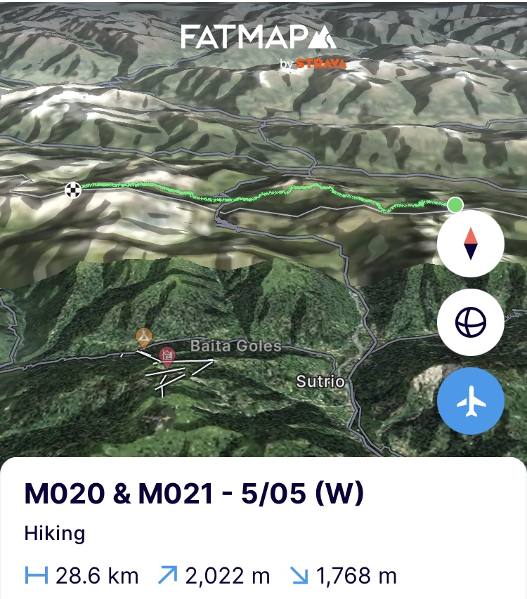
Vandaag liggen de uitdagingen vooral aan het begin en het einde van de dag. Ertussen is het genieten op de zuidgerichte hellingen waar amper sneeuw ligt, gemzen en reeën opschieten als ik passeer en dit tot aan de Plöckenpass. Daar begint de laatste beklimming van de dag met nog 9km en 1050 hoogtemeters tot aan de Wolayersee. Het is klimmen doorheen een surrealistisch landschap van oude lawinekegels, de brokstukken ervan, een speels wolkendek en door het oude Sahara zand beschilderde sneeuwflanken. Ook hier is het 19u als ik boven ben op de pas. Het wolkendek slaat dicht als ik net boven ben. Naar beneden en richting het winterruim van de hut navigeren is puur op gps en vooral opletten want onderaan ligt een meer. Het winterruim van de Italiaanse hut blijkt een te renoveren jachthut te zijn op de pas aan het meer. Het heeft een zeker boer-sjarel-gehalte maar na vandaag en 2 dagen van elk 25km kan ik overal slapen. De keuken verbouw ik alvast tot slaapplek voor de nacht.
https://fatmap.com/adventureid/126716877/m020-m021-5-05-w
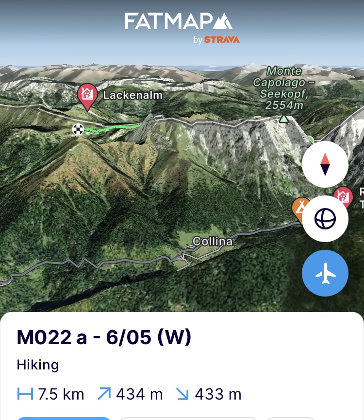
(Maandag 6/05) Voor deze dag heb ik de voorbije dagen doorgestapt. Deze dag zou slecht weer betekenen en ja hoor. De hele dag met het hoofd letterlijk in de wolken. Beperkte zichtbaarheid en dus niet ideaal om op de besneeuwde bergkam te lopen. Op de middag loop ik het eindpunt binnen aangezien ik goed heb kunnen vorderen door lager te lopen. Net als ik binnenloop begint de regen voor de rest van de dag. Het winterruim is er op slot maar het schoenenruim niet en dat doet dan maar dienst als slaapplek. Goed om even de benen een namiddag platte rust te geven. Ik haal en filter water, kook 2 keer warm en kruip vroeg onder de wol.
https://fatmap.com/adventureid/126716907/m022-a-6-05-w
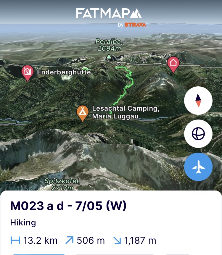
(Dinsdag 7/05) Veel en geweldig geslapen om er terug aan te beginnen. De route loopt verder via de Höhenweg tot aan de Luggauerer Torl pas (2232m) waar de route dan verder de bergkam op trekt richting de Porzehutte over een afstand van 12km. Eens aan de pas aangekomen en onderweg nog menig marmottengezin te hebben opgewekt, ligt de bergkam er ongelofelijk mooi bij zo in zijn nawinterse condities met sneeuwluifels. Het stoute (b)engeltje op mijn schouder roept van “ja, we zijn hier nu toch, gaan!” maar er steken wat rode vlaggen de kop op. De zichtbaarheid is zeer wisselvallig door het lage wolkendek, in de verte zetten regenwolken zich dreigend klaar en als ik toch ergens 1 blokje bereik vind en een nieuwe weer update krijg is de keuze snel gemaakt. Het wolkendek zal zakken verderop de dag en het gaat heel de dag regenen. Geen ideale condities dus om alleen over een sneeuwkam met luifels te traverseren. Weinig andere opties dus dan naar beneden in de vallei af te zakken. Ik wist dat dit kon voorvallen zo vroeg op het jaar en het is vooral een must van er bewust mee om te gaan. Als ik verderop op een verijsde laag sneeuw nog uitschuif en ongelukkig met de linkerenkel tegen een steen sla, heeft de berg helemaal beslist. Dan maar beneden. Onderweg merk je hoe het pad afziet door het acute en overtollige water. Her en der breekt het van de helling af of is het volledig weg. Opnieuw een gevolg van warmere condities en meer acute watervloed en een minder bevroren bodem die alles samenhoudt.
Ik volg verder door het prachtige Gailtal de grens tussen Karinthië en Tyrol via het Hoch und Heilig pelgrim pad tot in Obertilliach. Hoewel het buiten seizoen is en het hele agro toeristische dorp nog slaapt, biedt de familie Obererlacher me toch een plek aan als ze me doorweekt zien aankomen.
https://fatmap.com/adventureid/126671617/m023-a-d-7-05-w
(Woensdag 8/05) Boven een stuk brood, zelfgemaakte almkäse en koffie worden in het betere Jean-Marie-Pfaff Duits (ik spreek spijtig genoeg geen Duits) de gebruikelijke wie-wat-waarom vraagstukken beantwoord. Vanessa vertelt me dat behalve een top van lokale politici rond de problematiek van de bossen in de regio ze pas eind mei zullen open gaan en gasten verwachten. De kale en dorre plekken in de bossen waren me ook al meermaals opgevallen in de voorbije dagen en jaren. De schuldige is de “borkenkäfer” ofwel de schorskever. Die leeft tussen de schors en het hout van de boom en vreet zich in het oppervlakkige weefsel (cambium) dat de sapstroom van de boom organiseert. Zo snijden ze de sapstroom af en zal de boom afsterven. Een ware plaag en daar waar de schorskever normaal onder de 1450m leeft, vindt ie door een warmer klimaat zijn toegang tot meer van de bomenpopulatie in de Alpen. De combinatie van jaren met weinig sneeuw versus ongezien veel sneeuw, het omvallen van bomen en weinig aangroei maakt dat de wouden geen kans krijgen om deftig te herstellen. De kever stoort er zich niet aan en doet rustig door. De mens dweilt met de kraan open om de wouden op te kuisen, te herbebossen en de kever te lijf te gaan op steeds grotere hoogtes gezien de warmere condities. Een zwaar verlies aangezien de sparren en dennen op grotere hoogte zeer efficiënt zijn in CO2 absorptie doordat ze het hele jaar o.a groen zijn.
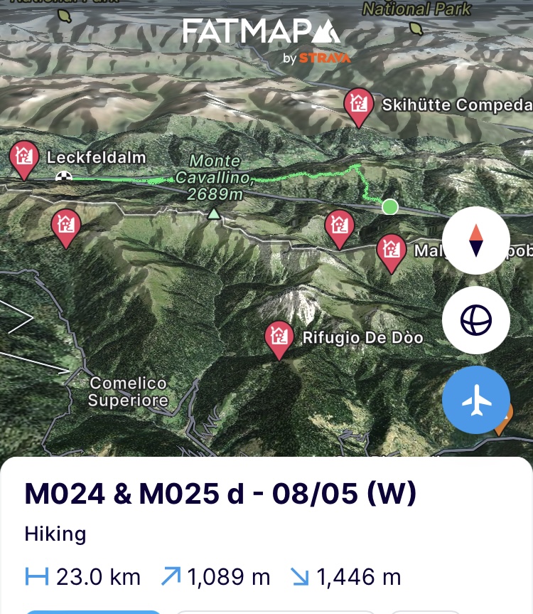
Ik laat Obertilliach en zijn typische bouwstijl met koeien in de kelder en bewoning er boven (vloerverwarming avant la lettre) achter me en klim richting de Gailtaler Höhenweg die pal op het zuiden gericht is. Het miezert en boven wordt de regen sneeuw maar wel duidelijk dat de sneeuwgrens aan het optrekken is in functie van de oriëntatie van helling. Ik voeg de top van de Golzentipp (2317m) nog toe aan het palmares en passeer zo ondertussen de kaap van de 2300m en daal dan via de bergkam naar beneden af door het lappendeken aan onaangetaste en aangetaste wouden. Ik duw door tot in Sillian en kom er 2 dagen voor op de planning aan. Ruimschoots tijd om de voeten wat liefde te geven, logistiek te regelen, dit epistel te schrijven en de route voor de volgende dagen te herbekijken in het licht van de hoeken van de kamer die de prachtige Karnische Alpen me lieten zien.
https://fatmap.com/adventureid/126939528/m024-m025-d-08-05-w
Op naar Monaco!
Bergse groeten en tot snel!
————— ENGLISH VERSION —————
(Tuesday 30/04) Batteries have been fully charged for a while, but it was mainly a matter of waiting for better weather. This early in the season it obviously remains very uncertain. It is a beautiful day and so with an easy stage ahead I continue to Austria to pick up material in the border town of Magglern which we dropped off there earlier. Not too calm, because the body is more than looking forward to it. The 700 meters of altitude for the day are right at the beginning of the day when I climb out of Ratece. In one go they are covered up until the summit of the Pec / Ofen / Monte Forno (1508m). The road winds back and forth along a pleasant forest path while meltwater splashes down everywhere. At every turn you can see over your shoulder the canvas of the Julian Alps with its mastodons of mountains. The Triglav prominently in the middle and in this sunny weather in great conditions as it seems (but we know better from before). Although this is a south-oriented slope and therefore the sun and the wind from the south (Föhn) have already done their work, it is encouraging to see that up to the top you only encounter stray snow fields in the landscape. In the coming days I have to go to higher altitudes and I think back to the snowpack I encountered in the Julian Alps. So the weather and the orientation of the slope will be crucial for feasible progress.
I have already read a lot about the Carnic Alps and the sublime Carnic Höhenweg that runs there. It is a mountain path that follows the border between Austria and Italy as much as possible and therefore often the ridge which separates both countries. When designing this traverse I tried to follow this ridge almost everywhere, but the snowpack will decide whether that will be feasible. According to the weather forecasts, a lot of rain is still coming in the days ahead but I am walking in front of this depression and hopefully it will help to set and strengthen the snowpack.
The top of the Pec / Ofen / Monte Forno is the border between Slovenia, Austria and Italy. It acts as a point of connection between the 3 countries with each year the 3 nations coming together at the summit for ski festivities. Later I heard that the ski slopes will close as of next year because they are no longer profitable due to the warmer conditions in the mountains. The air temperature increase is above global average since 1880 in the Alps at 2,1 degrees C* vs 0,85 degrees globally. The impact of climate change can thus be stared directly in the face here. Hopefully they don't lose their connection with it. Because if there is one thing in the mountains that is difficult to encounter elsewhere, it is the solidarity that people show. Everyone will always be there for each other and a simple hello and a smile is always included for free. I think of the stark contrast with taking a subway in Brussels where you can often not only smell the sourness but also read it from the faces of its passengers. I descend along the Austrian side and yes, there it is with the first hiker that I cross on the way to the summit, “Servus!”.
https://fatmap.com/adventureid/125004277/m015-30-04-w
(Wednesday 1/05) Straight up along the Carnic Höhenweg. The great thing about this mountain path is that, compared to the Via Alpina and the SMT in Slovenia, for example, it consciously takes you away from gravel roads and other wider unpaved roads. Everywhere it sends you on a single track where you can barely put 2 feet next to each other and so you continue as if walking on a catwalk. Furthermore, it takes you from border post to border post and from alm (farm high in the mountains) to alm through the typical Alpine meadows where you will encounter several marmot burrows but it is still too cold to see or hear them, I think. I could easily plop down there and get some sun, but unfortunately there are still some serious kilometers and altitude meters ahead of me.
Rain was forecasted and I got it, but it cleared up just as quickly. When I am almost at the end of the day and pass a hut on the Italian side, the usual hello and a smile lead to lemonade, Weissbier and a free place in their winter bivouac.
https://fatmap.com/adventureid/125687839/m016-1-05-w
(Thursday 2/05) The day would start with rain until 9 am and since there is 9 days' worth of food in the backpack, the cover does not fit completely over the backpack. So we have to rearrange and make choices based on what absolutely should not get wet. As I said before; “Toilet paper always wins here”.
Even when I gain the necessary altitude meters and walk above the cloud cover where they play a magical game against the flanks due to the warming of the valley, they still overtake me and give me a wet suit again. Rain was forecasted until 9am, but it is still there at 10am, 11am, etc. and it won't stop. When I reach the end of the day at noon, I arrive in a sleeping alpine pasture. No one to see. It's like a ghost village. Wet and chilling from standing still, I heat up food, take off wet clothes, and put on dry and extra ones and decide at 2 p.m. to continue walking to the next day's destination in the hope of finding a living soul and shelter there.
In the meantime, fully dressed in hardshell gear, with a full stomach and sufficient fuel, the engine runs warm under that water- and windproof hood. The raindrops tap on the hardshell as if in a rain shower under a plastic roof. It's a shame to have to blaze through this area like this because I think I'm passing one of the most beautiful parts of the Höhenweg. A path in white dolomite that stands out against a green slope where autumn leaves are still scattered is absolutely beautiful and sometimes makes me forget about the rain to take a few photos if the wet touchscreen wants to. In the remnants of new snow that are still there you can now clearly see the traces of the animals that walk around here. In addition to deer and chamois, I also come across tracks of wolves and even a bear. It appeals to the imagination, especially when a trail of a deer and a wolf leads on the path. Who followed whom.
The rivers swell due to the heavy rain and getting across them when the path crosses them is guarantee for wet shoes but they were already wet. Warmer conditions in the mountains and therefore more rainfall than snowfall also leads to more flooding. Just 2 years ago, in the Stubai Valley in Austria, the access roads to an entire valley were washed away, causing villages to become completely closed off. Something that is less prominent with snow that will release its water more gradually and will cause acute avalanches in some cases on very steep slopes. A challenge that many Alpine countries have to strengthen river banks as a result of climate warming.
It is 5 p.m. and I am 14 km further at the Nassfeldpass after having been able to climb up and down its ski slopes. Tomorrow there will be more of this again, so let's reconsider what we do with it, but I already have a day of flexibility to ride it out after today's 32km and 1800 meters of altitude.
https://fatmap.com/adventureid/125687883/m017-m018-2-05-w
(Friday 3/05) I am riding out the bad weather in the valley. This way I can also wish my youngest sister a happy birthday since having cellular coverage. Next, is also nice to meet the great breakfast culture of the Austrians in the local ‘confiserie’. The weekend hasn't started yet but they manage to have brunch at 8-9am as if it were. I found accommodation with Gerard, 61 years old and who just ran 100km in 20 hours to the Italian coast, as well as last year 809km to Santiago de Compostela in 22 days. Mountain people cannot be destroyed.
(Saturday 4/05) The weather has cleared up and I am back on the Nassfeld Pass to climb back up via the melting ski slopes. And there they are. The first marmots. Still a bit confused to see people, I think, because they easily let me approach 20 to 25 meters before they take on their screeching role as an alarm center for the mountains. The new snow has mostly melted at this altitude and I shuffle along ski touring tracks in the old snow layer to the next pass to see today's challenge, the Trogkofel (2279m). Although there are 29km ahead and the weather is not all that bad, the playful child in me takes the upper hand. I can't resist taking a via ferrata to the top. At the top of the ridge I follow the cairns (little piles of stone made by hikers to show the way) so that I stay on the ridge and do not end up on the snow canopies formed by the wind. There we are, 45 minutes later. It was climbing on all fours and the cable of the via ferrata was not always visible, but they will not take this view away from me anymore.
Getting there is nice. Getting down is something else and it takes serious searching to find where the path goes. The Alta via shows the path down and after another via ferrata it becomes seriously technical. In the summer this should be easy with some scrambling, but now every inlet is covered with a snow field and they are seriously steep and iced over.
If after a few passages it starts to look more like alpinism in traversing the snow fields, the choice is quickly made. The Höhenweg is 75m below the Alta via, so I choose the least steep slope and slide down with an ice axe slow me down to the territory of the marmots that sprint away screeching in the distance. My mom would strap me to the kitchen table if she could only see what I am doing here, but I made it down safely. The rest of the path is colorless, swampy and depressing. The old snow fields are melting away and leaving behind faded heathland or falling back on their old layers where the traces of the Sahara sand that has been blown in are still visible and make it a brownish layer on top of the virgin white.
When I arrive at the end point at 4 p.m., I decide to continue. 14 km further on there is a bivouac along the Italian side and if i do not manage to get there, there is still the Zollnersee hütte in the middle of the trajectory, but its bivouac is closed. Let's see where we get, but the weather is good and we have to make use of it. A long traverse of a northern slope along which the Höhenweg runs throws a spanner in the works. I take each step twice to kick out steps in the snow fields which cover the path. Sometimes the path is exposed and I can pick up speed for a few meters, but most of the time it is just kicking. The feet do their thing and alternate their own technique. It is 7pm when I arrive at the Zollnersee hut and my legs are completely wobbly after that drunken walk on the slope and I decide to call it a day. The hut is completely closed as expected, but one place is always open and that is the wood shed where I just fit into to sleep.
https://fatmap.com/adventureid/126716797/m019-4-05-w
(Sunday 5/05) The wind is strong today and therefore not ideal to continue following the route that runs right on the ridge. I will look for more south-facing slopes to also avoid endlessly traversing the snow fields. But before I get there, I first have to climb the snow-covered flank of the Köderkopf (2167m) via the Höhenweg over a distance of 4 kilometers.
Today the challenges are mainly at the beginning and end of the day. In between, I can enjoy the south-facing slopes where there is hardly any snow, seeing chamois and deer spring up as I pass, all the way to the Plöckenpass. There the last climb of the day begins with another 9km and 1050 meters of elevation up to the Wolayersee. It is climbing through a surreal landscape of old avalanche cones, their debris, a playful cloud cover and snowfields painted by the old Sahara sand. Here too it is 7pm when I reach the top of the pass. The cloud cover closes when I reach it and visibility is limited to one meter. Navigating down and towards the winter bivouac of the hut is purely on GPS and paying special attention because there is a lake at the bottom. The bivouac of the Italian hut turns out to be a hunting hut which needs renovation. It has a certain rustic feel to it, but after today and 2 days of 25km each I can sleep anywhere. I am already converting the kitchen into a place to sleep for the night.
https://fatmap.com/adventureid/126716877/m020-m021-5-05-w
(Monday 6/05) I have spent the past few days compensating for this day. Today would mean bad weather and sure enough. The whole day with my head literally in the clouds. Limited visibility and therefore not ideal for walking on the snowy ridge. In the afternoon I enter the end point as I have been able to make good progress by walking lower on the slopes. Just as I walk in, the rain starts for the rest of the day. The winter compartment is locked, but the shoe compartment is not and that thus serves as a sleeping place. Good to give my legs a rest for an afternoon. I get and filter water, make hot food twice and go to bed early.
https://fatmap.com/adventureid/126716907/m022-a-6-05-w
(Tuesday 7/05) Slept a lot and great to get started again. The route continues via the Höhenweg to the Luggauerer Torl pass (2232m) where the route then continues up the ridge towards the Porzehutte over a distance of 12km. Once I arrive at the pass and have awaken many marmot families along the way, the ridge looks incredibly beautiful in its late winter conditions with snow canopies. The naughty angel on my shoulder shouts “yes, we are here now, let's go!” but some red flags are emerging. The visibility is very variable due to the low cloud cover, in the distance rain clouds are forming threateningly and when I find one stripe of mobile coverage and get a new weather update, the choice is quickly made. The cloud cover will drop later in the day and it will rain all day. Not ideal conditions for traversing alone a snow ridge with canopies. So there are few other options than to descend into the valley. I knew this could happen so early in the year and it is especially a must to deal with it consciously. When a make a fall further down the slope on an iced layer of snow and unfortunately hit a stone with my left ankle, the mountain has completely decided. Down it is. Along the way you will notice how the path deteriorates due to the acute and excess water. Here and there it breaks off the slope or is completely gone. Again a result of warmer conditions and more acute flooding and less frozen ground holding everything together.
I continue through the beautiful Gail Valley, following the border between Carinthia and Tyrol via the Hoch und Heilig pilgrimage path to Obertilliach. Although it is off season and the whole agro-tourism village is still sleeping, the Obererlacher family still offers me a place when they see me arriving soaked.
https://fatmap.com/adventureid/126671617/m023-a-d-7-05-w
(Wednesday 8/05) Over a piece of bread, home-made alpine cheese and coffee, the usual who-what-why questions are answered. Vanessa tells me that apart from a summit of local politicians on the problem of the forests in the region, they will not open until the end of May and are not expecting guests. I had also noticed the barren places in the forests several times in recent days and years. The guilty one is the “borkenkäfer” or bark beetle. It lives between the bark and wood of the tree and eats into the superficial tissue (cambium) that organizes the tree's fluid flow. This way they cut off the sap flow and the tree will die eventually. A true pest and where the bark beetle normally lives below 1450m, a warmer climate gives it access to more of the tree population in the Alps. The combination of years with little snow versus unprecedented amounts of snow, the falling of trees and little growth means that the forests do not have a chance to properly recover. The beetle is not bothered by it and continues quietly. Man is sweeping with the tap open to clean up the forests, reforest them and fight the beetle at increasingly higher altitudes given the warmer conditions. A heavy loss since the spruces and pines at higher altitudes are very efficient in CO2 absorption because they are green all year round.
I leave Obertilliach and its typical building style with cows in the cellar and living quarters above (floor heating avant la lettre) behind me and climb towards the Gailtaler Höhenweg, which faces directly south. It is drizzling and at the top the rain turns into snow, but it is clear that the snow line is increasing depending on the orientation of the slope. I add the summit of Golzentipp (2317m) to my list and in the meantime pass the milestone of 2300m and then descend via the ridge through the patchwork of untouched and damaged forests. I push on to Sillian and arrive 2 days ahead of schedule. Plenty of time to give the feet some love, arrange logistics, write this story and reconsider the route for the following days in the light of the hard times the beautiful Carnic Alps showed me.
https://fatmap.com/adventureid/126939528/m024-m025-d-08-05-w
Off to Monaco!
Mountain greetings and see you soon!
