TITLE: From the source of the Rhine through Ticino to the source of the RhôneSUBTITLE: 6/07-10/07
————— NL version (ENG version below) —————
(Zaterdag 6/07) Laatste ontbijt samen. Was geweldig om op het midden van deze tocht en tijdens mijn rustdagen de familie erbij te hebben. 2 dagen hebben we geweldig weer gehad en die dan ook gevuld met rustige wandelingen, eten, drinken en bijpraten. Ik heb ze enorm gemist, net als vele andere zaken in België. Maar tijd om terug afscheid te nemen en elkaar hopelijk binnen exact 3 maanden terug te zien in Monaco. Afscheid nemen valt altijd zwaar. Zeker van de zus die binnenkort naar de States zal terugkeren en moeder zal geworden zijn van mijn volgende neefje tegen dat ik - hopelijk - in Monaco aankom.
Maar nu de comfortabele matras terug inruilen voor het matje en het goede weer voor het slechte want ik ga weer op pad. Het is begin juli en het weer blijft kwakkel in de Alpen. Om gek van te worden. Als Baptiste, die in mijn volgende regio zou gaan klimmen, me 's morgens laat weten dat de condities er nog alles behalve top zijn en ze naar Chamonix trekken, zet het me qua plannen terug op scherp. De tweede helft start alvast niet onbewogen.
Ik wuif de familie uit en trek San Bernardino uit. Op naar de gelijknamige pas via een prachtig pad zoals mijn vader de voorbije dagen zei over bijna elk pad dat we wandelden. Het duurt niet lang of ik loop in het lage wolkendek naar de pas en blijf erin hangen tot ik een uurtje later op de pas sta. Onmiddellijk trek ik door naar beneden want de voorspelde regen komt eraan. De komende 2 dagen geven ze bijna uitsluitend regen, dus ook die route heb ik alvast moeten aanpassen. In plaats van naar de bron van de Rijn te lopen aan de Rheinwaldhorn (3402m) zal ik errond lopen in de komende 3 dagen.
Beneden aangekomen in Hinterrhein, het dorp dichtst bij de bron, is het schuilen voor de gietende regen in de bushalte. De bushalte hangt vol met foto’s van de bron van de Rijn, waar de rivier haar reis naar Amsterdam begint. Dit jaar zal de Rijn wel genoeg water krijgen, in tegenstelling tot vorige zomers toen het waterpeil door de droogte in de Alpen zakte en ze op grote stukken niet meer bevaarbaar was. Niet veel later vallen er ook 2 verzopen Zwitserse fietsers binnen. Het gebruikelijke weerpraatje leert me dat volgens de Zwitsers het weer vanaf 15 juli zomers zou moeten worden. Laat ons hopen. Zij nemen de bus maar spijtig genoeg is dat geen optie voor mij. Enige optie voor mij is de regenbroek aantrekken en doorgaan.
Als de weerradar een uur geen regen geeft, begin ik aan de klim van 850hm naar de volgende vallei. Geen regen dus even stevig de tred erin om snel te klimmen. Een uur verder passeer ik langs een steile rotswand waar, aan de reikwijdte van de vleugels te zien, een baardgier boven cirkelt. Het dier moet de aankomende regen geroken hebben want even snel als ik hem heb opgemerkt, landt ie terug en begint het te regenen. Op de rest van de klim houd ik nauwlettend de rotswand in de gaten om hem hopelijk nog eens te zien opvliegen. Spijtig genoeg komt het er niet meer van. Wel merk ik op de graat nog een silhouette van wat misschien een steenbok zou kunnen zijn. Al 1250km en nog geen steenbok gezien. Het begint te knagen. Gedaan met naar wat boven me ligt te kijken want onder me genieten de alpiene salamanders lustig van de regen en kruipen ze overal het pad op.
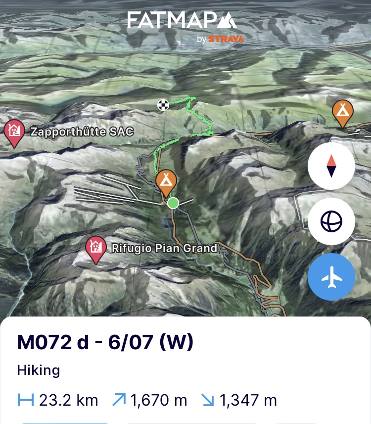
Vanaf 2300m zit ik opnieuw in de wolken en de oude sneeuwvelden. De zichtbaarheid is beperkt en met de regen erbij is het sowieso naar de voeten staren. Afwisselend krijg ik rots en sneeuw voorgeschoteld en moet ik de richting van het pad in het oog houden op de GPS. Als ik voel dat ik terug naar beneden aan het lopen ben, moet ik door het zadel zijn gepasseerd. Niks van gezien daarboven. In de aanhoudende regen is het vooral blijven bewegen en eten tijdens het stappen. In de vallei aangekomen, moet ik halt houden voor een stoet van honderden geiten die naar boven gedreven worden in de vallei. Terwijl ik sta te wachten, spreekt een Zwitserse vrouw me aan. Ze is met een groep studenten op bosklassen en ze vraagt me wat de condities boven zijn. Niks gezien zeg ik haar. Gezien de regen zullen ze blijven slapen in de stal van de boer. Ik trek verder want ik wil al een stuk van de omleiding achter de rug hebben voor morgen. Morgen zou het weer immers nog slechter worden dan vandaag. Eindpunt voor de dag zijn dan ook een paar stallen of hooischuren die ik hogerop op de kaart heb gevonden. Nat tot op het ondergoed van de regen en het zweet kom ik er aan en ontdek ik dat het enkel ruïnes zijn van wat ooit een stal moet zijn geweest. Zelfs een dak ligt er niet meer op. Ik twijfel niet en zoek snel een plek achter de ruïnes uit de wind om er in een mum van tijd de tent op te zetten. Alle materiaal erin en ik zit droog. Nog een keer eruit om water te gaan halen want ik had nog geen water genoeg gezien en dan alles uit wat nat is en direct de slaapzak in. Ik kook en bekijk de alternatieven voor morgen in functie van het weer. Boven het gevriesdroogd eten begint het geeuwen al. Oorstoppen in en slapen dan maar.
(https://fatmap.com/adventureid/142505631/m072-d-6-07-w)
(Zondag 7/07) Heel de nacht heeft het geregend. Het idee om opnieuw in natte kleren te moeten kruipen en weer de regen in te moeten, weegt. Het duurt alvorens ik uit de tent geraak, in de regen de tent afbreek en als laatste in de rugzak steek. Heel de vallei, mezelf incluis hangt in de wolken en de regen weet van geen ophouden. Niks aan te doen. Het verstand gaat weer even op nul en ik begin aan de klim naar de pas, de Fanellgrätli (2710m).
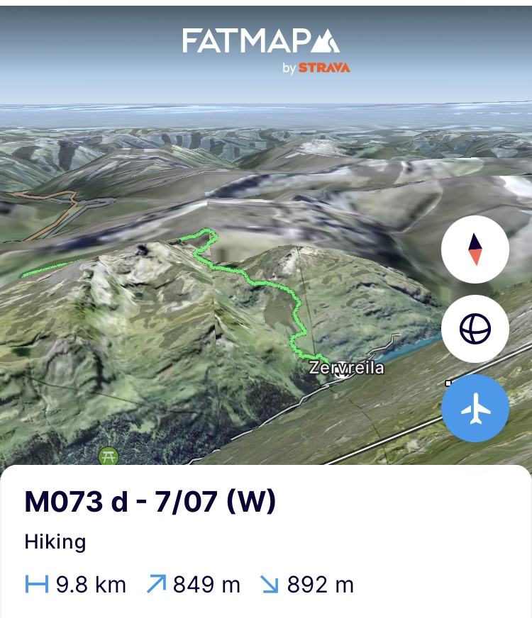
Onder de pas loop ik het pad totaal mis. De markeringen zie ik niet meer. Ik beland in oude sneeuwvelden en een rotsstrook. Uiterst bizar want de gps zegt dat ik net naast het pad loop. Dan maar klauterend à-l’-improviste naar het zadel. Net eronder vind ik de markering terug en kruip in het zadel. De regen stopt niet en aangezien ze ook nog bliksem voorspellen is het onmiddellijk verder door naar beneden. Voorzichtig naar beneden wel want het pad loopt door een brede puinkegel van enkel rotsen. Overal heeft men er prachtige steenmannen mee gemaakt die je de weg wijzen maar het is toch vooral op de voeten letten want alles is spekglad. Foto’s nemen is ook geen optie meer want de lens reageert permanent op de regendruppels. Tijd voor het alternatief want alles is doorweekt, ik ruik naar het extra schepje waspoeder dat ze hier blijkbaar standaard bij mijn vuile kleren doen. Door in de tent te kamperen krijg ik de spullen nooit droog. Ik daal af naar het stuwmeer, de Zervreila See, en ‘call it a day’. Morgen beter weer maar nu alles drogen en warm douchen.
(https://fatmap.com/adventureid/142505691/m073-d-7-07-w)
(Maandag 8/07) Alles droog krijgen was een huzarenstukje, een vorm van bandwerk op de kleine radiator in het hostel. Maar het is ons min of meer gelukt. De regen heeft weer lelijk huisgehouden en alle hostels zijn gewaarschuwd dat zo'n 150m van een lokaal pad is afgebroken. De klimaatverandering die het weer extremen oplegt en verder zal opleggen, betekent alvast een catastrofe voor de wandelpaden in de Alpen. De alpenverenigingen die de hutten bezitten, staan ook in voor het onderhoud van de wandelpaden errond. Met meer dan 65.000km aan wandelpaden in Zwitserland en 40.000km in Oostenrijk is dat dus een hele klus. De Oostenrijkse alpenvereniging deed enkele weken geleden nog een oproep tot een inzamelingsactie om het onderhoud mee te bekostigen. Ik vrees dat het niet de laatste zal zijn en dat mogelijk veel paden zullen verdwijnen of ontoegankelijk worden.
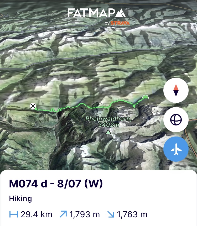
Het weer is opgeklaard en dat is maar goed ook want door de zondvloed van de voorbije dagen moet ik de opgelopen achterstand op de route inhalen. Dus 27km en bijna 2000 hoogtemeters voor de boeg en aangezien het ontbijt in het hostel pas laat begint, kan ik niet onmiddellijk aan de slag. Het tempo leg ik dus hoog aan het begin van de dag en voor ik het door heb, zijn de eerste 8km en 500 hoogtemeters na 1,5u gepasseerd. Bij een alm in de vallei stop ik voor suikers. Het is een prachtige vallei en van aan het stuwmeer een zeer toegankelijke wandeling. Zeker een aanrader dus voor wie een paar dagen het Alpengevoel wil opsnuiven om van aan het meer door de vallei naar de Lanta Hütte te wandelen en er te blijven overnachten tussen majestueuze 3000’ers.
Goed gesuikerd vertrek ik verder naar de zwaarste beklimming van de dag tot aan de Passo Soreda (2759m), 750 hoogtemeters die steil omhoog de rotsflanken in duiken. Hier en daar is het pad door steenlawines weggevaagd en betekent het dus wat klauterwerk in de rotsflank. Maar zo heb ik het graag. Een bilspier die verkrampt, wijst me erop dat ik het wat op het gemak moet doen. Een liter water en wat magnesium binnensteken en ik hoor ze niet meer. Vanaf 2500m is het terug trapjes stampen in de oude sneeuwvelden. We zijn bijna midden juli en op de zomerpaden boven de 2500 meter ligt gemakkelijk nog 1 tot 2 meter sneeuw. Mocht je dus een wandelvakantie in de Alpen plannen deze zomer, alvast enkele tips. Zoek de nodige zaken op over staptechniek op sneeuwflanken. Zorg voor een goede gps want het pad en zijn markeringen zal je niet gemakkelijk vinden. Voorzie voldoende tijd in je planning want je tempo zal gemakkelijk halveren.
Desalniettemin sta ik 1,5u later in de nog stevig besneeuwde bergpas. Ik gun mezelf een beetje pauze maar niet te lang want er staan nog 15km voor de boeg. Het lichaam is een raket vandaag, dus daar zal het niet aan liggen. De geur van waspoeder maakt dan ook plaats voor zweet. Opnieuw een prachtige maar technisch uitdagende afdaling door de sneeuw die langs gigantische watervallen leidt die bulderen van het regen en smeltwater. De paden zien af. Hier en daar scheuren ze letterlijk van de bergflanken af. Ook een brug is weggespoeld door de massale regenval. Met een kattensprong geraak ik er alsnog over. En dan is het goed doorstappen want ik wil op tijd in de hut op het eindpunt zijn. Ik vertrouw het weer nog niet 100%. Dus vanavond leg ik de tent even aan de kant. Beneden aan het tweede stuwmeer van de dag gaat het tempo terug de hoogte in zodat ik in Campo, het dorp onderaan de stuwdam een pauze kan inlassen. Nadat ik 2 tunnels ben doorgelopen (als we niet over de berg kunnen gaan we erdoor) kom ik aan op het dorpsplein waar 2 oude dames me toejuichen in het Italiaans. Even in de war in welk land ik exact ben, herinner ik me dat ik in het meest zuidelijke Zwitserse kanton, Ticino, ben. Een regio waar men in alle dorpen op 1 na Italiaans spreekt.
Goed eten en drinken en dan alles bijeen verzamelen om de laatste 5km en 650 hoogtemeters aan te vangen. Ik zet mezelf als doel om ze in 1u15 min te doen en om 18u aan te komen, ook al zegt de wegwijzer 2u20min. Volle focus omhoog dus en het lijf heeft deugd gehad van het eten en drinken en doet lustig mee. In alle focus en het trekken aan de stokken loop ik fout. Een halve kilometer erbij. Maar ik wil niet afgeven want dat zou zonde zijn van de inspanning. In de laatste kilometer begint de motor te sputteren na de helse tocht van vandaag. Uiteindelijk is het 18u10 als ik aan de hut aankom. 10min erbij. Was ik niet fout gelopen dan was het gelukt, maar ‘woulda-shoulda-coulda’. Hard genoeg gewerkt vandaag en het lijf krijgt onmiddellijk dubbele supplementen cadeau.
De hut, de Capanna Bovarina, zit vol met wandelaars die de Alpen-passeweg aan het doen zijn. Ik schuif aan tafel aan bij een Zwitsers koppel en we kletsen doorheen de 4 gangen die we voorgeschoteld krijgen. Geen ontvangst, dus is babbelen wat je doet in de hut. Morgen trekken ze naar het Plateau de Greina. Een stukje UNESCO werelderfgoed waar je naast de pracht van het plateau ook gemakkelijk steenbokken kan spotten. Spijtig genoeg heb ik die plek uit de route moeten halen omdat ik anders niet tijdig bij dat andere stuk UNESCO werelderfgoed zou geraken, het Jungfraugebied en Aletschgletsjer, de grootste gletsjer van de Alpen. Ik kruip er vroeg in want het lichaam schreeuwt om rust.
(https://fatmap.com/adventureid/142505768/m074-d-8-07-w)
(Dinsdag 9/07) Ik sta op met het voornemen om het vandaag rustig aan te doen. Hoewel het lichaam perfect oké is en het lijkt alsof het de zomer en de alpiene beklimmingen in het vooruitzicht geroken heeft, ga ik het paard toch even inhouden. Concreet, goed ontbijt, genieten van de prachtige vergezichten onderweg en water drinken waar ik kan onderweg. ‘A happy mountaineer always pisses clear’. Dus van water kan je nooit teveel hebben.
Doorheen een eerste pas voor de dag en tot aan het derde stuwmeer op deze etappe en het vijfde als ik de stuwmeren van tijdens de rustdagen ook meetel. 64% van de energie die gegenereerd wordt in Zwitserland komt dan ook uit hernieuwbare energie waarbij waterkrachtcentrales het leeuwendeel voor hun rekening nemen. 5% komt slechts uit fossiele brandstoffen.
In de hospice aan het meer hou ik even halt om wat website perikelen te proberen oplossen. Als ik een kerel zie stoppen met dezelfde gravelbike als de mijne, raken we aan de praat. Nog een enthousiasteling die zelf zijn eigen route in de Alpen uittekende en over de 112 bergpassen waar wegen lopen wil fietsen. Hij is al 82 passen ver en deze pas aan het stuwmeer is nummer 83. Ik voel een idee voor een volgende onderneming opborrelen. Maar eerst deze afmaken en terug ‘en route’ naar het einde van een totaal verlaten vallei. De vallei wordt opgevrolijkt door een kudde yaks, menig marmot en de gebruikelijke sneeuwvelden op het einde ervan aan de pas. In de Capanna Cadlimo die op de tweede pas van de dag ligt, stop ik voor rösti met kaas en tomaten. Het is vier uur en hoewel ik nog een laatste pas en 4km verder moet, mag er al een rädler bij.
En dan is ie daar. Eindelijk. Na meer dan 1300km door de Alpen toont de koning van de Alpen zich. De eerste steenbok. Een vrouwtjesdier dat zich lustig en ijdel laat fotograferen aan de hut. Het lijkt te mooi om waar te zijn en misschien gelokt met eten door de uitbaters van de hut want normaal zijn ze bijzonder schuw. Maar ineens verderop, bovenop de bergkam die 500m hoger ligt, tekent zich een enorm mannetjes dier af met gigantische hoorns. Mijn dag is goed. Eindelijk heb ik ze gezien na lang zoeken en afspeuren van de bergflanken.
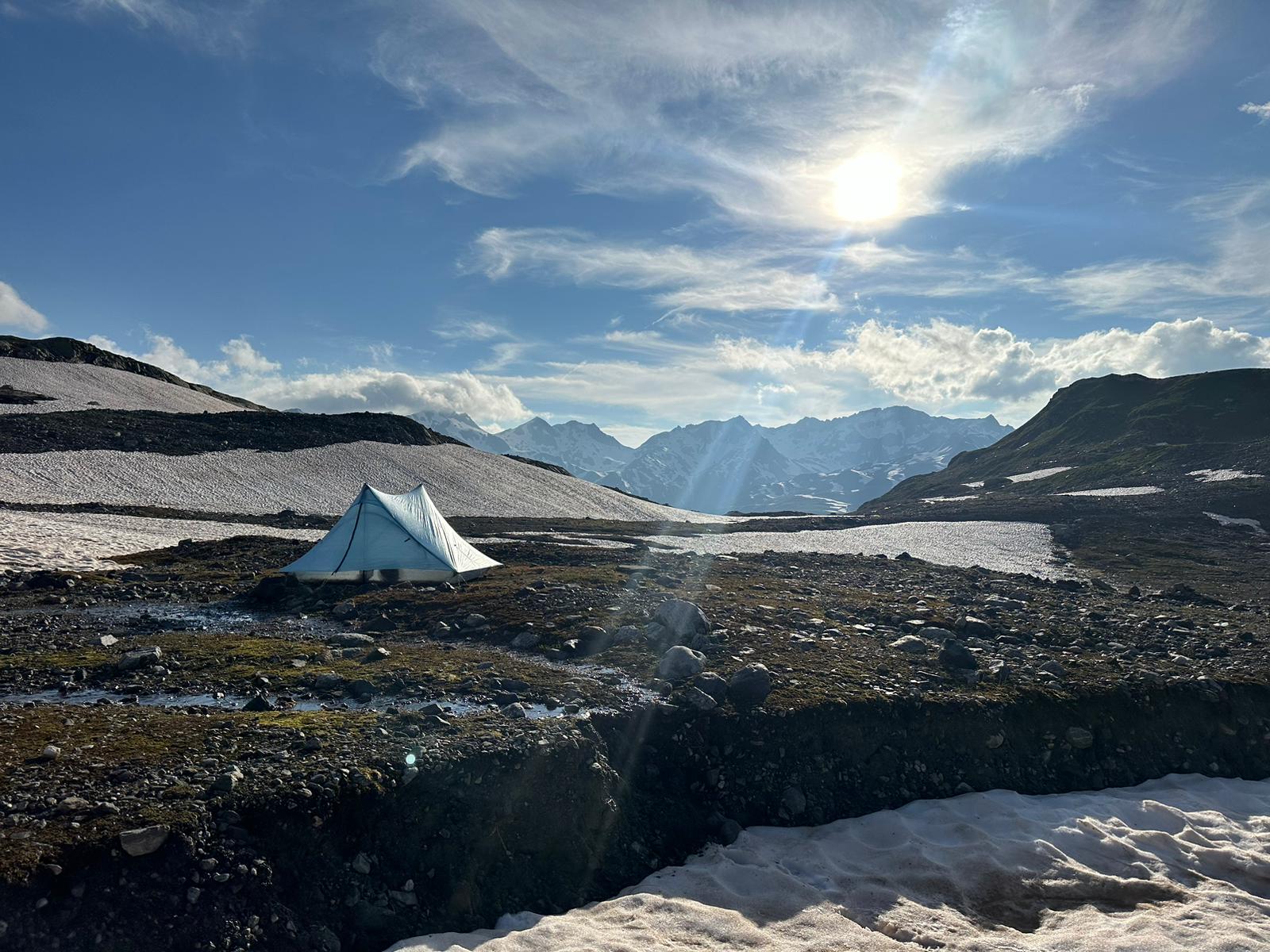
Goed gemutst en niet zeker of het door de rädler of door de steenbok komt, begin ik aan de steile klim naar het laatste zadel. Onderweg toch enige twijfel of de rädler de beste keuze was. Voorbij de pas is het nog even afdalen en zoeken naar een slaapplek. Aan de rand van een oude gletsjerkom vind ik in het steenveld, waar ooit de gletsjertong moet hebben gelegen, een mooi egaal stukje. Perfect. Koken, kousen drogen in de laatste zon en met volle teugen genieten van deze magische plek.
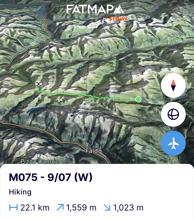
(https://fatmap.com/adventureid/142505839/m075-9-07-w)
(Woensdag 10/07) De laatste dag onderweg in deze etappe. Het was alvast een korte maar pittige etappe door de weersomstandigheden. Eindpunt is het dorp Hospental dicht bij de bron van de Rhône. 2 dagen zal ik er verblijven. Eén dag om de logistiek te doen voor de volgende 4 etappes en een volle rustdag. Ik begin er vroeg aan want de namiddag zou potentieel regen kunnen geven en ik had graag nog de top van de Gemsstock (2961m) meegepikt om uitzicht te hebben op de 4000’ers die in het verschiet liggen. Ik kan het niet laten hoewel het lichaam toch wat sputtert maar het krijgt vandaag maar 1 klim voorgeschoteld, dus al bij al wel oké.
Na de afdaling vanwaar ik de tent had opgezet, stop ik even onderweg bij de Vermigel Hütte voor suikers en om te horen wat de condities naar de top zijn. Een kort praatje met de uitbaatster van de hut wordt gemakkelijk een uur tetteren over het weer en de impact die ze momenteel al ondervinden op het wandeltoerisme. De klim naar de top is er het mooiste bewijs van. Vanaf 2300m is het terug stampen door de eeuwige oude sneeuwvelden. Eeuwig omdat ik ze hier blijf tegenkomen. In de weerextremen die we meer en meer zullen zien als gevolg van de klimaatverandering is het maar de vraag hoe eeuwig ze zullen blijven.
Op de top geven de 4000’ers zich niet bloot. Ze verschuilen zich in het lage wolkendek. Wat dreigende wolken die in de verte komen opzetten, doen me dan ook niet te lang pauzeren op de top. Nog een kleine klim naar het laatste zadel van deze etappe en de hoogtemeters zitten erop. Het is geen simpele klim want over het hele zadel hangt een ‘corniche’ (sneeuwluifel) van een goede 2 meter dik. Daarenboven is die aan het afscheuren door het smelten en zijn gigantische brokken al naar beneden gekomen. Het is dus met de vuisten en voeten in de sneeuwmuur slaan om door de corniche te klimmen. Geen doorsnee wandeltoerisme dus.
Wat eten in het zadel en afdalen over de Gothardtunnel, die onder me ligt, doorheen de oude sneeuwvelden en bloemenweides tot in het kleine Hospental. Klaar om terug gewassen te worden met dat extra schepje waspoeder en dan fris en fruitig…
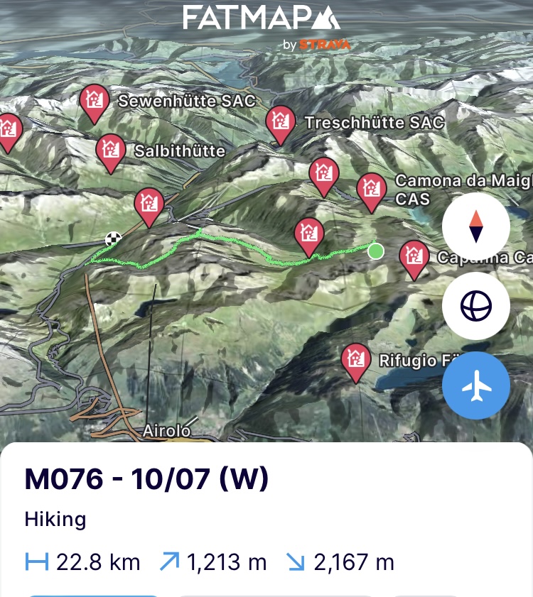
(https://fatmap.com/adventureid/142505908/m076-10-07-w)
Op naar Monaco!
Bergse groeten en tot snel!
————— ENGLISH VERSION —————
(Saturday 6/07) Last breakfast together. It was great to have the family here in the middle of this trip and during my rest days. We had great weather for 2 days and it was filled with short walks, eating, drinking and catching up. I missed them enormously, as well as many other things in Belgium. But time to say goodbye again and hopefully see each other again in Monaco within exactly 3 months. Saying goodbye is always difficult. Especially from the sister who will soon return to the States and will already be the mother of my next nephew by the time I arrive.
But now I have to exchange the comfortable mattress for the sleeping mat and the good weather for the bad because I am leaving again. Early July and the weather remains bad in the Alps. It’s driving me crazy. When I hear in the morning from Baptiste, who was going to climb a week before me in the next region, that the conditions are still anything but great and they will go to Chamonix, it puts me back in planning mode. The second half of this trip certainly doesn't start uneventfully.
I wave goodbye to the family and also leave San Bernardino behind me. On to the pass of the same name via a beautiful path, as my father said in recent days about almost every path we visited. It doesn't take long before I walk to the pass in the low cloud cover and linger in it until I get up an hour later. I immediately move down because the predicted rain is coming. The next 2 days it will almost exclusively rain, so I also had to adjust the route to the conditions. Instead of walking to the source of the Rhine at the Rheinwaldhorn (3402m) I will walk around it in the next 3 days.
When I arrive at the bottom in the village of Hinterrhein, the village closest to the source, I take shelter from the pouring rain in the bus stop. The bus stop is full of photos of the source of the Rhine where she starts her journey to Amsterdam. This year it will receive enough water compared to previous summers, when the water level dropped due to the drought in the Alps and it was no longer navigable in large parts. Not much later, 2 drowned Swiss cyclists also arrive. A weather report tells me that according to the Swiss, the weather should become summery as from July 15th. Let us hope so. They take the bus but unfortunately that is not an option for me. The only option for me is to put on the rain pants and continue.
If the weather radar shows me no rain for an hour, I start the climb of 850 meters in elevation gain to the next valley. There is no rain, so I have to set the pace high to climb quickly. An hour further I pass along a steep rock wall where, judging by the extent of its wings, a bearded vulture is circling above. The animal must have smelled the coming rain because as quickly as I noticed it, it lands back and it starts to rain. On the rest of the climb I keep a close eye on the rock wall to hopefully see it fly up again. Unfortunately, it doesn't happen anymore. I do notice a silhouette on the ridge of what might be an alpine ibex. Already 1250km and not yet seen an ibex so far. It's starting to bother me. No more looking at what lies above me because below me the alpine lizards are happily enjoying the rain and crawling everywhere on the path.
As from 2300m I am again in the clouds and the old snow fields. Visibility is limited and with the rain I have to stare at my feet anyway. I am alternately presented with rock and snow and I mainly have to keep an eye on the direction of the path on the GPS. If I feel like I'm walking back down, I must have passed through the saddle. Didn't see anything up there. In the persistent rain, it is mainly about keeping moving and eating while walking. When I arrive in the valley, I have to stop for a procession of hundreds of goats that are being driven up into the valley. While I'm waiting, a Swiss woman gets up to me. They are having a summer retreat as a group of students and she asks me what the conditions are high up. I didn't see anything, I tell her. Given the rain, they will stay the night in the farmer's stable. However, I continue because I want to complete a part of the diversion before tomorrow. After all, tomorrow would be even worse than today. The end point for the day is a few stables or hay barns that I found higher up on the map. Wet down to my underwear from rain and sweat, I arrive only to discover that they are the ruins of what must have once been a stable. There isn't even a roof on it anymore. I don't hesitate and quickly look for a spot behind the ruins out of the wind to pitch the tent in no time. All the material in and I'm dry. Once more I get out to get water because I haven’t seen enough water yet, and then I take off everything that is wet and go straight into the sleeping bag. I cook and look at the alternatives for tomorrow to deviate given the weather. But that's for tomorrow because the yawning already starts over the freeze-dried food. Earplugs in and off to sleep. (https://fatmap.com/adventureid/142505631/m072-d-6-07-w)
(Sunday 7/07) It rained all night and the idea of having to crawl back into wet clothes and go out into the rain weighs me down. It takes me a while before I get out of the tent and break down the tent in the rain and put it as the last piece of the puzzle in the backpack. The whole valley, including myself, is covered in clouds and the rain doesn’t stop. Nothing to do about it. My mind resets for a moment and I start the climb to the pass, the Fanellgrätli (2710m).
Below the pass I miss the path completely. I can no longer see the markings and I have now ended up in old snow fields and a rock strip. Extremely bizarre because the GPS says that I am walking just next to the path. Then, scrambling à l'-improviste to the saddle. I find the marking again just below it and climb into the saddle. The rain doesn't stop and since they also predict lightning, I immediately continue downwards. Being careful going down because the path runs through a wide scree of rocks. Everywhere they have made beautiful cairns that show you the way, but I have to pay special attention to my feet because everything is extremely slippery. Taking photos is no longer an option because the lens permanently reacts to raindrops. Time for the alternative because everything is soaked, I smell of the extra scoop of washing powder that they apparently add to my dirty clothes here as a standard and camping in the tent will never get me dry. So I descend to the reservoir, the Zervreila See, and 'call it a day'. Better weather tomorrow, but now dry everything and take a hot shower. (https://fatmap.com/adventureid/142505691/m073-d-7-07-w)
(Monday 8/07) Getting everything dry was a meticulous work on the small radiator in the hostel. But I still managed to get everything more or less dry. The rain has wreaked havoc again and all hostels have been warned that 150m of a local path has been broken off. Climate change, which is imposing and will continue to impose weather extremes on us, is already a catastrophe for the hiking trails in the Alps. The alpine associations that own the huts are often also responsible for the maintenance of the hiking trails around them. With more than 65,000 km of hiking trails in Switzerland and 40,000 km in Austria, this is quite a task. A few weeks ago, the Austrian Alpine Association called for a fundraising campaign to help pay for the maintenance. I fear it won't be the last campaign and potentially many paths will also disappear or become inaccessible.
The weather has cleared and that's a good thing because due to the deluge of the past few days I have to make up for the delay I have incurred on the route. So 27km and almost 2000 meters of elevation gain ahead and since breakfast in the hostel doesn't start until late, I can't get started right away. So I set the pace high at the start of the day and before I know it, the first 8km and 500 meters of altitude have been passed after 1.5 hours. I stop at an alm in the valley for sugar. It is a beautiful valley and a very accessible walk from the reservoir. Definitely recommended if you want to experience the Alpine feeling for a few days by walking from the lake through the valley to the Lanta Hütte and staying overnight among the majestic 3000m peaks.
Well prepared, I leave for the toughest climb of the day up to the Passo Soreda (2759m). 750 meters of elevation gain that plunges steeply into the rock flanks. Here and there the path has been swept away by rock avalanches, which means some scrambling on the rock flank. But that's how I like it. A butt muscle that cramps tells me to take it a bit easier. I put in a liter of water and some magnesium and I don't hear it anymore. From 2500m it is back to stomping steps in the old snow fields. We are almost mid-July and the summer trails are still easily covered under 1 to 2 meters of snow above 2500m. So if you are planning a walking holiday in the Alps this summer, here are some tips. Look up the necessary information about walking techniques on snow slopes. Make sure you have a good GPS because you will not easily encounter the path and its markings. Allow enough time in your schedule because your pace will easily halve.
Nevertheless, 1.5 hours later I find myself in the still snow-covered mountain pass. I give myself a little break, but not too long because there are still 15km ahead. The body is a rocket today so that can't be the reason. The smell of washing powder makes way for sweat. Another beautiful but technically challenging descent through the snow that leads past gigantic waterfalls that roar with rain and meltwater. However, the paths deteriorate and here and there they literally tear off the mountain flanks. A bridge is also washed away by the massive rainfall. I can still get over it with one cat jump. And then it's okay to move on because I want to get up to the hut at the endpoint in time. I don't trust the weather 100% yet, so I'm putting the tent aside for tonight. At the bottom of the second reservoir of the day, the pace increases further so that I can take a break in Campo, the village at the bottom of the reservoir. After walking through 2 tunnels (if we can't get over the mountain we'll go through it) I arrive at the town square where 2 old ladies cheer me on in Italian. A bit confused about which country I am in exactly in, I remember that I am in the southernmost Swiss canton, Ticino. A region where Italian is spoken in all but one village.
Some food and plenty of water and then I get mentally ready to tackle the last 5km and 650 meters of altitude. I set myself the goal of doing them in 1h15min and arriving at 6pm despite the signpost saying 2h20min. Full focus thus going up and the body has benefited from the food and drink and is participating happily. I'm making a mistake in all the focus and pulling on the hiking sticks. An extra half kilometer. But I don't want to give up because it would be a waste of effort. In the last kilometer the engine starts to sputter after today's hellish ride. Finally it is 6:10 PM when I arrive at the hut. 10 minutes extra. It would have worked, if I wouldn't have made a mistake, but 'woulda-shoulda-coulda'. Worked hard enough today and the body immediately receives double the supplements.
The hut, the Capanna Bovarina, is full of hikers doing the Alpine Passeweg. I sit down at the table with a Swiss couple and chat through the 4 courses we are served. No cellular coverage so chatting is what you do in a hut. Tomorrow they will go to the Plateau de Greina. A piece of UNESCO world heritage where, in addition to the beauty of the plateau, you can easily spot alpine ibexes. Unfortunately, I had to remove that place from the route because otherwise I would not have reached that other part of UNESCO World Heritage in time, namely the Jungfrau area and the largest glacier in the Alps, the Aletsch Glacier. I get in early because the body screams for rest. (https://fatmap.com/adventureid/142505768/m074-d-8-07-w)
(Tuesday 9/07) I got up with the intention to take it easy today. Although the body is perfectly OK and it seems as if it has smelled the summer and the alpine climbs ahead, I am still going to restrain the horse for a while. In concrete terms, a good breakfast, fully enjoying the beautiful views along the way and drinking water where I can. 'A happy mountaineer always pisses clear'. So you can never have too much water.
Through a first pass for the day and up to the third reservoir on this stage and fifth if I also count those during the rest days. 64% of the energy generated in Switzerland comes from renewable energy, with hydroelectric power stations accounting for the lion's share. 5% only comes from fossil fuels.
In the hospice at the lake I stop for a moment to try to solve some website problems. When I see a guy stop there with the same gravel bike as me, we start talking. Another enthusiast who designed his own route in the Alps and is driving over the 112 mountain passes which have roads going through them. He has already done 82 passes and this pass at the reservoir is number 83. I feel an idea for the next venture bubbling up. But first finish this one and return 'en route' to the end of a completely deserted valley. The valley is brightened up by a herd of yaks, many marmots and the usual snow fields at the end of it. In the Capanna Cadlimo, which is on the second pass of the day, I stop for rösti with cheese and tomatoes. It's four o'clock and although I still have one last pass and 4 km to go through, I can already have some apero with a rädler.
And then there it is. Finally. After more than 1300km through the Alps, the king of the Alps shows up. The first alpine ibex. A female animal that happily and vainly allows herself to be photographed at the hut. It seems too good to be true and perhaps the hut's owners lured them with food because normally they are very shy. But suddenly further up on the ridge that is 500m higher up, an enormous male animal with gigantic horns emerges. My day is good. I finally saw them after a long search and scouring of many mountain flanks.
In good spirits and not sure whether it is the rädler or the ibex, I start the steep climb to the last saddle. Along the way some doubt kicks in, whether the rädler was the best choice. Beyond the pass I only have to descend and look for a place to sleep. On the edge of an old glacier basin, I find a nice, smooth spot in the stone field where the glacier tongue once must have been. Perfect. Cook, dry stockings in the last sun and enjoy this magical place to the fullest. (https://fatmap.com/adventureid/142505839/m075-9-07-w)
(Wednesday 10/07) The last day on the road in this stage. It was a short but tough stage due to the weather conditions. The end point is the village of Hospental close to the source of the Rhône. I will stay there for 2 days. One day to do the logistics for the next 4 stages and a full rest day. I start early because the afternoon could potentially bring rain and I would like to climb the top of the Gemsstock (2961m) to have a view of the 4000m that lie ahead. I can't resist even though the body is sputtering a bit, but today it only has 1 climb ahead, so all in all it's OK.
After the descent from where I pitched the tent, I stop at the Vermigel Hütte for sugar and to hear what the conditions are like to the top. A short chat with the hut manager easily turns into an hour of chatting about the weather and the impact they are currently experiencing on hiking tourism. The climb to the top is the best proof of it. From 2300m I have to stomp back through the eternal old snow fields. Eternal because I keep encountering them on my path. In the weather extremes that we will see more and more as a result of climate change, the question is how eternal they will be.
At the top, the 4000'ers do not reveal themselves but wrap themselves in the low cloud cover. Some threatening clouds that appear in the distance prevent me from pausing too long at the top. Another small climb to the last saddle of this stage and the elevation gain is over. It is quite the climb because there is a 'corniche' (snow canopy) of about 2 meters thick over the entire saddle. In addition, it is tearing off due to the melting and gigantic chunks have already come down. So I have to pound the snow wall with my fists and feet and climb through the corniche. So not the average walking tourism.
I have some food in the saddle and descend over the Gothard tunnel that lies below me through the old snow fields and flower meadows to the small village of Hospental. Ready to be washed again with that extra scoop of washing powder and then fresh and fruity... (https://fatmap.com/adventureid/142505908/m076-10-07-w)Start hier met schrijven...
